Social Costs are Seen, Financial Costs are Felt


Question: Why should we focus on reducing the number of vacant homes in cities?


One answer: Vacant homes become a financial drain on that city’s resources.

For example, the cost to demolish one vacant home could reach up to $20,000. Sometimes more.


There are social costs as well…


Neighborhoods with high concentrations of vacant homes become breeding grounds for crime: social costs.


Yet social costs are not always correlated to dollars and cents. Social costs are sometimes deemed to be someone else’s problem.


But are social costs really someone else’s problem?


Social costs attributed to vacant homes lead to financial costs incurred by a city, by that city’s stakeholders and by that city’s taxpayers.


Social costs do affect those who may (at first) believe one vacant home in another part of town is not their problem.


A New Yorker living in Tribeca or on the Upper East Side is part of the New York City family. As such, they pay New York City taxes.


So, while there may be no vacant homes in Tribeca or the Upper East Side, Tribeca and the Upper East Side are still linked to the poorest neighborhoods in New York City. To the Morrisania neighborhood or the Crotona neighborhood in the Bronx, where just about 4-out-of-10 live below the poverty line.


Be it Morrisania or be it Tribeca. Be it Crotona or be it the Upper East Side. Each neighborhood – all four of them – is still part of the New York City family.


Let’s say there is a foreclosure in Crotona. And let’s say that foreclosure in Crotona becomes a vacant home.


Increased police patrolling in Crotona might be enacted. So as to avert utilization of that vacant home for illegal purposes.

More police cars driving through Crotona becomes a financial cost which addresses the social cost. That financial cost is a New York City cost: a cost bourne by Crotona, a cost bourne by the Upper East Side, a cost bourne by Tribeca.


The cost of the vacant home to Crotona is obvious: Lower home values. An overgrown yard. Broken windows. Possible break-ins. More police cars driving by.


The cost of that vacant home to the Upper East Side or to Tribeca? Less obvious. Yet real, nonetheless.


Homeowners on the Upper East Side and Tribeca contribute to New York City police officer salaries too.

Old Bridge’s Beginning: Stagecoaches and Steamboats


Today’s Old Bridge Township was established in the year 1869. Yet the beginning for Old Bridge involved an Old Bridge which was not, at its very beginning, Old Bridge.

Old Bridge Township was originally Madison Township. Named after President James Madison.

This name of Madison Township was later changed. From Madison Township to Old Bridge Township. This township name change took place in 1975. 

The township name change was enacted so as to avoid confusing this Madison Township – the one located in Middlesex County – with the Madison located in northern New Jersey. In Morris County.

Yet long, long before there ever was an Old Bridge Township – and before that, long, long before there ever was a Madison Township – before the Garden State Parkway, Route 9, Route 18 and Route 34 winded through this town, Old Bridge Township started out as a 17th Century trading post.

The Old Bridge Township we know today traces its history back to 1683.

In 1683 the King of England granted 1,000 acres of land to John and Suzannah Brown. This settlement became, Brownsville.

One year later, this settlement, granted to the Browns by the king, became South Amboy.

There would be no Old Bridge without there first being, South Amboy.

Today’s Old Bridge started out as a trading post. A trading post which emerged in Brownsville after the English gained control over today’s Old Bridge from the Dutch. Leading to the Brown’s land grant from the king.

During the 17th Century, English settlers recognized how today’s Old Bridge Township – as a trading post – would enhance commercial interests through its location alongside Raritan Bay and South River. 

The English recognized an opportunity through maritime commerce. And it was this opportunity to transport goods by ship which had been identified to be a perfect trade route junction.

In the 17th Century, goods made their way to today’s Old Bridge by stagecoach. Upon arrival in Old Bridge, goods could then be shipped further along by waterway – South River or Raritan Bay. 

During the 17th Century, maritime commerce originating in today’s Old Bridge involved the use of flat-bottomed river boats. Horses pulled these vessels. Slow though these vessels were, maritime commerce for English merchants in what today is Old Bridge established the settlement’s foundation. 

Found on these 17th Century horse-drawn barges would have been, primarily, flour. And later, oysters.

Oysters…

In times before harvesting oysters from Chesapeake Creek was decimated by polluted waters and overharvesting, during the 17th and 18th Centuries, getting oysters out of Chesapeake Creek represented a core commercial activity.  

While the English were developing their trading post, Old Bridge represented the center of an unincorporated collection of plantations located to the east and to the west of the Raritan River. At that time, Old Bridge was not a town. Old Bridge was a settlement. A maritime head…among a collection of plantations. 

Throughout the 17th and 18th Centuries, flour was arriving in today’s Old Bridge after having been packed into stagecoach boots. Flour arriving in Old Bridge was then loaded onto slow moving riverboats. On South River. Or Raritan Bay.

In the latter days of the 18th Century, the steamboat was invented…

For this settlement, the invention of the steamboat quickened how stagecoach-delivered flour could be transported along the river. Furthermore, the use of steamboats quickened the pace for the transport of flour across the Raritan Bay. To New York City markets.

Old Bridge is located just under 40 miles across Raritan Bay from Manhattan. There is no direct waterway route from Old Bridge to Manhattan. But there is a direct waterway route to Manhattan from South Amboy. The Laurence Harbor section of Old Bridge sits right next to South Amboy. 

Through the advent of steamboats, Old Bridge’s economy grew. This old English settlement – where once one found gristmills, sawmills and shops – added banks, taverns and small homes to the landscape. Resting among a sleepy collection of plantations along South River and Raritan Bay, this bayside settlement was undergoing a transformation. This settlement was becoming a bustling bayside-riverside locale. 

The beginning for what would go on to become New Jersey’s Old Bridge came in 1869. Through the formation of a town which once had been that 17th Century trading post. From which flour was had been shipped off to New York City. On steamboats.

In February of 1798, South Amboy, was incorporated.

When South Amboy was established, South Amboy included what later would become the independent townships of Monroe, Sayreville and a stand-alone South Amboy. As well as, Old Bridge

Through an act of the New Jersey legislature in 1869, Madison Township was spun off from the consortium.

One hundred and six years later – in 1975 – Madison Township would become, Old Bridge Township.

For questions or comments about this article you can reach the author, Ted Ihde, by email – authortedihde@gmail.com – or at 816-699-6804.

The story of a Missouri town, a blacksmith, mountains which are not there and rivers which are not blue.


Within the Kansas City Metropolitan Area, to the southeast Kansas City – a 20-minute drive from Kansas City’s Central Business District – 10 miles outside of Independence, with a land area totaling 10 square miles, bisected by Blue Parkway, we find Raytown.

The origin of Raytown goes back to how significant the Santa Fe Trail was to the opening up of the West to American settlement. 

In the 1820’s, Raytown – at that time, a settlement known as Blue Ridge –  was a trading post. Established as a stopover along the Santa Fe Trail. 

Frontiersmen heading west rested up at this Blue Ridge settlement. Settlers purchased supplies they needed for their long trek west at Blue Ridge. They repaired their wagons. Settlers purchased flour, bacon and coffee at Blue Ridge. Settlers bought shoes for their horses at Blue Ridge. They visited the local Blue Ridge blacksmith. That local Blue Ridge blacksmith, coming to play a most significant role in Raytown’s history.

Attributed to how Blue Ridge has been written into the annals of our American story is the role Blue Ridge took on along the Santa Fe Trail. 

Early in the 19th Century, Blue Ridge served as a “refueling depot” for those who confronted the rigors of the Plains as they pursued adventure.

Blue Ridge was a busy post along the Santa Fe. Iron workers, wagon makers and blacksmiths flocked to Blue Ridge. Tradesmen. Tradesmen attracted to opportunities found in Blue Ridge emanating from the ever-growing number of wagon trains traveling the Santa Fe Trail. 

This Blue Ridge settlement came to be named for one such tradesman. A tradesman who came from the East. Arriving at Blue Ridge to partake in business opportunities created by Santa Fe Trail traffic. This tradesman was William Ray.

William Ray left his native Ohio, opting to make a new home for himself at Blue Ridge. William Ray built a new life for himself in Missouri. At this settlement along the Santa Fe Trail which would one day be named for him.

William Ray was a tradesman. William Ray was a blacksmith. As a blacksmith along the Santa Fe Trail, the shop William Ray established for himself was located at today what would be the corner of Raytown Road and 63rd Street. In the heart of Raytown.

This settlement of Blue Ridge would later come to be known as Ray’s Town. Ray’s Town…named for our Blue Ridge blacksmith from Ohio, William Ray.

William Ray was born in Butler County, Ohio in 1808. William Ray arrived in Missouri in 1848. Purchasing seven acres of land where today 63rd Street meets Raytown Road. In Raytown.

That acreage acquired by William Ray along the Santa Fe Trail was located at a junction where several trade routes met.

With his blacksmith shop – and his seven acres -situated at the heart of those Blue Ridge trade routes, William Ray’s address positioned him at the nucleus of where locals were clamoring for better roads to be built in Blue Ridge. The construction of new and improved roads – I.e.: local trade routes – which would connect Blue Ridge to the local, larger nearby markets of Independence and Kansas City.

William Ray’s blacksmith shop was located where those new roads would emanate from. Through William Ray’s geographical relevance, Blue Ridge locals started referring to Blue Ridge as “Ray’s Town.” Because planned growth for Blue Ridge involved the building of new roads which were to have beginning points at what today is the intersection of 63rd Street and Raytown Road. William Ray’s seven acres. William Ray’s blacksmith shop.

Within the American story there is an inescapability one encounters in the forever-association between the Santa Fe Trail and Blue Ridge. I.e.: Ray’s Town. I.e.: Raytown. 

In Raytown today, the path Blue Ridge Boulevard follows is the path of the original Santa Fe Trail. Yet there is no “blue ridge” in Raytown. There never was a blue ridge in Raytown.

The Blue Ridge Mountains…

Blue Ridge Parkway in Raytown was named after a mountain range – the Blue Ridge Mountains. 

Frontiersmen arriving at what would be, first, Blue Ridge, then later, Ray’s Town, then later, Raytown were taken back by how the wooded ridges they encountered in Missouri reminded them of the high wooded ridges familiar to them in the Blue Ridge Mountains. A mountain range located where their expedition west – to Missouri – began.

William Ray’s contribution to Raytown proved to be long lasting. Although William Ray’s residence in Raytown was nothing of the sort.

William Ray resided in Blue Ridge for only five years. Leaving Blue Ridge in 1853.

The story of William Ray leaving Blue Ridge – as well as the story of William Ray arriving in Blue Ridge – are each interwoven with famous American trails heading west.

William Ray left Blue Ridge for Oregon in 1853. To live near his children. William Ray’s children lived in Oregon.

The beginning point for the Oregon Trail is found in Missouri. In Independence, Missouri.

The beginning point for the Oregon Trail – the trail which took William Ray’s children west, from Missouri to Oregon – is located ten miles from where William Ray had his blacksmith shop. At the corner of today what would be 63rd Street and Raytown Road. In Raytown.

Trenton: a case study in the relationship between de-industrialization and housing


Trenton’s population peaked in the mid-1950’s. While at the same time, socioeconomic challenges were gripping Trenton. And industrial cities like Trenton. Throughout the United States.

Trenton, like countless mid-Century manufacturing hubs, encountered substantial problems resulting from a national movement towards de-industrialization. Akron. Detroit. St. Louis. Cleveland. Trenton. To name but a few. Each, once an industrial powerhouse. Each, sadly brought to their knees by globalization. By de-industrialization. By an economy which moved away from manufacturing.


Problems accompanying de-industrialization can be seen in circumstances which overtook labor. Decimating workers. Shuttering factories.

The platform for this problem…


As northern industrial cities grew, workers migrated from southern states to northern cities which possessed strong manufacturing bases. Workers pursued higher paying jobs found in factories.
Workers went north to attain higher wages and good weekly paychecks. They found what they were looking for in northern manufacturing cities.

Yet the economy was changing…


A notable portion of mid-century workers who came to Trenton lacked the skill sets required to retain wages which were sufficient enough to support the purchase of (and the upkeep of) homes as the economy changed. As factory jobs were shed. As the United States de-industrialized.


Lacking the incomes needed to update their homes and pay property taxes, over time, more and more Trenton homes fell into a state of disrepair.


An inability to afford the upkeep of homes, combined with (arguably, by some) a trend towards lax oversight by the City in regard to enforcing housing maintenance standards led to the deterioration of Trenton’s housing stock. Which, when combined with White flight, redlining by lenders and suburbanization, led to a decrease in center city Trenton home values. A problem which was then compounded by a newfound ease in the commute by workers into (and out of) Trenton.


Easy commutes exacerbated center city housing challenges. The ability to commute to and from jobs in cities such as Trenton was made possible by the construction of roads and highways.

One could buy a home in the suburbs. Then drive to their job in Trenton. Leading to a decrease in demand for center city Trenton homes. A perfect elixir for urban blight.

Today upwards of 60% of those who live in Trenton rent. Whereas in Mercer County – as well as in New Jersey overall – the rental rate is between 30% to 40%. A disproportionately high percentage of Trenton residents rent.


The consequence? Lack of homeownership.

In Trenton one will see hundreds of vacant lots, vacant buildings and vacant homes. The result of a hollowing out of Trenton’s industrial base. Redlining. And easy commutes. Each contributing in their own unique way to a deterioration of Trenton’s center city housing stock.


This one time industrial powerhouse certainly owns its share of economic and housing challenges. Yet, with thousands of vacant lots, vacant buildings and vacant homes, this former Mid-Atlantic industrial heavyweight also possesses the ingredients to establish processes to transition now non-performing properties to affordable homes.

The construction of new homes. Older homes renovated. Repurposed center city made available to those who would like call Trenton “home.” As homeowners. Not as renters. While at the same time, increasing the city’s property tax base. Decreasing blight.


The solution?


A comprehensive land bank in Trenton. Or, a commitment made by City officials to the issuance of RFP’s. RFP’s which real estate developers could submit Responses to.

An old, iconic and rusty former industrial titan


The slogan – “Trenton Makes, the World Takes” – is stamped to Lower Trenton Bridge. Illuminated. Bold. “Trenton Makes, the World Takes” is a testament to Trenton’s past manufacturing glory. “Trenton Makes, the World Takes,” hung on the first bridge ever built across the Delaware River. The bridge was built in 1935. In the City which would, for a very short time, that is, be our nation’s capital. 

Trenton was the nation’s capital. From November 1, 1784 to December 24, 1784.

This confident slogan of Trenton’s originated in 1917. Justifiably so. What Trenton was really good at was manufacturing. The City thrived. Trenton’s manufacturing prowess was the foundation for the City’s successes.

Trenton built an economy based on exports. Attributed to the City’s strong manufacturing base. Trenton’s industrial might was coupled to the City’s expertise in the manufacture of finished products such as wire rope and rubber. Trenton became a booming Mid-Atlantic industrial hub.

Wrought iron beams. The very same beams used to build the dome in the U.S. Capital at the east end of the National Mall. Those were manufactured in Trenton.

Wire rope. The very same wire rope used to build the Brooklyn Bridge, the George Washington Bridge, the Golden Gate Bridge and the Wheeling Bridge (the bridge which connects West Virginia to Ohio). That bridge-building wire rope came from Trenton. 

Mechanicals used in San Francisco’s first streetcars? Manufactured in Trenton. 

The cable, spark plugs and electrical wire used in Charles Lindbergh’s single-engine Spirit of St Louis? Manufactured in Trenton. 

The cable used for the Wright Brother first airplane? Manufactured in Trenton. 

Prior to Akron, Ohio claiming the “Rubber Capital of the World” title early on in the Twentieth Century, Trenton was the nation’s tire capital.

John A. Roebling established his steel wire empire – The Roebling Steel Company – in Trenton. 

In 1849 Roebling set out to build his company alongside the Delaware Canal and the Raritan Canal. John A. Roebling’s company would go on to become a manufacturing stalwart. Becoming Trenton’s largest employer. Built on the 25 acres Roebling purchased in 1848. 

Twenty years after John A. Roebling laid the groundwork for Roebling Steel Company, a father and son team placed their signatures upon Trenton’s industrial past. 

Alan and Frank Magowan founded the oldest rubber mill in the United States – Trenton Rubber Company. By the late/1800’s, Trenton was a major production center for rubber…while Roebling went on to become the world’s largest manufacturer of wire rope. 

Wire rope, shipping, mining, construction, electrical power transmission, cable cars, tramways, aircraft, submarine netting, musical instruments, elevators, logging, oil drilling. At one time, each representing products proudly made in Trenton.

Trenton’s industrial prominence was routed in the City’s ability to harness productivity gains attributed to the canals and the railroads built in Trenton. Trenton’s expansive network of canals and railroads enabled the City to ship finished manufactures off to New York City and Philadelphia.

While Trenton enjoyed its long and storied run as an American manufacturing center, in June of 1974, a Trenton chapter was forever closed.

In June of that year the final 1,400 employees of what had once been the Roebling industrial empire lost their jobs. These final Roebling layoffs coming after numerous failed attempts to revive the Trenton plant. The plant, that time, a subsidiary of Colorado Fuel & Iron. 

Both Roebling manufacturing plants closed their doors for good in Trenton in 1974. Marking the formal ending of Roebling’s presence in Trenton. The closing of Roebling…poetic justice in that this end to an era was representative of Trenton’s last days as a manufacturing center. 

Cheap foreign goods. Foreign competition. The hollowing out of the City’s property tax base due the demise of manufacturing. Suburbanization. Each contributed in their own unique way to Trenton’s decline. Declining productivity. Bleeding over into a decline in the City’s population. A decade-by-decade descent.

Long before Trenton’s descent, the City’s population steadily increased. Year-by-year. Beginning in the latter part of the 18th Century through the 1950’s. Topping off at just about 128,000 in 1955.

By 2022 Trenton’s population was down to 90,000.

They headed west…

During the latter part of the 19th Century, the Homestead Act enabled settlers to become landowners. The Homestead Act was signed into law by President Abraham Lincoln on May 20, 1862.


Through the Homestead Act, after living on and improving their homestead for five years, a homesteader would then receive their deed by paying a $18 filing fee.


Leading up to the Civil War, southern states seceded from the Union. One year before the Homestead Act went into effect.
Southern states intended to advance the institution of slavery. Members of Congress representing the South recognized that land added to the Union which would be owned slave owners could point the country in a pro-slavery direction. Their goal being, for slavery to be established as the foundation for rural economies in the West.


In the 1860’s there was a tug of war over the institution of slavery. It was slave owners versus free-staters. As the United States pushed west, land totaling just about 10% of the country would be conveyed to homesteaders. One million homesteaders. Representing a voting block which would be integrated into the Union. One which would influence policy.

Prior to the Homestead Act, the Preemption Act of 1841 was used by settlers – those age 21 or older, and head of a household – to acquire up to 160 acres. The price? $1.25 per acre.


Through the Preemption Act, a homesteader was required to make improvements to their homestead and to live on their homestead for a minimum of five years.


Opposition to the Homestead Act – and to the Preemption Act beforehand – had largely been anchored in plantation owners of the South. Their concern? Land acquired in the West would go to stakeholders who would not be advocates of slavery. While slavery was the bedrock on which the southern economy was based.


Representing a barrier to southern interests, the Homestead Act prohibited conveyances of land to those fought against the United States in the Civil War. Which meant, land conveyed through the Homestead Act was not available to former Confederate soldiers.


Homesteading continued on as federal policy through the 1970’s. In 1976 President Gerald Ford signed the Federal Land Policy and Management Act into law. Effectively ending homesteading at the federal level.


The Federal Land Policy and Management Act governs how federal land is administered by the Bureau of Land Management.


By the end of the Civil War, some 15,000 homesteaders acquired land through the Homestead Act. Establishing their homes in what today we know to be Kansas, Colorado, Nebraska, Montana and Wyoming. Nearly 80 million United States acres, conveyed to homesteaders.

Crossroads


Lewis and Clark arrived at the confluence of the Missouri River and the Kansas River at a time when the country was keen on opening up the west.


The best pathway west at that time was the Missouri River. Kansas City sits alongside “the Big Muddy.”


One hundred years after Lewis and Clark arrived with their team of 50 and 3 boats the first train depot opened in Kansas City – Union Depot, in 1878.


Kansas City’s Union Depot became the second of its kind. Indianapolis’ union depot was the first.

During the latter part of the 19th Century, goods making their way to the Western-most points of the United States likely came through Kansas City.

In a fast-industrializing 20th Century, Kansas City connected an industrial Northeast to the West.


At its height, 200 trains pulled into Union Depot each day. Rail was the primary method of transporting freight. And Kansas City outgrew Union Depot.


Needing additional capacity, railroad companies utilizing Union Depot decided to replace Union Depot with a larger station at a better location.

Union Depot was located in the West Bottoms. The West Bottoms was prone to flooding.

The new station would be built near the central business district, atop a hill.


Kansas City’s Union Station opened in 1914 – 850,000 square feet.


Kansas City’s Troost Avenue

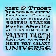
Troost Avenue, a 10-mile corridor in Kansas City running from 4th to Bannister.

Among the Kansas City neighborhoods bordering Troost Avenue are Beacon Hill, Longfellow, Squier Park, Rockhill and Hyde Park.

Troost Avenue was named after a doctor. Benoist Troost. Dr. Troost, a prominent Kansas City physician, was also a civic leader.


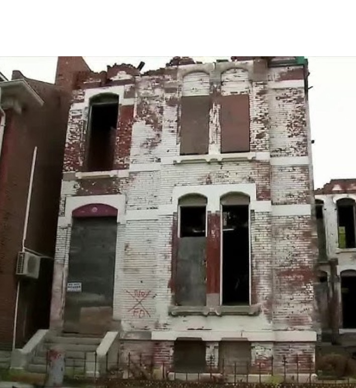
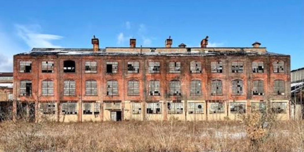
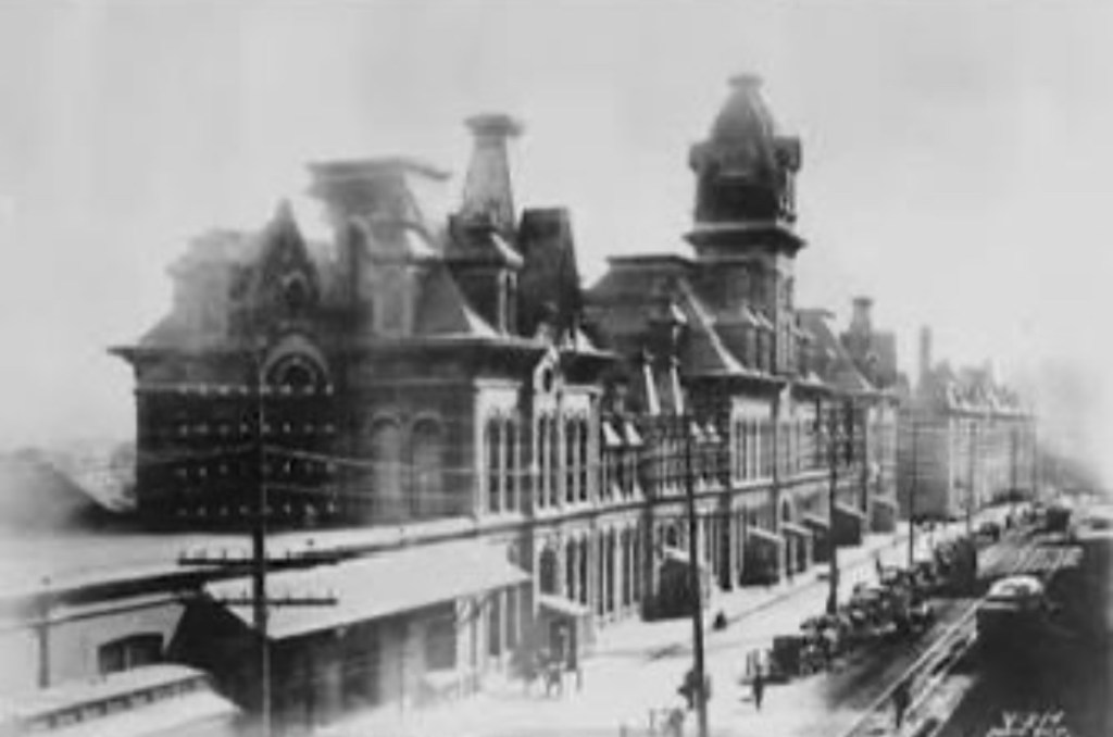
Troost Avenue was once home to “Millionaire’s Row.” Early in the 20th Century, “Millionaire’s Row” had been a strip of stunning mansions constructed along Troost Avenue. Those mansions adorned Troost from 31st Street to 34th Street.

Today, Troost Avenue is experiencing redevelopment interest. And a tasteful renaissance.


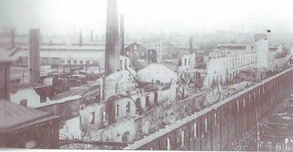
In times past, Troost Avenue experienced a sad history written with the underpinnings of disinvestment. Leading to decline. Leading to decreased home values. This, before Troost’s renaissance.


So what led to Troost’s decline?

Disinvestment. But real estate disinvestment was not the primary catalyst which led to Troost’s mid-20th Century decline. Real estate disinvestment certainly was one catalyst. But real estate disinvestment was not the primary catalyst.

Disinvestment in public schools east of Troost was the primary catalyst which led to Troost’s decline.


Starting off in the late ‘60’s, the School Board in Kansas City, Missouri consistently requested increases in education funding for Kansas City, Missouri schools which were located east of Troost Avenue. There were in the range of twenty such education funding requests made by the Board during this time. Funding requests made throughout the ‘60’s and ‘70’s.

Those funds – if approved – would have gone to Kansas City, Missouri public schools east of Troost Avenue. Funding requests were voted down. The result? Disinvestment in schools. Culminating in “White flight.”

Families, those having the means, that is – predominantly White families – moved. White families moved out of neighborhoods which were adversely affected by the undercutting of school funding.

White flight. Neighborhood home values decreased. One prominent Kansas City mayor once referred to Troost Avenue as, “…the demarcation line in a war zone.”

The problem, east of Troost, wasn’t the legal segregation of schools. Nor was the problem segregation of schools. The problem, east of Troost, was funding for education. Or a lack thereof.


Long before round after round after round after round of failed requests to secure funding for Kansas City, Missouri public schools east of Troost were submitted, those same public schools were desegregated. Yet school desegregation didn’t really solve this problem in Kansas City east of Troost.

Because while the desegregation of schools, based upon race, was the national mandate after Brown v. the Board of Education, decisions which were made affecting education funding were made at the local level. Therein we find the problem. For why public schools east of Troost declined.


In 1954, the United States Supreme Court unanimously ruled in Brown v. The Board of Education of Topeka, Kansas that state-sanctioned segregation of public schools was unconstitutional. Prior to Brown v. The Board of Education, in Kansas City, east of Troost, Lincoln High School had been the only high school providing post-elementary education to Black students. One high school.


In 1955, one year after Brown v. The Board of Education, the Kansas City School Board enacted a “segregation” of public schools in a different way. This was a “de-facto segregation.” Not based upon race. But rather, this was a segregation based upon attendance zones.

Revisiting “White flight” east of Troost, the “White flight” which occurred as round after round of school funding requests were voted down led to the “panic selling” of homes. Leading to block busting. As White families relocated out of the Kansas City, Missouri school district. Real estate values declined.


No, Kansas City, Missouri public schools east of Troost were not segregated based upon race after the 1954 Supreme Court decision. But yet, in a practical sense, they were still segregated.


Kansas City, Missouri public schools east of Troost remained overcrowded. And underfunded. The city’s expansion just made it worse.


In real estate, developers often utilize – and benefit from – tax abatements. On Troost Avenue, and east of Troost, there is a real estate renaissance taking place.


While panic selling and block busting were factors which contributed to neighborhood destabilization east of Troost in years past, neighborhoods east of Troost today are likely to not experience the same type of disruptions as the pendulum swings the other way. Through redevelopment.


What we may see is, not decreasing property values east of Troost. We’ll likely see increasing property values east of Troost.

We likely won’t see panic selling east of Troost. We’ll likely see home sellers fetching ever-increasing prices for their homes, east of Troost.


We won’t see blockbusting, east of Troost. We’ll see continued interest in homes, east of Troost.


What we’ll also likely see, east of Troost, is community members priced out of their neighborhoods. We’ll likely see gentrification. We’ll see investment. Not disinvestment. We’ll see tax abatements.

Accompanying such, we’ll also see hundreds of millions of dollars in deferred maintenance incurred by Kansas City, Missouri public schools.


We’ll likely see challenges in education. Different education challenges. But challenges, nonetheless. Not segregation. Not the same challenges as before. But challenges.


If redevelopment on Troost Avenue and east of Troost is the #1 goal, all good. If there are other concerns to consider, maybe one should revisit Kansas City history? Focusing on this topic: public schools east of Troost.

The Trolley Trail in Kansas City’s Brookside


Brookside is a charming, leafy neighborhood located on the southern end of Kansas City, Missouri…the largest contiguous master planned neighborhood in the country.


Part of the Country Club District, the original plan for Brookside was new homes built for middle-income, upper middle-income and for upper-income families.


The more expensive homes in Brookside were built to the west. Higher home values in Brookside are often determined by how far east or how far west of Main Street the home is located.


Brookside’s Trolley Track Trail. The Harry Wiggins Trolley Track Trail.


The trolley which once ran through Brookside was named for a Missouri state senator who was born in Kansas City. This senator was Harry Wiggins. Brookside’s Trolley Trail is a six-mile path.


Today there is no trolley that runs along Brookside’s Trolley Trail. There are no trolley tracks on the Trolley Trail either. But at one time, long ago, there was a trolley in Brookside which ran along what today is our Harry Wiggins Trolley Track Trail.


This old trolley run in Brookside was borne in the late 19th Century.


In the late 1800’s, comparable to cable cars one would have found in San Francisco at that time, the trolleys which ran through Brookside were propelled by underground cables. The earliest Brookside trolleys operated by gripping underground cables which were installed underneath the tracks.

As the 19th Century turned into the 20th Century, the means by which trolleys were propelled changed. Underground cables were replaced. The cable system trolleys used were replaced by electricity.


Those old Brookside trolley tracks have long since been torn up. The Harry Wiggins Trolley Track Trail is now occupied by walkers, joggers, baby strollers and cyclists. There are no trolleys. Trolley travel gave way to pedestrians on the old trolley track.

At its inception, the Harry Wiggins Trolley Track Trail fostered a trackbed, wooden cross ties and a ballast. This trolley line in Brookside was the Country Club Line.


The Country Club Line took riders south to Brookside shops found in the Brookside Shopping District. Where 63rd Street meets Brookside Boulevard was the heart of Brookside’s shopping district.


Founded in 1920, the Brookside Shopping District was Kansas City’s first suburban-themed shopping center. It was thirty-seven years after the Brookside Shopping District opened that the last Country Cub Line trolley ran through Brookside. That year was 1957…the end for trolleys in Brookside.


At one time, Kansas City had one of the most extensive trolley systems in the country.


Today, Kansas City’s rich trolley history has been reawakened with the city’s streetcar.


Long ago Brookside trolleys and streetcars found in center city represented a popular mode of transportation in Kansas City.

Times changed. And Kansas City – as did most cities by the mid-20th Century – replaced their trolleys and their streetcars with buses.


In Brookside, the end of trolleys led to a new constitution for the Harry Wiggins Trolley Track Trail. The new constitution for the Trolley Track Trail has been written for walkers, joggers and cyclists.


The Harry Wiggins Trolley Track Trail.

The Trolley Trail in the Bookside Neighborhood of Kansas City


Brookside is a charming, leafy neighborhood located on the southern end of Kansas City, Missouri…the largest contiguous master planned neighborhood in the country. 

Part of the Country Club District, the original plan for Brookside was new homes built for middle-income, upper middle-income and for upper-income families. 

The more expensive homes in Brookside were built to the west. Higher home values in Brookside are often determined by how far east or how far west of Main Street the home is located.

Brookside’s Trolley Track Trail. The Harry Wiggins Trolley Track Trail. 

The trolley which once ran through Brookside was named for a Missouri state senator who was born in Kansas City. This senator was Harry Wiggins. Brookside’s Trolley Trail is a six-mile path.

Today there is no trolley that runs along Brookside’s Trolley Trail. There are no trolley tracks on the Trolley Trail either. But at one time, long ago, there was a trolley in Brookside which ran along what today is our Harry Wiggins Trolley Track Trail. 

This old trolley run in Brookside was borne in the late 19th Century. 

In the late 1800’s, comparable to cable cars one would have found in San Francisco at that time, the trolleys which ran through Brookside were propelled by underground cables. The earliest Brookside trolleys operated by gripping underground cables which were installed underneath the tracks. 

As the 19th Century turned into the 20th Century, the means by which trolleys were propelled changed. Underground cables were replaced. The cable system trolleys used were replaced by electricity.  

Those old Brookside trolley tracks have long since been torn up. The Harry Wiggins Trolley Track Trail is now occupied by walkers, joggers, baby strollers and cyclists. There are no trolleys.

Trolley travel gave way to pedestrians on the old trolley track. 

At its inception, the Harry Wiggins Trolley Track Trail fostered a trackbed, wooden cross ties and a ballast. This trolley line in Brookside was the Country Club Line. 

The Country Club Line took riders south to Brookside shops found in the Brookside Shopping District. Where 63rd Street meets Brookside Boulevard was the heart of Brookside’s shopping district.

Founded in 1920, the Brookside Shopping District was Kansas City’s first suburban-themed shopping center. It was thirty-seven years after the Brookside Shopping District opened that the last Country Cub Line trolley ran through Brookside. That year was 1957…the end for trolleys in Brookside.

At one time, Kansas City had one of the most extensive trolley systems in the country.

 Today, Kansas City’s rich trolley history has been reawakened with the city’s streetcar.

Long ago Brookside trolleys and streetcars found in center city represented a popular mode of transportation in Kansas City. Times changed. And Kansas City – as did most cities by the mid-20th Century – replaced their trolleys and their streetcars with buses.  

In Brookside, the end of trolleys led to a new constitution for the Harry Wiggins Trolley Track Trail. The new constitution for the Trolley Track Trail has been written for walkers, joggers and cyclists. 

The Harry Wiggins Trolley Track Trail.