Today’s Old Bridge Township was established in the year 1869. Yet the beginning for Old Bridge involved an Old Bridge which was not, at its very beginning, Old Bridge.
Old Bridge Township was originally Madison Township. Named after President James Madison.
This name of Madison Township was later changed. From Madison Township to Old Bridge Township. This township name change took place in 1975.
The township name change was enacted so as to avoid confusing this Madison Township – the one located in Middlesex County – with the Madison located in northern New Jersey. In Morris County.
Yet long, long before there ever was an Old Bridge Township – and before that, long, long before there ever was a Madison Township – before the Garden State Parkway, Route 9, Route 18 and Route 34 winded through this town, Old Bridge Township started out as a 17th Century trading post.
The Old Bridge Township we know today traces its history back to 1683.
In 1683 the King of England granted 1,000 acres of land to John and Suzannah Brown. This settlement became, Brownsville.
One year later, this settlement, granted to the Browns by the king, became South Amboy.
There would be no Old Bridge without there first being, South Amboy.
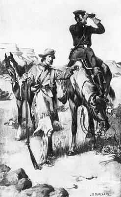
Today’s Old Bridge started out as a trading post. A trading post which emerged in Brownsville after the English gained control over today’s Old Bridge from the Dutch. Leading to the Brown’s land grant from the king.
During the 17th Century, English settlers recognized how today’s Old Bridge Township – as a trading post – would enhance commercial interests through its location alongside Raritan Bay and South River.
The English recognized an opportunity through maritime commerce. And it was this opportunity to transport goods by ship which had been identified to be a perfect trade route junction.
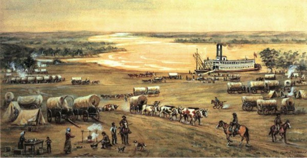
In the 17th Century, goods made their way to today’s Old Bridge by stagecoach. Upon arrival in Old Bridge, goods could then be shipped further along by waterway – South River or Raritan Bay.
During the 17th Century, maritime commerce originating in today’s Old Bridge involved the use of flat-bottomed river boats. Horses pulled these vessels. Slow though these vessels were, maritime commerce for English merchants in what today is Old Bridge established the settlement’s foundation.
Found on these 17th Century horse-drawn barges would have been, primarily, flour. And later, oysters.
Oysters…
In times before harvesting oysters from Chesapeake Creek was decimated by polluted waters and overharvesting, during the 17th and 18th Centuries, getting oysters out of Chesapeake Creek represented a core commercial activity.
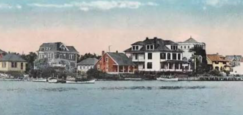
While the English were developing their trading post, Old Bridge represented the center of an unincorporated collection of plantations located to the east and to the west of the Raritan River. At that time, Old Bridge was not a town. Old Bridge was a settlement. A maritime head…among a collection of plantations.
Throughout the 17th and 18th Centuries, flour was arriving in today’s Old Bridge after having been packed into stagecoach boots. Flour arriving in Old Bridge was then loaded onto slow moving riverboats. On South River. Or Raritan Bay.
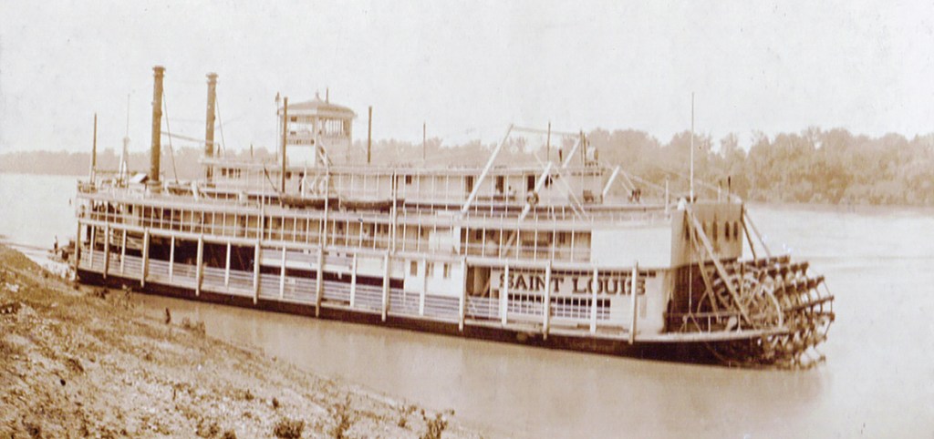
In the latter days of the 18th Century, the steamboat was invented…
For this settlement, the invention of the steamboat quickened how stagecoach-delivered flour could be transported along the river. Furthermore, the use of steamboats quickened the pace for the transport of flour across the Raritan Bay. To New York City markets.
Old Bridge is located just under 40 miles across Raritan Bay from Manhattan. There is no direct waterway route from Old Bridge to Manhattan. But there is a direct waterway route to Manhattan from South Amboy. The Laurence Harbor section of Old Bridge sits right next to South Amboy.
Through the advent of steamboats, Old Bridge’s economy grew. This old English settlement – where once one found gristmills, sawmills and shops – added banks, taverns and small homes to the landscape. Resting among a sleepy collection of plantations along South River and Raritan Bay, this bayside settlement was undergoing a transformation. This settlement was becoming a bustling bayside-riverside locale.
The beginning for what would go on to become New Jersey’s Old Bridge came in 1869. Through the formation of a town which once had been that 17th Century trading post. From which flour was had been shipped off to New York City. On steamboats.
In February of 1798, South Amboy, was incorporated.
When South Amboy was established, South Amboy included what later would become the independent townships of Monroe, Sayreville and a stand-alone South Amboy. As well as, Old Bridge.
Through an act of the New Jersey legislature in 1869, Madison Township was spun off from the consortium.
One hundred and six years later – in 1975 – Madison Township would become, Old Bridge Township.
For questions or comments about this article you can reach the author, Ted Ihde, by email – authortedihde@gmail.com – or at 816-699-6804.