Pemberton, New Jersey

The naming of Burlington County, New Jersey’s Pemberton goes back to late-17th times. In naming of a town, we find a link William Penn. To a prominent local mill. To a a successor to Benjamin Franklin. To an abolitionist. One who decried waging war on Indian tribes. 

The beginnings for the Pemberton’s…

In 1682, an Englishman by the name of Phineas Pemberton settled on 300-some acres along the Delaware River. Phineas Pemberton, arriving as a colonial settler in England’s new American colony of Pennsylvania. Arriving in Pennsylvania by way of Lancashire, England. Phineas Pemberton started his colonial journey in Maryland. Later, migrating north. To Pennsylvania.

Once settled in Pennsylvania, Phineas Pemberton proceeded to work closely with Pennsylvania’s founder, William Penn. Phineas Pemberton served as Chief Administrator of Buck’s County, Pennsylvania for William Penn. Across the Delaware River from where today we find Pemberton, New Jersey.

Phineas Pemberton’s arrival in Pennsylvania’s Buck’s County came one year after King Charles II granted an area of land across “the Pond” within the British Empire to William Penn. Or, to be more era-precise, to Sir William Penn. This land, granted to Sir William Penn as a debt payoff by England’s king. This had been money owed by England’s king to William Penn’s father.

Pennsylvania’s very beginning. On land which had once been – prior to falling under Britain’s rule – New Sweden. New Pennsylvania settlements were taking hold. This, a time of colonial settled. And colonial migration. Leading to population growth for the new Buck’s County. 

Hence, we have our framework for an entrance by the Pemberton family name into the annals of American history.

In Buck’s County’s, Phineas Pemberton became William Penn’s Chief Administrator. As William Penn’s Chief Administrator, Phineas Pemberton was responsible for record keeping pertaining to the arrival of new settlers in Buck’s County.

Phineas Pemberton became Clerk of all Courts for Buck’s County. Phineas Pemberton became Register of Wills for Buck’s County. Phineas Pemberton became Master of the Rolls for Buck’s County. Phineas Pemberton became Receiver of Proprietary Quit Rents for Buck’s County. Phineas Pemberton became Surveyor General for Buck’s County. Phineas Pemberton’s was, shall we say, quite an important man.

Be it calculations of Buck’s County cattle. Be it births in Buck’s County. Buck’s County deaths. Migration tabulations for new settlers arriving in Buck’s County. These records were being memorialized by William Penn’s Chief Administrator, Phineas Pemberton.

Phineas Pemberton…establishing groundwork in Pennsylvania for a Pemberton family member who would later go on to become Pemberton’s namesake.

It would be some fifty years after Phineas Pemberton’s record keeping exercises for William Penn that we’ll find our origin for what would go on to become the New Jersey community for which the Pemberton family name today remains affixed.

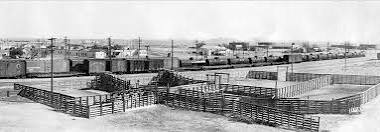
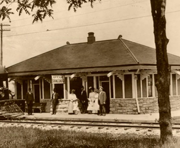
As we will find when we learn about the beginnings for so many American cities and towns, industry was at the forefront of the progression of this community towards a becoming, first, a borough. Then later, a township. And in Pemberton’s case, that American industry happened to a mill. A saw and grist mill.

In 1752, David Budd, together with a group of entrepreneurs, established New Mills Company. Recognizing how Pemberton’s access to a great natural waterway could provide power to his mills, David Budd built his first industrial mill twelve years prior to the founding of his New Mills Conpany.

Upon building his first area mill in 1740, David Budd’s New Mills Company proceeded to build additional mills. These were saw and grist mills.

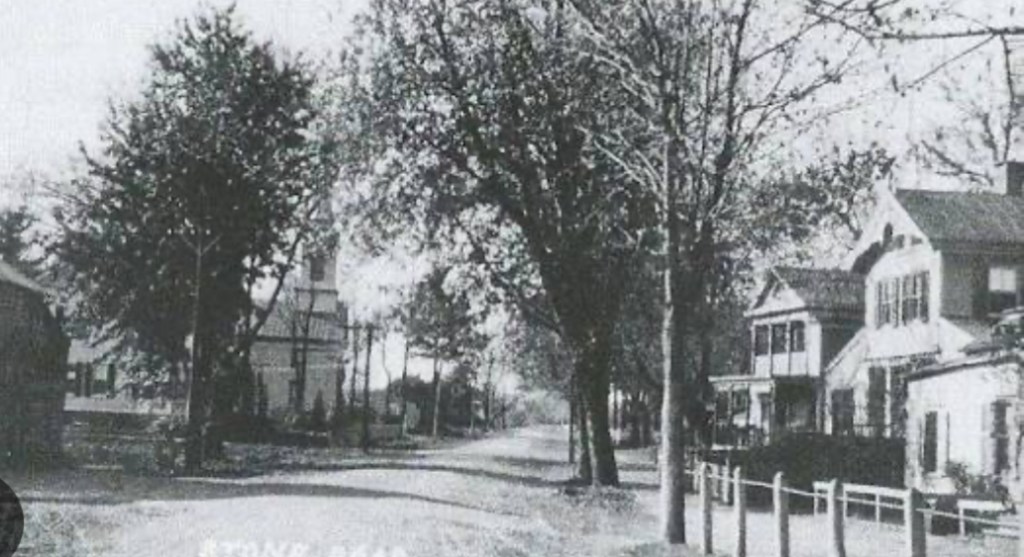
David Budd’s original New Mills Company mill stood in a community which would later go on to adopt the name, for which, David Budd’s company provided the reasoning. The community became, New Mills.

Yet, New Mills at this time was not a township. Nor was New Mills yet a borough. At that time, part of this New Mills community was situated within New Hanover. While another part of this New Mills community was situated within Northampton. Northampton, today’s Mount Holly.

Nonetheless, what was then New Mills was very much a burgeoning community. Growing around David Budd’s saw and grist mills. Across the Delaware River from where Phineas Pemberton earlier served as William Penn’s record keeper.

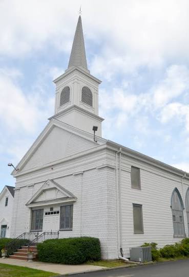
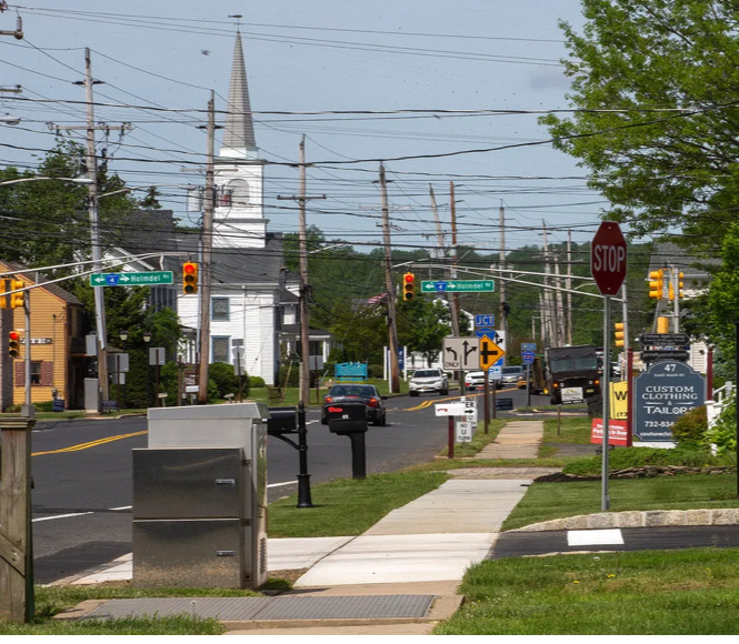
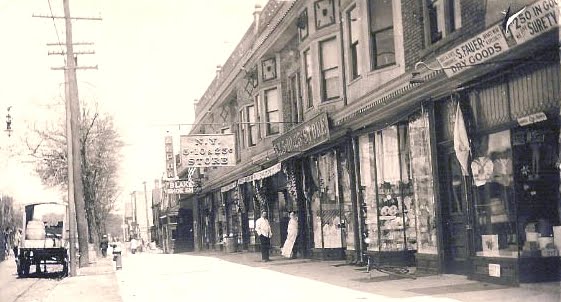
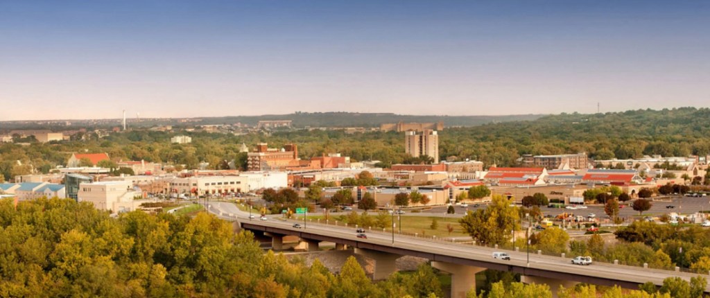
As the 18th Century faded, becoming the 19th Century, this mill community of New Mills would go on to adopt its new name: Pemberton.

These old sections of New Hanover and Northampton, together making up New Mills, broke off from their respective townships. They broke off to form a new borough. This township break-off is where we find the origin for the borough of Pemberton.

The borough of Pemberton – this, which once had been known as New Mills – was incorporated as a New Jersey borough in March of 1826. Pemberton was later incorporated as a New Jersey township. That happened twenty years later. In 1846.

We have Phineas Pemberton, William Penn’s numbers cruncher. We have New Mills Company. And David Budd. We have our township name, Pemberton.

While Phineas Pemberton and David Budd were locals of great importance to this region within New Jersey’s Burlington County, neither of these two men ended up becoming the reason for why Pemberton today goes by the name of Pemberton.

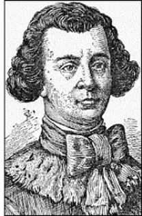
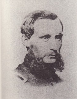
Pemberton is really Pemberton due to values espoused by an abolitionist from Pennsylvania. James Pemberton 


James Pemberton. The Pennsylvania Quaker who succeeded Benjamin Franklin as President of the Pennsylvania Abolition Society.

The New Mills borough renaming which took place in 1826 – from New Mills, to Pemberton – was an undertaking to honor that successor to Benjamin Franklin. He who headed up Franklin’s anti-slavery organization, after Franklin’s departure. An anti-slavery movement in Pennsylvania which was led by the Pennsylvania Abolition Society. Carried onward by James Pemberton. So as to ensure that the institution of slavery would not become one pillar on which this new country of America would be built.

James Pemberton. A founder of Pennsylvania Hospital. President of Benjamin Franklin’s Abolition Society. Influential area landowner. Member of the Pennsylvania Assembly…resigning from the Pennsylvania Assembly due to the fact that the governor of his State declared war on Indian tribes. Phineas Pemberton’s grandson.

James Pemberton. Our namesake for Pemberton.

Emporia, Kansas


In east central Kansas, at the junction of the Cottonwood River and the Neosho River, you’ll find the foothills of the Flint Hills. Emporia, Kansas. The very beginning for Emporia…a $1,800 land purchase.

This original land purchase encompassed an area within Emporia which stretches from what today is Emporia’s 6th Street to 18th Avenue. Due northwest, of this article’s topic.

Founded in 1857 as a trading post along the Santa Fe Trail, one can hypothecate that “DNA” for the Emporia one sees today took hold during the 1960’s. 

In 1969, the Tyson plant in Emporia opened. Opening after a two-year period of thorough plant modernization, and expansion. That Emporia Tyson plant which opened in 1969 was not yet Tyson. This plant, at that time, had been IBP – Iowa Beef Processing. 

The decade of the ‘60’s brought with it notable innovation in the American beef business. Leading to increases in investment in America’s beef industry. Which significantly reshaped the economy for the Great Plains. In which, Emporia resides. 

IBP’s plant in Emporia opened in 1969. And it was the sale of this plant to IBP two years prior to the plant’s opening – the sale of the plant to IBP taking place in 1967 – which foretold of innovation in America’s beef processing industry.

In 1967 Armour and Company sold their Emporia-based beef processing operation to IBP. IBP’s plant modernization – completed two years later – was emblematic of this decade of innovation.

Emporia is nestled within the Great Plains along I-35. Between Wichita and Kansas City. For this piece, I’d like to cite one unique 19th Century paradigm which, one can argue, led to Emporia’s evolution as a beef processing hub. And then, so too, to the emergence of major Midwest beef processing centers situated throughout the Midwest.


One hundred years prior to the sale of that Armour and Company Emporia plant to IBP, the British Empire made up just about one quarter of the world’s GDP. In the 1860’s, a severe plague broke out in Great Britain. Curtailing Britain’s domestic beef industry. Reducing the total number of heads of cattle which could be brought to market within the British Empire.

While over half of all revenues in 1860 for the British Empire flowed to London through Great Britain’s expansive “outposts,” those living on the British Isles themselves back home loved their beef.


England. Scotland. Wales. Ireland. As well as thousands of smaller islands. The British Isles. Enter a beef shortage. Coupled to, no let-up in the demand for beef within Great Britain. 

As this epidemic ravaged Great Britain, domestically raised cattle – cattle which could have been brought to market in Great Britain – took a hit. Less cattle. Less cattle going to market in Great Britain. The beef shortage.

At this same time, across The Pond in the United States, the Great Plains was opening up to commercial interests.

Great Britain recognized this confluence of events: a) a beef shortage in Great Britain, plus b) the opening up of thousands of acres of prime cattle-grazing land in the United States.


With the beef shortage taking hold in the world’s largest economy, the price of beef shot up. Elevated beef prices lead to investment opportunities. Then. And now.

Prior to an increase in beef prices, American businessmen were already deploying capital to develop the United States cattle industry. Deployed capital which led to modernization for, and the growth of, American cattle business on the Great Plains. Enter additional capital. From London.


Increased demand. Higher prices. Investment. The build-out of the cattle industry on the Great Plains. Yet still, in 1860, transportation lines for Midwest cattle had yet to be modernized. Inhibiting efficiency for the market.

While grazing land in the Great Plains further opened up to American ranchers, a notable degree of capital was flowing to the Plains from across The Pond. Coming from British financiers. This capital infusion fueled the growth of – as well as modernization for – the American cattle industry. As investments made by Great Britain to facilitate the transportation of cattle led to investment in railroads, the very means by which the shipment of cattle took place incurred new efficiency.

While buyers of beef were (and are) concentrated in urban centers – and for Great Britain, across The Pond – United States stockyards were (and are) located in America’s Midwest. So too, is Emporia.

Investment in railroads – by the United States government, and by British financiers – connected urban centers – I.e.: buyers of beef – to beef supply – I.e.: stockyards. In fact, many early stockyards evolved through partnerships struck between railroads and the cattle industry itself.

Timing…

Emporia was founded in 1857. Thirteen years later, in 1870, Emporia was incorporated.

Emporia was founded not long before the aforementioned bout of anthrax gripped the domestic British cattle industry. Leading to…Britain’s shortage of beef.

This beef shortage checked the world’s largest economy. Driving down the number of heads of cattle which came to market in Great Britain. While at the same time, driving up the price of beef. As demand for beef remained constant.

The curtailing of production of domestic beef in Great Britain – the anthrax – coincided with the opening up of the Great Plains to ranchers in the United States. Fueling investment. Leading to improvements made in the transportation of cattle by rail. Leading to the prioritization of investments in railroads. And in beef processing centers. 

By 1870, two railroads reached Emporia. The Atchison, Topeka and Santa Fe Railway. And the Union Pacific Railway. Emporia became a booming railroad hub. As well as a cattle industry center, at that.

Railroads’ have unique American relationship to our cattle industry. And to Emporia.

Driving through Emporia today, one can’t help but recognize our correlative railroad-to-cattle industry linkage.


Cattle sales are held in Emporia every Wednesday. Held at Emporia Livestock Sales on Albert Street.


The Emporia Livestock Sales building is nearby train tracks. Tracks which are owned by BNSF. These BNSF train tracks in Emporia enable freight to be transported from California to Chicago.


Standing in front of the Emporia Livestock Sales building, looking to the south, you’ll see the Tyson plant.

That old Tyson plant in Emporia – where my aunt Rita worked for over 30 years – is, just like the Emporia Livestock Sales Building, located alongside Emporia’s BNSF train tracks. BNSF’s Southern Transcon line. 

This Midwest connection of stockyards to urban centers. The railroad and the cattle industry…

Stand atop the Prairie Street Bridge in Emporia. Look down. BNSF’s Transcon tracks. Look to the north. Emporia Livestock Sales. Look to the west. The former Armour plant. Which became the IBP plant. Which then became the Tyson plant…where Aunt Rita worked for over 30 years.


We can attribute this Emporia story to the opening of the Great Plains to ranchers. Yet there was also was that epidemic in Great Britain to think about.

As such, Great Britain, some may argue, is an unseen hand, contributing to the history for Midwest beef processing plants. Beginning in 1860’s.

Then, so too, Great Britain would be a catslyst, an oft overlooked forefather, one may say, which added their own special contributions…collectively making up Emporia’s unique and rich American story.

Holmdel Township in the very beginning…


What one could say was the dawn for New Jersey’s Holmdel Township finds its beginning verse in the Monmouth Patent.

The onset for Holmdel Township started off with the annexation by Great Britain of territory formerly possessed by the Dutch.


This territory – that which had once been the Netherlands’ New Amsterdam – was put under the control of Great Britain’s Royal Crown. As such, the Monmouth Patent enabled conveyances of land to settlers by Great Britain in this new British territory.

In April of 1665, Great Britain’s deputy-governor for New Amsterdam granted “patents” for a triangular parcel of land located in today’s Monmouth County. This was the Monmouth Patent. This, the tract of land in Great Britain’s New Amsterdam territory which would later become New Jersey’s Monmouth County.


The earliest families to acquire land through the Monmouth Patent in what today we recognize as Holmdel Township had been the Bowne family, the Holmes family, the Cotterell family and the Stout family.

The Holmes family’s tract of land stretched north of Ramanessin Brook to Hop Brook Farm – the Holmes Tract.

John Bowne’s tract of land touched the northernmost boundary of the Monmouth Patent “triangle.”

Eliezer Cotterell received two land conveyances. Cotterell’s first conveyance totaled 100 acres. Cotterell’s second conveyance totaled 130 acres.

Richard Stout acquired a tract of land within the “triangle” which was situated to the east of Ramanessin Brook – the Richard Stout, Senior Tract.

One other such early land conveyance through the Monmouth Patent was the Bray Tract. This, the conveyance of land to a Baptist minister. John Bray.

Fifty acres was the Bray Tract…running from the easternmost portion of the Monmouth Patent “triangle” – at Bray’s Brook – to the east side of Hop Book Farms. 

And it was this 1687 purchase of territory by John Bray which led to the establishment of the first Baptist church in the State of New Jersey. Which was rather symbolically supportive of the Monmouth Patent “exercise” in the first place. As the Monmouth Patent codified religious freedom in this new British territory of New Amsterdam.

New Jersey’s first Baptist church evolved from this Bray Tract. In time, becoming Middletown Baptist Church. A church located in today what we know to be, Holmdel Township. As Baptists throughout New Jersey can point to their New Jersey origin as being, the Bay Tract.

On land John Bray acquired through the Monmouth Patent, John Bray proceeded to set up Bray’s Meeting House. 

Bray’s Meeting House became a congregation for Baptists. Local Baptists whose house of worship became…Bray’s Meeting House. At the corner what today would be Main Street and Holmdel Road. In Holmdel Township.


As the number of Baptists who resided within and near this new British territory of New Amsterdam in today what we call “Holmdel” grew, in 1709 John Bray donated a portion of his land to the Baptist Church. This land donation by John Bray led to New Jersey’s first Baptist church. This first Baptist church in New Jersey was, at first, known as The Upper Meeting House


With The Upper Meeting House established, during the first half of the 18th Century, this farming community of what one day would one become Holmdel Township experienced an increase in the migration of Baptists to the area.

First, at John Bray’s Meeting House, then later, at what would become The Upper Meeting House, Baptists weren’t yet meeting in Holmdel Township. Where Holmdel Road meets Main Street, as Baptists joined together, this was not yet Holmdel Township. At that time, Baptists were meeting in Middletown. There was not yet a “Holmdel.”

What had been Middletown then consisted of all of the territory in Monmouth County north of the Navesink River. And east of today’s Freehold Township. So for nearly 150 years, The Upper Meeting House – at the corner of Main Street and Holmdel Road – was located in Middletown.

In 1848, the expansiveness of what was then Middletown was altered. Middletown was broken up. And parceled out. 


In 1848, Raritan Township was spun off from Middletown. This new Raritan Township consisted of what later would become Hazlet, Aberdeen, Union Beach, Keansburg, Keyport, and Matawan. As well as…Holmdel.

Nine years after Middletown was restructured, in 1857, Holmdel Township officially formed. Formed, through an act of the New Jersey Legislature. 

John Bray originally settled in today’s Holmdel Township in 1684. Three years later, John Bray received his 50 acres. Granted to Bray by New Amsterdam’s acting governor.

The earliest land conveyances made possible through the Monmouth Patent were not enacted through the acts of a full-fledged territory governor. 

In 1664, the British territory made up of what would one day become New Jersey – then, being, New Amsterdam – was governed by a British deputy governor. This British deputy governor in 1664 was Richard Nicolls.


A few years after settling in Monmouth County, John Bray increased his land holdings. Bray purchased two additional tracts of land. These purchases took place in 1688.

The first of John Bray’s subsequent land purchases totaled 130 acres. Bray’s second land purchase in 1688 totaled 30 acres.

Johm Bray’s land holdings – the land grant he received from Deputy Governor Richard Nicolls, coupled to his subsequent land purchases – foretold of the pathway to Bray’s later establishment of his Meeting House. While also foretelling of Bray’s later land donation. To the Baptist church. Leading to, New Jersey’s first Baptist church.

On the corner of Main Street and Holmdel Road.

Belleville, New Jersey

The name Belleville has a French connotation. In French, Belleville means “beautiful town.” To those of us here in the United States, Belleville means, “birthplace of the Industrial Revolution in America.”


Outside of Belleville’s earlier days, well-earned setting within our Industrial Revolution, the origin for what today we know to be Belleville can be traced back to the late-18th Century. Yet then, in those waning years of the 18th Century, today’s Belleville was once, Second River.

In 1797 Belleville’s name was changed. From Second River. To Washington. But that name change – to Washington – didn’t last very long.

This new name – Washington – proved to be unsatisfactory to inhabitants of the old Second River settlement. As such, shortly thereafter, the name change – from Second River to Washington – proved to be the first of two name changes for Second River.

Second River’s name was changed, once again. This time, changed to Belleville. Yet at that time, Belleville was moreso a settlement than it was an organized town.  That changed.

Belleville was incorporated as a New Jersey township 42 years after receiving its name – as Belleville. The year was 1839. This once-a-settlement completed its evolution into becoming a full fledged township in New Jersey by way of an act of the State legislature. The year was 1839. 

Forty-some years prior to the thrice renamings – from Second River, to Washington to Belleville – an occurrence of historical significance took place in this township. An occurrence which cemented Belleville’s place within the annals of an emerging industrial economy in the New World.

You see, Belleville is the official birthplace of America’s Industrial Revolution. Belleville’s position, as such, brought to be through the workings of an 18th Century New World newcomer. A newcomer who arrived in Belleville by way of Great Britain. Josiah Hornblower.


In 1753, Josiah Hornblower was commissioned by his company across The Pond – his company being, Newcomen – to build what would become the first steam engine assembled in the New World. 

And it was the result of this first steam engine that Josiah Hornblower’s link to Belleville, and thus, Belleville’s position as the birthplace of America’s Industrial Revolution, was formed.

Josiah Hornblower traveled from Great Britain to the New World to build a Newcomen steam engine. A steam engine he’d build for the owners of what was then the oldest copper mine in the New World. A copper mine located in Belleville. The Schuyler Copper Mine. 


The Schuyler Copper Mine traces its history all the way back to 1710. 

In 1710 Arent Schuyler purchased a tract of land on which the future Schuyler Copper Mine would be built. The construction of this mine…the byproduct a discovery. This discovery being, copper ore. Copper ore discovered on Schuyler’s land.

This discovery of copper ore coming three years after Arent Schuyler completed his land purchase. This discovery of copper ore taking place in 1713.

The purchase of a large tract of land… The discovery of copper ore… Yet, neither the land purchase, nor the subsequent copper ore discovery directly led to Josiah Hornblower’s arrival in Belleville. Nor did the land purchase, nor the discovery of copper ore, directly lead to Belleville’s designation as the birthplace of America’s Industrial Revolution.

Belleville – as the birthplace of America’s Industrial Revolution – and Belleville – as the Josiah Hornblower’s home- came about because of an act of God. It was a flood.

In 1748, a flood decommissioned the Schuyler Copper Mine. In order to continue on with mining operations, Schuyler Copper Mine – then run by Arent Schuyler’s sons – was in need of a steamship. A Newcomen steam engine, that is.


Newcomen steam engines were manufactured in England. The Schuyler mine was in Belleville. Therein, we find our Belleville link to Josiah Hornblower. And thus, to Belleville becoming the birthplace of our Industrial Revolution.


Schuyler Copper Mine contracted England’s Newcomen to build the steam engine they needed.

Newcomen, located in Cornwall, England, sent Josiah Hornblower across The Pond to assemble this steam engine for the Schuyler Copper Mine. 

Thus arriving, Josiah Hornblower established himself as a Belleville resident. To assemble the Newcomen steam engine for Schuyler Copper Mine. A steam engine which would be used to pump flood water out of Schuyler’s mine.

Thirty-nine years later, the first steam engine was manufactured in the United States. That year was 1794. Tellingly so, the very first steam engine manufactured in the United States was manufactured in Belleville.

In 1797 – three years after the manufacture of the first steam engine in the United States – the first steamboat produced in New Jersey was built by Josiah Hornblower. New Jersey’s first steamboat was built in Belleville.

Two-hundred years after Josiah Hornblower built that first steam engine in Belleville, the Congress passed a resolution recognizing Belleville’s historical role in a then-industrializing United States.

Congress’s 1994 resolution: Belleville, birthplace of our Industrial Resolution.

The late, great Congressman Bill Pascrell was responsible for our Belleville resolution. 

Overland Park


In real estate, developers acquire land, then plat a subdivision. For Overland Park, Kansas, that is how it all began. As a platted subdivision. 

This platted Kansas subdivision – the one which evolved into today’s Overland Park – came to be through entrepreneurship espoused by a Johnson County entrepreneur. This entrepreneur, William B. Strang, Jr., his contributions to the Kansas City region coming through his establishment of a local rail service which connected Kansas City to Olathe, Kansas. Leading to the formation of Overland Park.


William B. Strang, Jr. founded the Missouri and Kansas Interurban Railway. Strang founded his railroad in 1906. Two years prior to Henry Ford’s Model T entering into production. 

When Strang founded his Missouri and Kansas Interurban Railway, there were no cars on Kansas City roads. One could not drive in to Kansas City, Missouri from Johnson County, Kansas. And in 1906, train travel in Kansas City was a luxury. A luxury with longer distance routes. A train to St. Louis. A train to Chicago. When Strang founded his Missouri and Kansas Interurban Railway there was no specific train route which took passengers from Kansas City, Missouri to Johnson County. No railroad was offering this local service. Yet Strang believed this could be an economically viable route. Hence, the origin of the Strang Line


Headquarters for Strang’s Missouri and Kansas Interurban Railway could be found in downtown Kansas City, Missouri. At the corner of 7th and Walnut. In the Railway Exchange Building.


With Missouri and Kansas Interurban Railway headquartered in Kansas City, Missouri, Strang proceeded to build several depots in Johnson County, Kansas. The largest of Strang’s depots was the one he built at what is today the corner of 80th Street and Santa Fe Drive. In Overland Park.  


William B. Strang, Jr. was a 20th Century railroad entrepreneur. He was also a real estate developer. A speculator. Strang built spec homes. The sale price for one of Strang’s spec homes – as well as demand for spec homes built by Strang – was driven by an idea: you can own your own new home in Johnson County.

To this point, Strang’s rail service enabled city dwellers in Kansas City, Missouri to gain access to the Johnson County suburbs. And, so too, to new homes built in Johnson County by William B. Strang, Jr. New homes being built where today we find Overland Park. 

William B. Strang, Jr.’s Olathe-to-KCMO Missouri and Kansas Interurban Railway contributed to the success Strang attained as a real estate developer. In that Stang’s Missouri and Kansas Interurban Railway increased access to new suburban Kansas homes Strang was then building. In turn, driving up demand for Strang’s homes. The result? Higher sale prices for Strang’s homes.

William B. Strang, Jr. arrived in what would go on to become Overland Park in the earliest days of the 20th Century. He arrived in Johnson County 1905. Upon his arrival, Strang proceeded to acquire land on which the downtown for today’s Overland Park now sits. Strang’s initial Johnson County land acquisition – the land acquisition which led to an Overland Park – totaled 600 acres.

A 600-acre acquisition…

A real estate developer…

The coupling of an idea: new homes/increased access to new homes…

A railroad entrepreneur…

The makings of Overland Park…

As a city, Overland Park was incorporated 55 years after William B. Strang, Jr. set foot in Johnson County. Overland Park was incorporated in 1960. Yet, by 1960, the railroad which laid the groundwork for the formation of Overland Park was no longer. The last Missouri and Kansas Interurban Railway train car pulled into Olathe in 1940…20 years prior to the incorporation of Overland Park.

Those 600 acres William B. Strang, Jr. purchased in Johnson County in 1905… Those subdivisions to the southwest of Kansas City, Missouri, those out in the Johnson County suburbs… One of those subdivisions was named “Overland Park.” 

Overland Park… Originally, one of William B. Strang, Jr’s subdivisions. The undertaking of one Johnson County real estate developer who became a railroad entrepreneur. 

A railroad entrepreneur whose subdivisions ignited the construction of new homes to the southwest of Kansas City. New homes which increased in value as a result of new access – by rail, circa the Missouri and Kansas Interurban Railway – to these new homes which were being built. Several of which were being built by William B. Strang, Jr. The train entrepreneur who was also the real estate developer.

William B. Strang, Jr. Real estate developer. Railroad entrepreneur. Founder of Overland Park. 

Manhattan, Kansas


In 1854, when President Franklin Pierce signed the Kansas-Nebraska Act into law, a new Kansas Territory was opened for settlement. That same year, seeds were planted for one such riverside settlement within this new Kansas Territory. A settlement that would go on to become “The Little Apple.”


Steps taken by pioneers to establish what would go on to become “The Little Apple” -aka, Manhattan, Kansas – should be thought about with the Kansas-Nebraska Act also in mind. This is so due to the relationship the Kansas-Nebraska Act had to the institution of slavery. To how the Act served as a catalyst for Kansas’ formation. To how the Act fueled the antislavery movement in Kansas. Then too, to how the Act served as the precipice for the early organizers of a townsite which would evolve into “The Little Apple.”


So how do we connect Manhattan’s formation to the Kansas-Nebraska Act? Then too, to the antislavery movement? This connection really begins, with a Senator from Illinois…

In 1854, Illinois Senator Stephen Douglas introduced a bill to Congress. This bill that Senator Douglas introduced to Congress was the Kansas-Nebraska Act.


Senator Douglas’ bill – which President Pierce signed into law the same year the bill was introduced – ended the Missouri Compromise. The Missouri Compromise banned slavery in states north of an established latitudinal designation. Minus, one state, Missouri. Missouri’s exclusion from the ban of slavery, being, the “Compromise.”

While doing away with the Missouri Compromise, the Kansas-Nebraska Act also organized two new territories for the United States. These two new U.S. territories being, one, the Kansas Territory, and, two, the Nebraska Territory.

Two new U.S. territories were organized. The Missouri Compromise was ended. Without the Missouri Compromise, the two new U.S.territories would be free to enact “popular sovereignty.” And this popular sovereignty, within Douglas’ Kansas-Nebraska Act, related to whether slavery would become an institutional pillar within each of the two new U.S. territories.

So, with President Pierce’s signing of the Kansas-Nebraska Act, the race was then on to settle these two new territories. And, to settle the territories with positions on slavery which would thus, in turn, be representative of the viewpoints pertaining to the institution of slavery espoused by the early framers of the territories.  

Popular sovereignty was in. The Missouri Compromise was out. The Kansas-Nebraska Act was in. What remained to be either in or out, was, the institution of slavery.

The same year the Kansas-Nebraska Act was signed into law by President Pierce, a settlement took hold in the Kansas Territory at the junction of the Kansas River and the Big Blue River. This, a riverside settlement founded by Colonel George Park. Colonel Park named his settlement, Poleska.

As Colonel Park founded Poleska, another group of pioneers heading into the new Kansas Territory – this group, cattlemen from Illinois, led by Samuel Houston – founded a neighboring settlement. Their neighboring settlement, Canton.

Popular sovereignty. No Missouri Compromise. And two new settlements in the Kansas Territory.

One year after Colonel Park founded Poleska, one year after Samuel Houston founded Canton, we find the structural framework for what would go on to become, “The Little Apple.” Manhattan.

Our framework for Manhattan, inspired by the popular sovereignty which came to be in the Kansas Territory. As the Missouri Compromise, was no more.


One year after the settlements of Poleska and Canton were founded, in 1855, a group of New England abolitionists traveled to this new Kansas Territory. From Boston. With popular sovereignty in mind, these New Englanders wanted to establish a Free State for this new Kansas Territory. They realized that they could do so. By increasing the number of antislavery voters in the Kansas Territory. Thus, with a majority of antislavery voters, ensuring that when Kansas did become a United States state, Kansas would enter the Union, as a free state. 


These abolitionists from Boston – the New England Emigrant Aid Company – selected the contiguous Poleska-Canton settlements as their new Free-State home. Their new Kansas Territory home, located alongside those two Kansas rivers. The Big Blue River. And the Kansas River. 

Recognizing how their settlement could develop reliable channels for commerce as a result of the settlement’s strategic position alongside two rivers, a river landing was built. With a river landing, then, ferries were built. Means of waterway commerce was established. A town constitution was adopted. The pioneers from Boston proceeded to acquire acreage. With their land acquisitions, the footprint of this new antislavery settlement, had been enhanced.

Yet, this antislavery settlement, was not yet a town. This settlement was not yet, Manhattan. 

Manhattan was once, Boston…

This townsite, nestled alongside the Kansas River and the Big Blue River was still known as – just as this townsite had been known to be, since its founding by Boston settlers – Boston.

The name Manhattan would indeed come…not long after.

The same year the New England Emigrant Aid Company arrived at the Poleska-Canton settlements, another group – this group, with their origin being, Cincinnati, Ohio – also arrived. And it was this second group, from which, our Manhattan name, came to be.

This second group was the Cincinnati and Kansas Land Company. The Cincinnati and Kansas Land Company arrived at the Poleska-Canton settlements, also in 1855. Making their journey to the new Kansas Territory, on a steamship.

Upon arrival, ready to put up buildings. And houses. To further develop the commerce which was still in its infancy – in year one – within the Poleska-Canton settlements.


As an inducement to advance commerce, the New Englanders offered the Cincinnati and Kansas Land Company half of their Kansas Territory townsite of Boston. 

Our new Kansas Territory group from Cincinnati accepted the stake holding offer. With one condition. This condition being, the townsite name would need to be changed. From Boston. To Manhattan.

A deal was struck. 

Manhattan, Kansas was founded in 1855. Two years later, Manhattan, Kansas was incorporated. 

The Little Apple.

Indiana University at the very beginning.


In 1820, the academic institution at which the Six Million Dollar Man first began his college football career as a defensive end, thanks to an IU athletic scholarship, was founded. This Midwest school with nine campuses and 90,000 students today was founded as a seminary

Classes began at this Hoosier seminary four years after the school’s founding.

Those early classes were held in Bloomington. Just as IU classes are held in Bloomington today.

Before Indiana University became Indiana University, Indiana University was educating Hoosiers as Indiana College. After first educating Hoosiers as Indiana Seminary.

Our Hoosier school. First, Indiana Seminary. Then, Indiana College. Then, Indiana University.

Indiana Seminary became Indiana College in 1828…four years after those first classes were held in Bloomington. At Indiana Seminary. Eight years after the school which would go on to become Indiana University was established. Twelve years after an Indiana university was to be established. According to Indiana’s state constitution.

Indiana’s university became Indiana University twenty two years after Indiana’s state constitution called for the establishment of an Indiana university.

Indiana’s state constitution was written in 1816. Written at the state capital. Written in Cordyn.

Indianapolis is Indiana’s capitol today. in 1816 Cordyn was the capital in the Hoosier State. Written in Cordyn in 1816, Indiana’s state constitution paved the way for the transformative history of IU.

Indiana’s university…

Indiana Seminary. Later becoming Indiana College. Later becoming Indiana University, where the Bionic Man once played defensive end.

UCONN, and how the Huskies’ school came to be


In the year 1822, a boy by the name of Charles Storrs had been born into a world of Mansfield, Connecticut agriculture. The Storrs family…a family of Mansfield farmers.

While Charles Storrs’ 19th Century life found its origin in agriculture, Charles Storrs ventured out. Beyond his family’s humble Mansfield farm.

Charles Storrs migrated from an agricultural world, into Connecticut mercantilism. Going on to sell silk. For a Hartford manufacturer.

While Charles Storrs started out on a family farm in Mansfield, he attained his wealth by way of successes found in Connecticut mercantilism.

And, to the benefit of Charles Storrs’ home state of Connecticut, Charles Storrs turned back from his mercantile successes. Turning back to where it all began in Mansfield for Charles Storrs. Turning back, to agriculture.


The success of Charles Storrs…

In 1854, Charles Storrs ascended from silk salesman, to entrepreneur. By partnering with his older brother Augustus Storrs to establish Storrs Brothers. 

Charles Storrs headed the company he founded, the company which bore his name, from the company’s inception in 1854, on through 1879.

In 1880 Charles and Augustus Storrs donated 170 acres – along with several buildings – to the State of Connecticut. This land that Charles and Augustus Storrs granted to Connecticut was conveyed with a condition. The condition being, for Storrs’ farmland to become the ground on which a Connecticut agricultural school would be established. A college. An agricultural college.

These 170 Mansfield acres went on to become a Connecticut village. Storrs, Connecticut.

The agricultural school intentioned through the Storrs’ land conveyance went on to become a college – Storrs Agricultural College. Charles and Augustus Storrs, being the College’s founders.

Storrs Agricultural College evolved into the University of Connecticut. I.e.: UCONN.

One of those old buildings which had been given by the Storrs Brothers to the State of Connecticut went on to become the very first Storrs Agricultural College campus building – Edwin Whitney Hall. Which today, on UCONN’s campus, is the Edwin Whitney Residence and Dining Hall.

Today, the village of Storrs, Connecticut remains anchored in academia. The village’s stalwarts being UCONN. As well as the Connecticut Repository Theatre.

UCONN’s address? 110 Storrs Road, Storrs, Connecticut.

During the latter part of the 19th Century, at the Kansas-end of the Texas-to-Kansas Chisholm Trail, an unruly establishment sprang up. Located just outside of Wichita. This new establishment, a cowtown. Laden with gambling. A place where saloons and brothels far outnumbered any churches. At the Kansas end of the Chisholm Trail, this raucous establishment was a place where cowboys – weary from cattle drives – could rest up. Enjoy bourbon. Play cards. Before heading back out on the road. This congregation-of-cowboys along the Chisholm Trail became, Delano.

Delano in the 1870’s became an unruly cowtown on the Chisholm Trail. So let’s look at how this Kansas cowtown came to be.

The emergence of Delano as a Kansas cowtown had been foundationally based upon, a convergence. Our convergence being, an over-abundance of cattle during the 1870’s in Texas. Coupled to a shortage of cattle during the 1870’s on the East Coast.

As one part of the country – Texas – had an abundance of cattle, and one part of the country – the East Coast – had a shortage of cattle, a business opportunity presented itself. Hence, our Chisholm Trail. Hence, Jesse Chisholm. And within the circumstances of this need – cattle to be shipped to the East Coast – we have our catslyst, for Delano.

To optimize this opportunity in the cattle business, Jessse Chisholm figured out that an establishment of a trail, starting out in Texas, and ending in Wichita, would enable cattle to be transported from where there had been an abundance of cattle – Texas – to where there had been a shortage of cattle – the EastCoast. As the Chiron Trail formed, Wichita was the perfect endpoint. Cattle transported from Texas (the Chisholm Trail began in San Antonio) to Wichita could then be shipped off to where there had been demand. With limited supply. The East Coast.

Cattle were shipped north…along Jesse’s Trsil. Delano. To Wichita. Located right next to Wichita, had been Delano. 

Delano was built upon the cattle-shipping industry. Delano’s growth, made possible through Jesse Chisolm’s 500-plus mile trail. From San Antonio to Wichita.

Along with the growth of the cattle shipping industry in Wichita, you had cowboys. And while Wichita was the established city, just next door to Delano – as Wichita had rules, and a sheriff…and laws, with a jail – Delano had no such checkpoints. 

During the 1870’s, there was no sheriff in Delano. During the 1870’s there was no law enforcement in Delano. No jail. Just across the Arkansas River from Wichita, to west. No rules in Delano. And right across the river from Delano, in Wichita, lots of trail-weary cowboys. That’s how Delano grew. 

The growth of Delano accompanied Wichita’s growth as a cattle shipping hub. Thanks yo the Chiron Trail.

Cattle drives from Texas – where there had been an abundance of cattle in the 1870’s – ending up in Wichita. Once the cattle got to Wichita from Texas, Wichita railroads transported cattle from Wichita to the East Coast. A major industry took hold – and grew -in Wichita. Facilitating Wichita’s cattle shipping industry, the Atchison, Topeka and Santa Fe Railroad was extended to Wichita in 1872. With the cattle industry in place, with the arrival of the railroad, Wichita became “Cowtown.” 

And just across the river from Cowtown, cowboys enjoyed their bourbon. And gambling. With no sheriff. With no jail. Hence, we have Delano. 

Delano. The perfect “wild west city” – with no law enforcement, with no sheriff, with saloons and with brothels – for Wichita’s cattle industry cowboys.

Today, Delano is a neighborhood in Wichita. Wichita annexed Delano in 1880. So, by the end of the 1870’s, Delano as an independent town, frequented by raucous cowboys, was no more. Integrated into Wichita – then locally becoming known as West Wichita – Delano adopted the rules of its city, just across the river. 

By 1880, Delano’s existence as a playground for cowboys – with no sheriff, with no jail – was no more. 

Council Grove, Kansas


What is so very interesting about our nation’s history can be discovered through historical connections we make between famous Americans, and quite often, places we frequent. Or, places we visit. Or, in my case, the restaurant which serves the best bread pudding.

One of my – How did this come to be? – started off as an affinity for bread pudding. Bread pudding in Council Grove, Kansas. Bread pudding served at Hays House 1857.

Hays House 1857, Daniel Boone, Benjamin Franklin and Council Grove.

Council Grove’s origin…


In the earliest part of our nation’s 19th Century, in what would – 29 years later – go on to become the Territory of Kansas, in 1825, westward-focused American settlers had been eager to identify quicker (and better) trade routes. With this impetus for expanding trade to the west in mind, a treaty in 1825 had been negotiated between United States commissioners and the Osage Indians. Negotiated in a section of the Great Plains where frontiersmen gathered. Rested. And congregated. Before continuing on…west.

In the early part of our 19th Century in what today is Kansas, as United States trade – and as United States trade routes – were being expanded to the west, one 1825 treaty entered into by the United States with Indians – the Osage Indians – grew what would go on to become one of the most famous passageways – passageways, trails, routes, roads and/or highways… – in all of United States history. 

This trail…a 900-mile United States trade route. 


This trail…starting out in a small town, 100 miles to the east of Kansas City, Missouri.

This trail…its origin, a small town which had been founded by European setters in 1816. 

This trail…beginning in that small Missouri town – to the east of Kansas City – which had been named for one of the United States’ Founding Fathers.

This trail…which one would, at that time, start their travels on in Franklin, Missouri

Franklin, Missouri…a town named for one of the United States most famous Founding Fathers, Benjamin Franklin.


This trail…ultimately arriving in, Santa Fe, New Mexico.

This famous trail we are speaking to? The Santa Fe Trail. 


The treaty between United States commissioners and the Osage Indians extended our Santa Fe Trail to the west. Through a section of what would later go on to become, the Territory of Kansas. Later becoming, the State of Kansas. 

This treaty entered into between United States commissioners and the Osage Indians – in 1825 – was centered upon a destination point for frontiersmen traveling west. At the “Grove.”

In 1825, there was no incorporated United States town through which this section of the Santa Fe Trail had been extended. 

In 1825, there was no organized territory through which this section of the Santa Fe Trail had been extended.

This 1825 treaty – extending the Santa Fe Trail though a most-scenic part of the largest tall grass prairie in the United States, the Flint Hills – focused on an area in the Plains where travelers gathered their wagons. They’d form wagon trains. And they’d head west. From the “Grove.”

We are referring to an area in Kansas’s Flint Hills which was at that time – to the Osage Indians, and to frontiersmen – simply known to be, the “Grove.”

The “Grove.” Named for a grove of trees

This 1825 extension of the Santa Fe Trail would wind along – what had been at that time – simply, the main street in the “Grove.”

The unincorporated territory in which this section of the Santa Fe Trail had then been extended – in 1825 – would go on to become a formal United States Territory. In 1854. This territory would go on to become the Territory of Kansas.

This grove of trees would go on to become an incorporated United States city. Twenty-six years after the Territory of Kansas became the State of Kansas in 1861. The grove of trees would go on to become…Council Grove

Council Grove was incorporated as a city in Kansas in 1887.

And that old main street in the “Grove?” Our old main street would go on to become …Main Street. In Council Grove


Which brings us to our link between the “Grove,” the Santa Fe Trail, Council Grove and…Daniel Boone.

But first…Seth Hays.

Hays house ( lower case “h”) started serving American pioneers three years after the Territory of Kansas was incorporated as a United States territory. 


In 1857, Hays’ house originally started out as a Santa Fe Trail trading post. A Santa Fe Trail trading post coupled to a Santa Fe Trail restaurant. Located – then, and now – on the Santa Fe Trail. 


With its historical position, quite literally, on the Santa Fe Trail, the Hays house traces back to Seth Hays.


Seth Hays. Founder of Council Grove, Kansas.

Seth Hays. Rancher. Tavern owner. Trader. Publisher.

Seth Hays, who grew up in the Kansas City, Missouri neighborhood of Westport.

The original Hays house? Well, the original Hays house that Seth Hays built next to the Neosho River wasn’t actually a house.

The original Hays house was in fact a log cabin. A log cabin which functioned as Seth Hays’ home – I.e.:. where Seth Hays lived with his adopted daughter, a freed slave. And as a Santa Fe Trail trading post. 


The trading post built by Seth Hays in the “Grove” was a business venture headed by a relative of his, A.G. Boone. 

A.G. Boone…grandson of Daniel Boone.

Seth Hays…great-grandson of Daniel Boone.