New Jersey’s Municipal Development Impact Fee Authorization Act, if enacted, could broaden municipalities’ ability to collect from developers. To offset costs municipalities incur because a project is approved.
The way impact fees are levied tilts too far in favor of developers. At the expense of municipalities.
For example, the hiring of additional teachers accompanies more kids in schools. Which is one byproduct of the building of more homes – more kids in schools.
A) Homes are built. B) Families move in. C) Families have kids. D) Kids go to school.
Yet, in New Jersey, increases in education funding are not able to be passed through to developers by way of impact fees. Though they should be.
Because increases in education funding to accommodate larger classroom sizes – and the hiring of more teachers – is as much of a development-related cost as one can think of. It’s attributed to the building of new homes.
Education funds for a New Jersey municipality collected through impact fees imposed upon developers should be permissible.
Larger classrooms. More teachers. Potentially, the construction of a brand new school. These are costs a municipality will incur when student counts increase. One proposed solution? Broadening the scope for the collection of impact fees by municipalities.
Whereas critics view additional impact fees as impediments to growth, that argument is easily overcome.
Impact fees can be collected in lieu of property tax hikes.
Furthermore, impact fees are specific to the development at-hand. And to the area being developed. As such, using impact fees enables existing homeowners to not be unduly burdened by increases in property taxes which go towards funding development which really does not directly affect them.
It is suggested that one should wait until wind gusts are less than fifteen miles per hour.
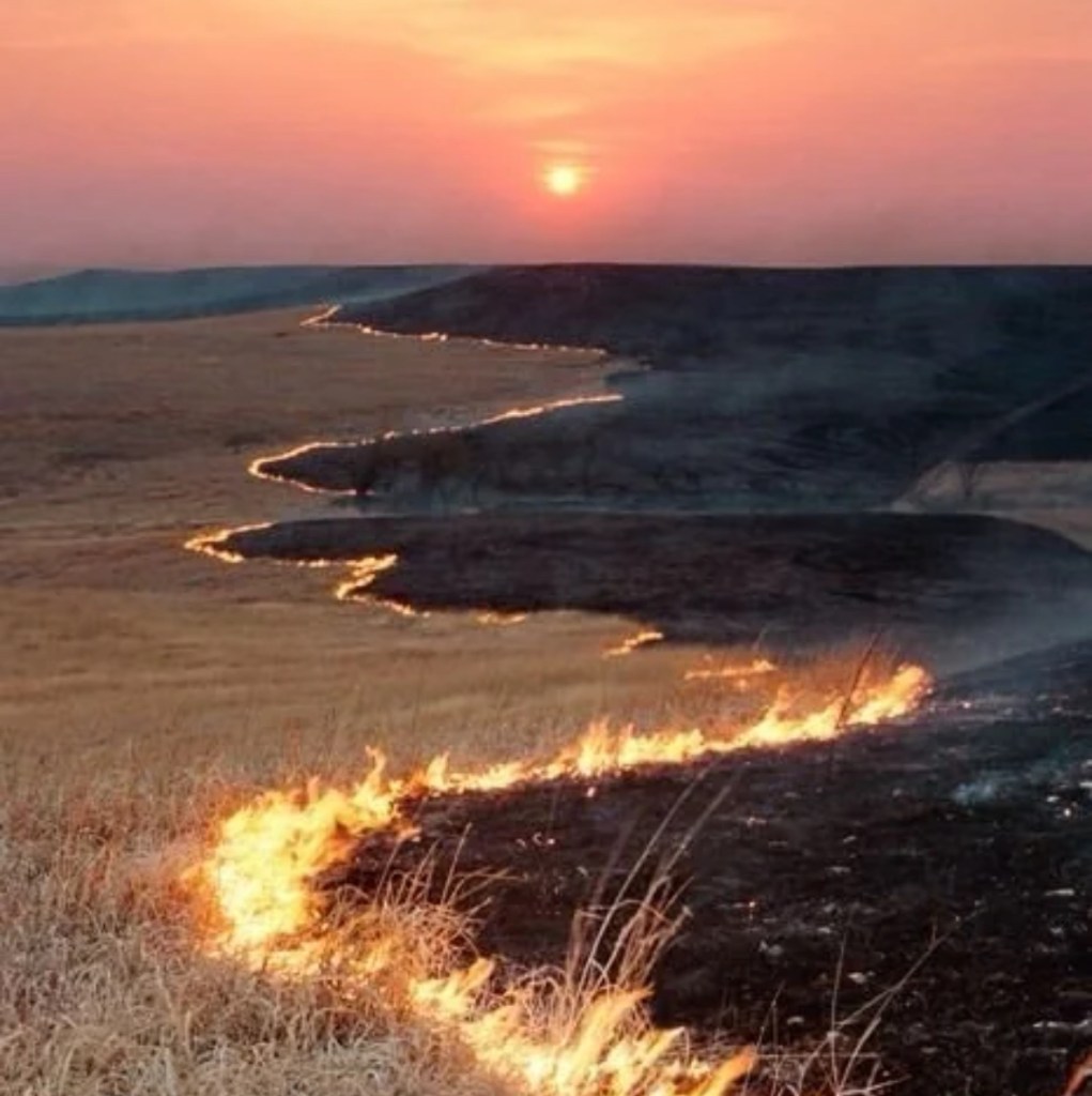
The fertile soil under our boots in the largest natural tallgrass prairie in the United States – The Flint Hills of Kansas – undergoes a replenishment every few years. Occurring when dead prairie tallgrass – dead tallgrass which has accumulated, and now lays dormant – is burned off. Right before Spring arrives.
The ignition of acres upon acres of tallgrasses culminates in quite the scene. Nighttime walls of fire, cascading the prairie’s landscape. Ablaze. Reaching up to twenty feet in height. It’s quite the site to see.
For those driving as the prairie burns, expect to encounter thick smoke. Christened with ash.
Strong winds create a dangerous situation while a prairie burns. Fires are erratic. Winds blowing in excess of 30 mph, coupled to low humidity, could lead to unintended consequences. Such as, a “firenado.” Hence, wise planning. As coordinating burning off dead prairie grasses with tame wind gusts is necessary. “Tame” meaning, wind gusts which max out at less than fifteen miles per hour.
Ranchers patroling fence lines so as to ensure that flames don’t cross over into their pasteurs. Just one of many nuances which come, hand in hand, with Springtime in The Flint Hills of Kansas.
Unplowed slopes of rolling hills. Beset by shallow rocky soil. You may see bison, off in the distance. Topography of TheFlint Hills. Anchored through erosion-resistant limestone.
Tallgrass prairie of the Flint Hills today covers roughly four million acres. With the majority of those nearly-four million acres, found in Kansas. Making The Flint Hills the largest remaining tall grass prairie in the United States.
At one time, tallgrass prairie blanketed 170 million acres of the country. Once extending from the tallgrass prairie’s home today in Kansas – and, to a lesser extent, in Oklahoma – over into Nebraska, Texas, Iowa, Missouri, South Dakota, North Dakota, Illinois. And parts of Canada.
Burning of Flint Hills grasses precedes the planting season each year in Kansas. Taking place in late March. Or early April.
The primary purpose for the annual igniting of the prairie is to enrich the soil. While so too, preventing the encroachment of trees.
Fire-adaptive grasses thrive in The Flint Hills. These grasses, fortified by nutrients which are absorbed by the soil. This absorption of nutrients by the soil is one byproduct of the igniting of the prairie during the Spring.
The prairie is burned. Trees don’t thrive. Nutrient-rich grasses do. Therein lies the point.
Those fires we see in the Flint Hills each Spring eliminate dead grasses. Ridding the prairie of dead grasses – barren of nutritional value – facilitates rapid growth of nutrient-rich grasses. High in protein. A high-protein diet is required in the cattle business.
Switchgrass…
Golden in the Fall, with a greenish-blue color in the Spring. The optimal grazing height of switchgrass is one-and-a-half feet to two feet. In the summer, as traditional grasses stop producing, Flint Hills switchgrass remains rich in protein. Perfect for cattle.
The cattle-to-person ratio in Kansas is two-to-one. Two head of cattle, one person. Cattle is a stalwart in the Kansas economy. There are, give or take, six million head of cattle in Kansas. Needless to say, the cattle industry is firmly entrenched in the economy of Kansas. Contributing $10 billion each year to the State’s GDP.
One secret to the success of Kansas beef would be, weight gains. I.e.: rapid putting on of pounds, which Kansas cattle are able to do. Thanks in large part to rich grasses found throughout The Flint Hills. Those nutrient-rich grasses in Kansas, making up the lion’s share of the diet for cattle.
In Kansas, cattle add most of their pounds, beginning in April – which coincides with the burning of the tallgrass prairie – running through July.
Cattle’s gains…
Kansas cattle can put on up to four pounds of weight – each day – within that April-to-July window. This rapid bulking up by cattle – fueled by nutrients found in Flint Hills tallgrass – contributes to an interest held by out of state ranchers of shipping their cattle to the Sunflower State.
Mature Kansas beef bulls can clock in at between 2,000 to 2,400 pounds. Mature bulls consume up to 45 pounds of dry matter (nutrient content without water) everyday. Possessing such appetites, 4,000 acres of unobstructed nutrient-rich tall grass presents a very nice resource. For ranchers.
With a bull’s substantial daily consumption requirements, cattle from as far away as Florida often make their way up to Kansas’ Flint Hills.. Those nutrient-rich grasses? Attractive to ranchers. Even ranchers beefing up cattle as far away as the Sunshine State.
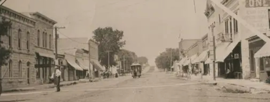
…for the next time you see one of those long BNSF freight trains chugging along the tracks. Whether you see one of those BNSF freight trains in Los Angeles. Or in New York City. Or in Dallas. Or in Chicago. The next time you see one of those BNSF freight trains, you can think about a town located along the Flint Hills Scenic Byway in Chase County, Kansas. You can think about Strong City. Population, 388.
Five years after the Kansas Territory was first organized… Two years prior to Kansas becoming our 34th U.S. State…Chase County, Kansas was born. That year? 1859.
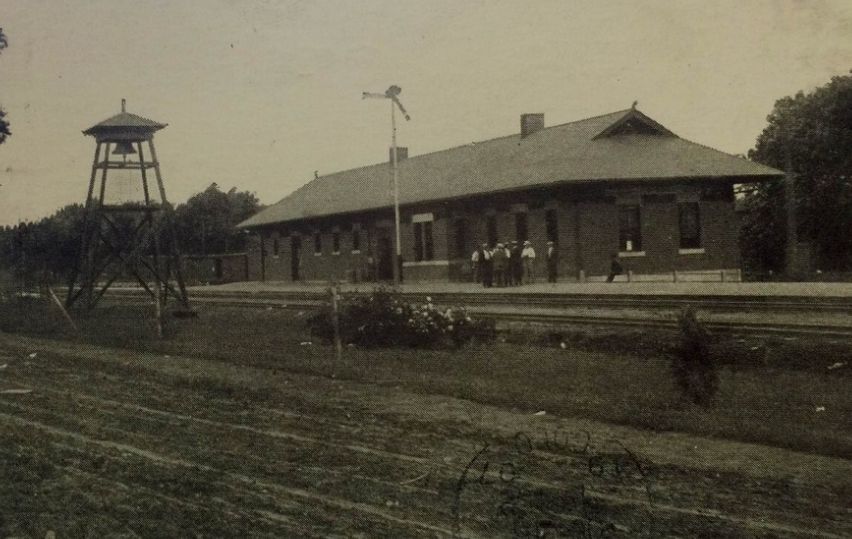
Twenty-two years after that – in 1881 – the railroad in the United States entered Chase County, Kansas. The Chase County town which was the benefactor of this rail extension in Kansas had been Cottonwood.
And in Cottonwood, a new train station was built. That new train station – built in 1881 in Cottonwood – became, the Cottonwood Station.
The very next year – in 1882 – the town of Cottonwood would change its name. Becoming, Strong. Later becoming, Strong City.
Our Strong City name took hold much, much later. Sixty-three years later, to be precise. In 1945.
Strong City…
Yet, let’s go back to the beginning of it all. To the very beginning of Strong City’s – then, Strong’s – imprint on U.S. rail.
The beginning, which brings us to a New Englander. A New Englander, who was born in Vermont. A New Englander by the name of William Barlow Strong. W.B. Strong. As W.B. Strong is where our Strong City-BNSF connection begins.
W.B. Strong. Our namesake for Strong. Our namesake for Strong City. W.B. Strong. W.B.Strong, the man on whom a petition had been set forth to change a Chase County town’s name. From Cottonwood to Strong.
When that railroad – the Atchison, Topeka and Santa Fe Railway – was extended into Cottonwood in 1881, W.B. Strong served as president at Atchison, Topeka and Santa Fe Railway.
The year Cottonwood Station first opened- in 1881 – would be the same year W.B. Strong took over the reins at Atchison, Topeka and Santa Fe Railway. As president. Atchison, Topeka and Santa Fe Railway. ATSF, for short.
Expanding on from the opening of that Cottonwood Station in 1881, under W.B. Strong’s leadership, ATSF significantly grew its train routes. To cover 7,000 miles. 7,000 miles of Atchison, Topeka and Santa Fe Railway routes. Throughout the United States.
Headed by W.B. Strong, Atchison, Topeka and Santa Fe Railway went on to become part of what is today the largest railroad in the United States. ATSF’s growth spurt coincided with the opening of that Cottonwood Station. In our Chase County town that would go on to bear W.B. Strong’s name. In Cottonwood. Later becoming, Strong. Later becoming, Strong City.
Strong City. The Chase County town named after our railroad executive, W.B. Strong.
Whenever we see a freight train, we no doubt will see the letters “BNSF” on those freight cars. And on those, once-steam, now diesel or electric, engines. BNSF is our modern-day evolution for Atchison, Topeka and Santa Fe Railway.
Atchison, Topeka and Santa Fe Railway went on to merge with Burlington Northern Railroad in 1995. Out of this merger, we had, Burlington Northern & Santa Fe Railway.
Later becoming, simply, BNSF.
The prevalence of those BNSF freight trains we see throughout the United States…transporting goods from the West Coast to the East Coast. From the Midwest into Canada. From the Midwest into Mexico. The prevalence of those BNSF freight trains we see…we see those BNSF freight trains, arguably, as the modern day result of the expansion-oriented mindset which had been espoused by the man whose name is forever linked to our Chase County town. W.B. Strong. Our namesake, for Strong City.
In the late 19th Century, then-Cottonwood, later becoming Strong and later still, becoming Strong City, had a population of, between, a few hundred to one thousand people. Strong City’s population today is just about where it had been in its earliest days. A few hundred people.
Just as our Strong City forefather – W.B. Strong – laid the late 19th Century “tracks” for a company which would go to become the largest rail company in the United States – with over 32,000 miles of track, across 28 U.S. States – Strong City would proceed to make a second notable contribution to the freight-by-rail system we now have.
Beginning in the late-19th Century, Strong quarries supplied large quantities of the stone which had been used for U.S. railway expansion. While at the same time, Strong stonemasons handled a good deal of the stone-work which had been necessary in order for that that late-19th Century/early-20th Century rail expansion to take place.
While Strong stonemasons performed according to their names – as stonemasons, handling stone-work for railroads – Strong stonemasons extended their contributions to the growth of late-19th Century/early-20th Century rail in the U.S. beyond their stone-work. In fact, Strong stonemasons went on to enter into numerous phases of late-19th Century/early-20th Century railroad construction. Far beyond stone-work.
The laying of track. Building the bridges on which track was laid. Building train stations. Roadhouses.
Each being one such category of railroad construction that Strong stonemasons placed their signatures upon.
So…our Chase County town of 300-or-so residents, located a little less than a two hour’s drive west of Kansas City. Our Chase County town can be thought of whenever we do see one of those BNSF freight trains.
W.B. Strong. Strong. Later becoming, Strong City. Strong stonemasons. United States rail. BNSF.
For me, it’s quite difficult, moreso, impossible, to see a freight train and to not think about those picturesque drives I’ve taken, oh so many, many times, along Highway 177 in Kansas. Onto Main Street. Along the Flint Hills National Scenic Byway. Into…Strong City.
Strong City. Our Chase County town of 300-or-so people which has left its not so-little-at-all “Strong City signature” – in more ways than one – on U.S.cargo, shipped by rail.
In 1865, at the conclusion of the Civil War, William B. Howard filed a plat to establish a new Missouri town. This new Missouri town would be located 25 miles to the southeast of Kansas City. The platting for Howard’s new town would become the Town of Strother.
Growth prospects for the Town of Strother, as well as planning for the economies of numerous towns which would emerge (or reemerge) in post-Civil War times, had been triggered by post-War Reconstruction.
The founder of the Town of Strother – I.e.: Lee’s Summit – is William Bullitt Howard.
The name for the Town of Strother, paying homage to William Bullit Howard’s late wife, Maria Strother.
Maria Strother died the same year William B. Howard filed his plat to establish the Town of Strother – 1865.
Land on which this new Missouri town would be erected totaled 70 acres. This 70-acre allotment which would go on to become Lee’s Summit was parceled out from the 800-plus acre Missouri plantation owned by William B. Howard.
Born and raised in Kentucky, William B. Howard moved to Jackson County, Missouri in the 1840’s. Coming from a wealthy family in the South, William B. Howard did not serve in the Civil War. As the War raged on, William B. Howard left Missouri. Returning to his native Kentucky. Preceding his later return to Missouri. Preceding the establishment of Lee’s Summit.
At War’s end, Howard did indeed return to his adopted Missouri. Returning to Missouri, while holding a belief that a pending rail connection of St. Louis to Kansas City would create opportunities in commerce. Opportunities which were sure to benefit William B. Howard. A large landowner.
When the Civil War came to a close, recognizing the role rail was certain to play in a post-War economy – and in opportunities for growth in and around Kansas City – William B. Howard entered into negotiations with Missouri Pacific Railroad. Howard negotiated the construction of a new depot. A new depot which was to be built alongside Missouri Pacific Railroad tracks. Just south of Kansas City. On Howard’s land.
Missouri Pacific Railroad proceeded to build their new depot on Howard’s land in Strother.
Upon the incorporation of the Town of Strother in 1868, there was a name change for the town. From the Town of Strother. To Lee’s Summit.
Construction of a second Lee’s Summit depot – the all-brick Missouri Pacific Depot which, still, is located in downtown Lees’s Summit, to this day – was completed years later. In 1905.
The current Missouri Pacific Depot replaced the older, original boxcar station which had been built in the Town of Strother by Missouri Pacific. That old Missouri Pacific boxcar station, and one famous old boxcar parked at that old station, played a humorous yet important role in the town’s name.
The Missouri Pacific Depot which would be built on Howard’s land enabled passengers to travel from Lee’s Summit to St. Louis. That railway connection, having been completed two years after Howard filed his original plat for the Town of Strother in 1865. The Kansas City-to-St. Louis rail connection was completed in 1867. Two years after Howard filed his plat to establish the Town of Strother. One year prior to the incorporation of Lee’s Summit.
The name change from the Town of Strother to Lee’s Summit is attributed to William B. Howard learning of another Missouri town which had also been named “Strother.”
The “Lee” in Lee’s Summit.
Upon relocating to Missouri, from Kentucky, William B. Howard resided in Big Cedar. In Jackson County. Among Howard’s neighbors and friends in Big Cedar had been the Leas. Pleasant and Lucinda Lea.
Pleasant Lea was the local doctor. And postmaster. The Lea family and the Howard family grew to become close friends. Sharing more than their adjacent Missouri addresses. They shared also, their southern pasts.
The Leas moved to Jackson County from Tennessee. The Howards moved to Jackson County from Kentucky. Each family had been a wealthy, transplanted southern family. Establishing new homes for themselves just outside of Kansas City. In Civil War times.
Pleasant Lea died in 1862. Three years before William B. Howard filed his plat to establish his Town of Strother. Which had originally been named for his late wife.
The change in the town’s name from the Town of Strother to Lee’s Summit involved another close relationship of Howard’s. His neighbor and friend, Pleasant Lee.
Pleasant Lea, the origin for our “Lee” in Lee’s Summit.
Pleasant Lea resided in Big Cedar, to the south of Kansas City, prior to the Howards’ arrival. Pleasant Lea. The local doctor. The local postmaster. Pleasant Lea, William B. Howard’s close friend.
It’s Pleasant Lea, spelled L – E – A , so why is it Lee’s Summit, spelled L – E – E?
What should have been spelled out as “Lea’s Summit” – Lea – on a boxcar at that old Missouri Pacific Depot in the Town of Strother, was simply a misspelling.
That boxcar should have had Lea’s Summit” painted on it. L – E – A. The “Lea” denoting the correct spelling for Pleasant Lea’s last name – Lea.
Rather, that boxcar had “Lee’s Summit” painted on it. A misspelling. And so, going forward, the “a” in Lea’s was dropped. Replaced with the “e.” To arrive at, Lee’s Summit.
The “Summit” in Lee’s Summit.
The definition of summit is, the highest point of a hill or mountain.
The “Summit” in Lee’s Summit was coined in recognition of Lee’s Summit being the highest point on the Missouri Pacific line which ran from St. Louis to Omaha, Nebraska.
Lee’s Summit. The name for which we find a wealthy landowner, originally from Kentucky. The railroad. A neighbor. And an elevation point.
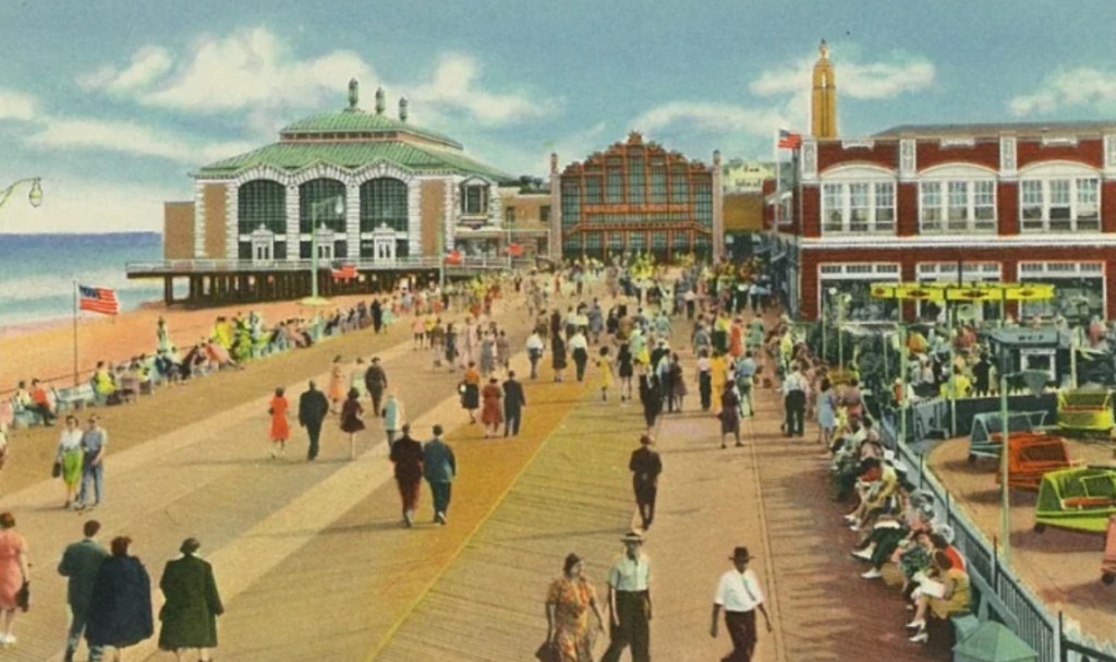
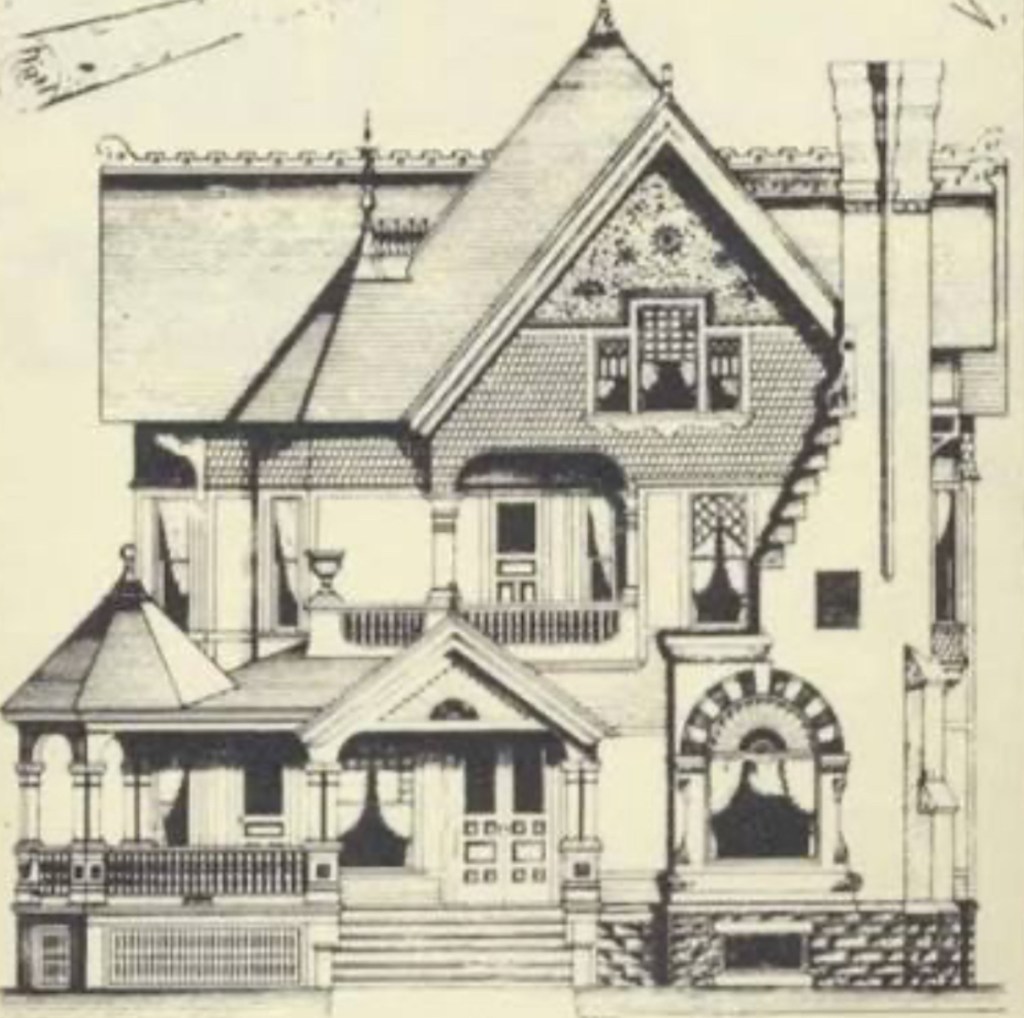
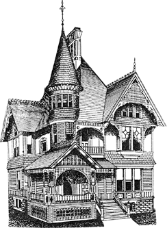
Queen Anne style architecture in Asbury Park, New Jersey can be spoken of as late-19th Century Victorian-styled homes. Victorian homes boasting of seaside-inspired asymmetrical designs.
The building of Queen Anne-styled homes in Asbury Park enjoyed a 30-year run in popularity. Beginning in 1880.
Originally, home for a Queen Anne-style home, was England.
Americans speak English. The British speak English. Yet, in taking a Shakespeare course in college, I discovered that while Shakespeare did indeed write in English, Shakespeare’s English required a translation.
So, in order to translate Early Modern English, Professor Carey read Shakespeare while translating the Early Modern English to a context that I could follow.
Historically, sometimes that of old English origin isn’t exactly the same as it is upon arrival in the United States. Even when it is “the same.”
This can be said of architecture.
In one such case, English architecture which ended up coming to the United States – architecture known by the same name in Great Britain as it was in the States – followed that storyline.
Shakespearean English. American English. Queen Anne-style architecture in England. Queen Anne-style architecture in the United States. English-inspired Queen Anne architecture in Asbury Park. In each case, the labels match. Yet, the products…not exact matches.
Ocean Grove, Avon-by-the-Sea, Long Branch and Asbury Park. Each, a Jersey Shore seaside gem established long, long ago along the coast of Monmouth County.
Asbury Park…
In Asbury Park, a segment of the city’s architecture tastes of a Victorian flavor. These being homes built in Asbury Park near Deal Lake.
Following the pattern of Victorian homes which were then being built on the East Coast during the latter stages of the 18th Century, three floors were the standard in a Queen Anne home. Following that trend, three-floor Queen Anne homes would be built in Asbury Park.
Whereas Queen Anne homes being built on the West Coast at this time tended to have two floors.
In Asbury Park, the Queen had her say…
Beginning late in the 1800’s, and extending on through the early part of the 20th Century, a New World Queen Anne Revival in architecture was becoming quite popular on the Jersey Shore. And Asbury Park was incorporated, right around this time.
First developed as a residential resort in 1871, Asbury Park was incorporated three years later. Asbury Park’s beginning, occurring just as this architectural trend from England – a style, named for a Queen – took hold.
Queen Anne-style architecture was a popular choice in the United States from 1880 through 1910.
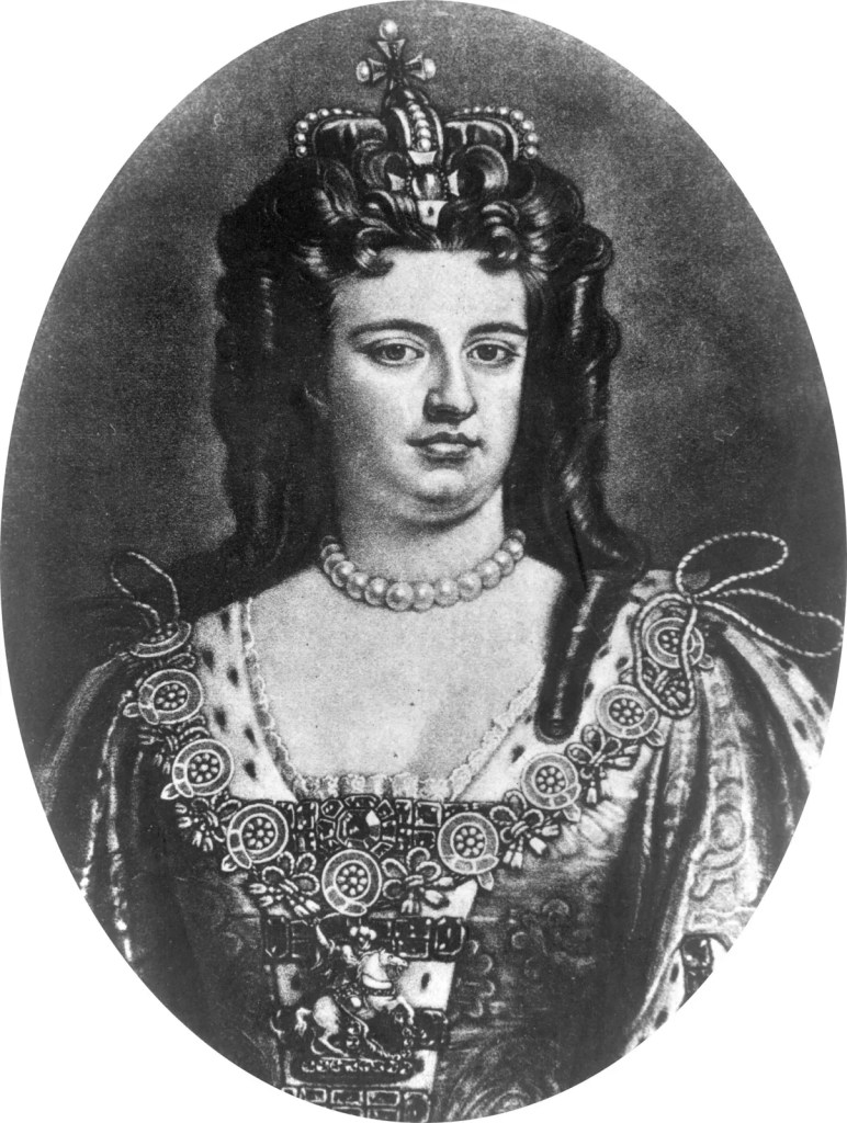
Queen Anne, an 18th Century English Queen. She, a Queen holding the throne from 1702 through 1714. Asbury Park adopted their own version of this trend in architecture which had been named for the queen.
Homes built in Asbury Park utilized a style found within the Queen Anne architectural movement. These designs, which found their way onto 19th Century Asbury Park blue prints, not being mirror images of those used for Queen Anne homes built in Great Britain.
Queen Anne homes of Great Britain were more closely aligned with the Arts and Crafts movement than were their Asbury Park sister homes.
Distinct brickwork. Corner towers. Wide porches. Asymmetrical fronts. Red-brick walls which were commonly offset by pale stone. White-painted woodwork. Bay windows. Characteristics found in a Queen Anne home built in Great Britain late in the 19th Century. And early in the 20th century.
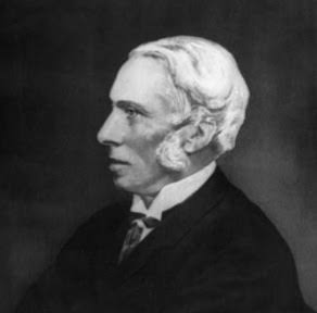
In the midst of Great Britain’s Industrial Age, one British architect’s Queen Anne imprint was famously being cast upon the English landscape. He, an English architect whom many an American has heard of – Norman Shaw.
Born in Scotland, Norman Shaw is widely considered to be one of the very finest architects Great Britain has ever produced. Or, the world has produced, for that matter.
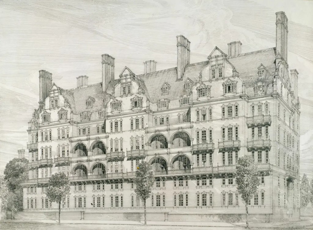
Norman Shaw is responsible for a consortium of Queen Anne structures which, to this day, still proudly stand in Great Britain. Among Shaw’s 19th Century Queen Anne Revival contributions to Great Britain? Albert Hall Mansions.
Shaw’s Albert Hall Mansions was built in 1878. Four years after Asbury Park was established.
Queen Anne masterpieces designed by Shaw were famous for blending characteristics taken from Arts and Crafts homes. As well as from Tudor homes.
With regard to Asbury Park’s version of Queen Anne architecture, when one looks, one will see an inspiration drawn from this style. Inspired by, yet not an exact match.
Asbury Park’s Queen Anne-styled influence can best be seen when walking near Deal Lake. Seen in the turrets. Seen in the towers. Towers and turrets of a Queen Anne design. First thought up in England.
Several of the towers affixed to Asbury Park homes prominently stand three stories tall. Just as a comparable tower which had been added to a Queen Anne blue print in England by Shaw, so too, still stands.
Named for the Queen, made popular in England by one of the world’s most renowned architects, Asbury Park’s version of a Queen Anne home adopted distinct Asbury Park features.
For example…
In Asbury Park, the stateliness of a Queen Anne home often included a wrap-around porch. Also, we’ll see the bay windows in an Asbury Park Queen Anne home. Norman Shaw also liked bay windows. Yet in Asbury Park, the bay windows we’d see would have been below a cedar shingled-roof. Wood shingled-roofs were quite popular in Asbury Park Queen Anne homes.
Not so for a Queen Anne home designed by Norman Shaw in England.
Norman Shaw favored roofs owning a very steep pitch. A favorite of Shaw, his roofs were often finished with red tile. Not wood shingles. With Shaw roofs often married to handsome gables. And to decorative chimneys.
Whereas Shaw went with a deep pitch for his roofs, Queen Anne roofs in Asbury Park had uniquely irregular shapes. Less-reliant upon a steep pitch.
While cedar shingle roofs were commonly found in Asbury Park, such a roof might also have had terracotta tiles. Or metal cornices. Neither of which, Shaw would have used.
The facades…
Norman Shaw’s facades felt fortress-like. Stone-clad. Classic. Old English. Shaw’s facades, inspired by medieval times.
While in Asbury Park, the facade of a Queen Anne home took a different direction.
Asbury Park Queen Anne architecture is known for asymmetrical fronts. And in comparison to Shaw’s homes, for lighter color schemes.
An Asbury Park Queen Anne home would also have had more windows than a Queen Anne home built by Shaw. With lighter color schemes – as well as higher window counts – reflective of Asbury Park being an oceanside community.
Old English – much like Queen Anne architecture – was translated. And in so for each, exactness accompanied not, the translations.
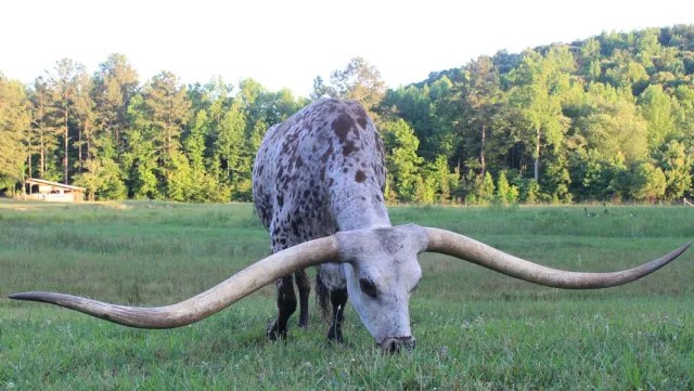
The origin of the name? Their distinct, pronounced long horns. Long horns which can exceed 8 feet in width. From tip to tip.
Bulls weigh between 1,500 to 2,000 pounds. Cows weigh less. On average, 1,000 pounds.
The Texas longhorn.
Texas longhorn color is unique to the breed. Texas longhorn colors vary. And vary they do. Quite a bit.
Just about four-out-of-ten Texas longhorns proudly wear their light red coat. The Texas longhorn coat might also be black. Or yellow. Or brown. Or white. Or brindle. The Texas longhorn coat could also be blue. Blue, that is, with a gray-ish tint.
At auction, the color category of the Texas longhorn have bestows a distinct identity.With rarity in color for the Texas longhorn correlating to a higher price fetched at auction.
Facing near-extinction one hundred years ago, thinning during the 1960’s to a dangerously-low head count, while today the Texas longhorn is primarily found in Texas, the breed confidently grazes – no longer facing extinction – on ranches throughout the United States. A “trophy” on any ranch.
Long, long ago, the Texas longhorn was known as “Texas cattle.” Ancestors of “Texas cattle?” “Mexican cattle.”
Descendants of the Texas longhorn were first introduced to North America during the 1400’s. Finding their way here, thanks to Spanish explorers. The introduction of the Texas longhorn to our prairies dates back to the days of Christopher Columbus. To the days when Columbus led his expedition to the Americas.
With regard to the introduction of the Texas longhorn to North America, the Texas longhorn came ashore in Mexico. From Mexico, as Spanish explorers ventured north into what would go on to become Texas, the Texas longhorn accompanied Spaniards on their northern ventures. Hence, the introduction of “Mexican cattle” to a territory which would one day go on to become Texas.
Cattle brought to North America by Spaniards. “Mexican cattle” led north to Texas. “Mexican cattle” renamed “Texas cattle.” “Texas cattle” renamed “Texas longhorns.”
As more Spanish settlements in the Americas took hold, as the number of settlements established in the Americas by additional European countries grew, so too did grow cattle head count on the continent. Head count for the Texas longhorn increased.
Spaniards reached today’s Texas by the end of the 17th Century. With Spaniards arriving in Texas, along too, came their longhorns.
The Texas longhorn footprint expanded. North into Texas. To the east, into Louisiana.
As cattle head increased, inevitably, some head were bound to escape from captivity. And escape, some did.
Found among escaping Spanish cattle in Texas, our foundation for the history of the Texas longhorn in the United States begins.
Escaping longhorns…
The Texas Longhorn roamed Texas – roaming freely, upon their escape from captivity – through the final days of the 19th Century. At which time, the cattle industry changed Texas longhorn fate.
Late in the 19th Century, the Texas longhorn began to be rounded up en masse. Rounded up and loaded onto rail cars. To be shipped off. Shipped north, that is. To Kansas City slaughterhouses.
Ten-year totals for head of cattle shipped north to slaughterhouses during the last decades of the 1800’s exceeded 5,000,000 head. Over 5,000,000 head of cattle shipped north, per decade.
Those prairies the Texas longhorn escaped to were perfect for grazing. Upon the escape of the Texas longhorn from captivity, the Texas longhorn was not alone on the prairie. The longhorn had company.
The Texas longhorn escaped to what had been “bison country.” In “bison country” the Texas longhorn lived free as, as the bison’s neighbor. Bison and the Texas longhorn, alongside one another for centuries.
That neighborly existence of bison and longhorn began in the 15th Century. When the longhorn was first brought to the western hemisphere. Brought from Europe. Aboard Spanish ships.
In the 15th Century, longhorn count in North America had been low. North American settlement by Europeans – as well as the introduction of cattle to North America – was in its infancy.
Fast forward a few hundred years to the Texas longhorn’s prime. The last days of the 19th Century.
As the 19th Century drew to a close, that “bison country” the Texas longhorn escaped to was subjected to an extermination. This was an extermination at the hands of the United States government.
In the late 1800’s, “bison country” was in the process of being cleared. Cleared of bison. Cleared by the government of the United States.
United States prairies cleared of bison. This, a concerted effort undertaken by the United States to rid the western corridor of the country of the primary food source of Native Americans. Native Americans, whom the United States government was intent on removing from their land, hunted bison. Eliminating the bison. Eliminating Native Americans. Opening up the west for United States expansion.
The Texas longhorn thrived in “bison country” when they arrived. The Texas longhorn thrived in “bison country” for hundreds of years. Thriving alongside bison.
The removal of the Texas longhorn’s competition for rich prairie grasses – this removal being the extermination of bison by the United States government – as the Civil War was coming to a close led to what would turn into the United States’ southwest becoming blanketed by cattle.
Head count of cattle increased. Head count of the Texas longhorn increased.
Prime years which encompassed the run for the Texas longhorn as a major contributor to the economy of Texas – and to bottom lines for Kansas City slaughterhouses – would be late in the 18th Century through the first two decades of the 20th Century.
By the 1920’s, the United States southwest was undertaking a notable increase in private property ownership. Private property, that is, which would now be fenced off.
The increase in private land ownership by individuals in Texas – as well as in the United States’ southwest – by the 1920’s substantially curtailed the Texas longhorn’s once unimpeded access to thousands of acres of rich grassland. The Texas longhorn’s food source – that open grassland – was significantly altered.
Between 500,000 to 1,000,000 head of cattle were shipped by train from Texas to Kansas City annually during the latter days of the 19th Century.
By the mid-1960’s there were fewer than 2,000 Texas longhorns in the United States. Total.
Once nearly wiped from existence entirely, today, Texas longhorn head count exceeds 300,000.
The reemergence of the Texas longhorn in Texas, as well as on privately-owned ranches throughout the United States, firmly re-established.
Today, if you are looking to purchase one Texas longhorn, you can expect to write a check for between $2,000 to $5,000. At a minimum.
For breeds of the Texas longhorn, breeds with a horn width considered to be wide, tip-to-tip (T2T), the price paid for one head will increase. The wider the T2T, the higher the price for one Texas longhorn.
The color of a Texas longhorn also affects its price.
The coat of the Texas longhorn sports an interesting array of desirable color coordinations.
Three Texas longhorn coat categories have traditionally been acknowledged to be the most highly-sought after: 1) White Roan, 2) Brindle, and 3) Grulla.
The Texas longhorn with the White Roan coat also possesses a red-ish pigment. Influenced by a roan gene. The result? The Texas longhorn whose coat is blue-ish in color.
The Texas longhorn with the Brindle coat? That Texas longhorn will own vertical black stripes.
The Texas longhorn with the Grulla coat? That Texas longhorn would be silver-ish in color.
Should you decide to purchase one Texas longhorn, one whose genetic history can be documented to be of “championship pedigree,” that $2,000 to $5,000 check you’d write to buy one head would increase. Increase substantially. To a few hundred thousand dollars. For one head.
The top price paid for one Texas longhorn? $700,000.
Located 47 miles to the south of New York City, bordering Red Bank, Fair Haven and Rumson, home to 12-acre Parker, Sickles Farm Park, with a population of a cat’s whisker over 6,000 residents, we find the Borough of Little Silver. An exclusive community majestically nestled alongside the Shrewsbury River…a Monmouth County borough which speaks to boating and water sports enthusiasts.
The beginning for Little Silver was that of a quiet agricultural community. With fisheries adding to the borough’s landscape in its earliest days.Little Silver’s history dates back to 1663. To a King’s Land Grant. A land grant from Great Britain by the King of England, King Charles II.
Two years after King Charles’ land grant, a Rhode Island Quaker by the name of Peter Parker settled with his family in what went on to become Little Silver. This, in 1665.
Our borough’s name of “Little Silver.”
The origin for “Little Silver” came about when Peter Parker named his new settlement in Monmouth County after his father’s Portsmouth, Rhode Island estate. His father’s Portsmouth estate, Little Silver.
With Parker’s arrival along the Shrewsbury, neighboring settlements forming around Parker’s Homestead affectionately referred to the area as Parkerville. As a tribute to Peter Parker. The Parker Homestead was built in 1720. Built on today what would be Rumson Road, alongside Parker’s Creek.
Parker family descendants resided at the original Homestead for over three-hundred years. The last Parker residing at the original Homestead was Julie Parker.
The last surviving Parker Homesteader, Julie Parker passed away in 1995. Her death marking an end to 330 years of uninterrupted occupancy at the original Homestead by a member of the Parker family.
From early settlement, to destination point.
During the 19th Century the emergence of steamboats added to Little Silver’s guest list. With Patten Line Steamboats handling maritime transportation to and from Little Silver.
This topic of steamboat travel and Little Silver connect us to one steamboat captain in particular. A steamboat captain to whom an epoch found within Little Silver’s past is correlated. A steamboat captain whose signature was scripted to Little Silver in the 19th Century.
A steamboat captain: the founding father of Little Silver Point. In 1844 a steamboat captain by the name of John Borden arrived in Little Silver. Relocating to Little Silver from nearby Red Bank. With his arrival in Little Silver, John Borden proceeded to establish Little Silver Point. An unincorporated section of Little Silver.
Prior to the establishment of Little Silver Point, this peninsula in Little Silver’s northeast corner had been not much more than farmland. And soggy saltwater marshes.
The arrival of John Borden in Little Silver marked the beginning of a transformation for the peninsula. Little Silver Point changed. Taking on a new identity. One scripted by the construction of fancy hotels on the peninsula.
Those early hotels built in Little Silver Point would accommodate visitors coming to a new Little Silver Point. On steamboats. Little Silver’s farms and marshes, no longer defining fabric for the peninsula.
John Borden’s lot in life had always been his pioneering of steamboats. Steamboats let New Yorkers come to Little Silver Point. Little Silver Point became a sought-after resort. Guests arriving in Little Silver Point atop steamboat decks.
John Borden passed his steamboat acumen on to his son, Richard Borden. Cementing the Bordens in Little Silver history, Richard Borden went on to operate Silver Bay House in Little Silver.
Borden’s Silver Bay House became the place to go for New Yorkers who came to Little Silver on Patten Line steamboats.
Patten Line’s path to Little Silver’s riverside hotels was the Shrewsbury River. The Patten Line connected Monmouth County to Battery Park from the end of the Civil War to the 1930’s.
It was a sixty year-run for those Patten Line steamboats which started their voyages in Battery Park. Arriving in Monmouth County on the Shrewsbury River.
Accompanying 19th Century steamboat travel, the advent of passenger trains contributed to Little Silver’s accessibility.
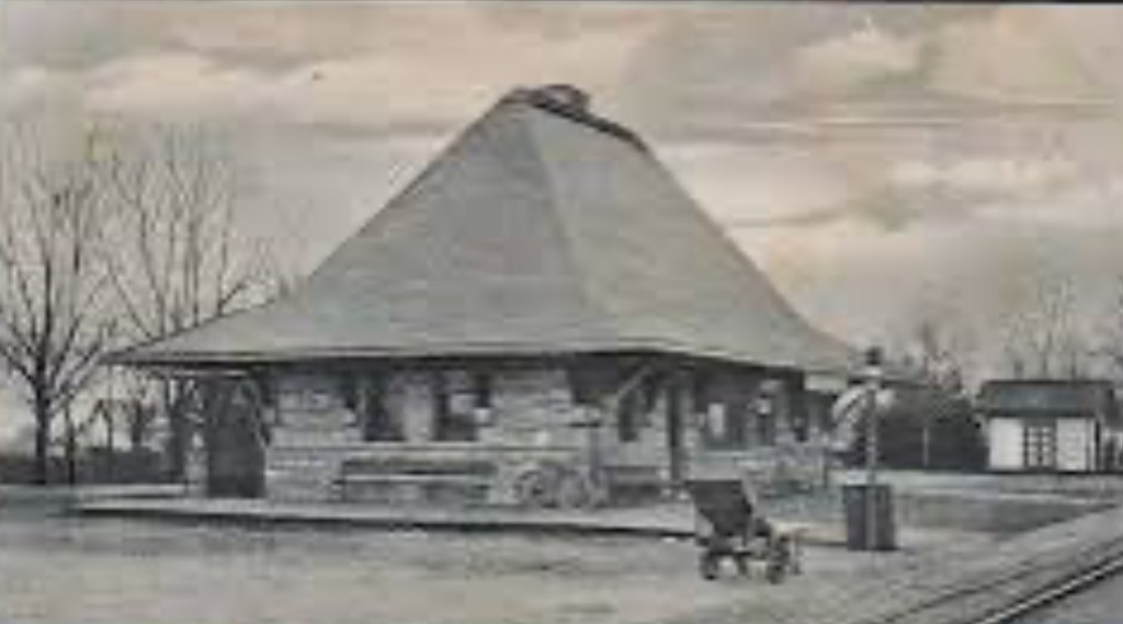
Construction of The Little Silver Train Station occurred in 1875. Little Silver’s station was built by the New York and Long Branch Railroad.
The original station in Little Silver served passengers for fifteen years. From 1875 through 1890.
The original station was replaced in 1890 by the structure which still stands along tracks in Little Silver to this day. At the intersection where Branch Avenue meets Sycamore Avenue.
The one-hundred thirty-six year old station we find in Little Silver at 705 Branch Avenue in 2026 gets commuters to Newark’s Penn Station. And New York’s Penn Station.
The Little River Train Station, with its sandstone exterior and its distinct slate roof, was the creation of a famed architect from Brookline, Massachusetts.
The Little River Train Station architectural design is attributable to Henry Hobson Richardson.
Henry Hobson Richardson’s contributions to the American architectural landscape include The Little Silver Train Station, Trinity Church and the Boston Public Library.
Up through 1923 Little Silver had been part of Shrewsbury Township. Little Silver became its own municipality through an act of the New Jersey legislature in March of 1923.
Little Silver’s history is intertwined with the Shrewsbury River. This connection of borough to waterway, foretelling still Little Silver of today.
In 2026, nearly 10% of all homes in Little Silver touch the banks of the Shrewsbury River.
Four hundred years after King Charles’ land grant to this riverside settlement, the river remains an anchor for the settlement.
Long, long ago, the Shrewsbury River functioned as a maritime agent for those visiting Little Silver Point. Today, the Shrewsbury River can be characterized as a waterway pillar. A waterfront pillar upon which a stock of distinct Monmouth County real estate now proudly resides.
Fixing and flipping homes, one-by-one, is not the most effective way for cities and townships to pursue neighborhood revitalization.
Rather, the issuance of requests for proposals (“RFP’s”) is a better way for municipalities to transition non-performing properties owned by municipalities onto the market as “performing properties.” While at the same time, A) providing investment opportunities for real estate investors, and B) aligning investment opportunities for real estate investors with the municipality’s goals.
Eliciting the submission of proposals from developers is the way to do it.
Furthermore, a fix-and-flip, one-home-at-a-time approach can’t function in a neighborhood centric manner. How could it? Ten homes available to rehab. Ten individual investors. Ten individual investors…ten home renovations. Ten home renovations…not cohesively aligned.
Whereas, within a request for proposals, neighborhood revitalization goals can be intertwined with investment opportunities. Thus, creating a proverbial “win-win.”
Developers are presented with an investment opportunity through the request for proposals. Win #1.
The municipality receives multiple proposals from multiple developers. From which, the municipality possesses the opportunity to select the proposal which best speaks to the municipality’s objectives. Win #2.
Hence, my reasoning for the utilization of requests for proposals. For land bank agreements. For the designation of redevelopment entities.
You’ve thought about building your own home. You can. A construction loan can make it happen.
There are different types of construction loans. So let’s look at two of these loan types: a) the one-time close construction loan, and b) the two-time close construction loan.
With the OTC, you qualify one time for two loans.
The 1st qualification is for your construction loan. The 2nd qualification is for your permanent loan.
And then there is the two-time close (“TTC”) construction loan.
The TTC is a riskier loan than the one-time close. Due to the fact that with the two-time close, you will need to qualify based upon your credit and your income a second time- after your home is built.
With the TTC, any reduction in your income or a drop in your FICO Score – while your home is being built – could make it more difficult to qualify for your permanent loan.
Another potential risk to consider with the two-time close is, What if the construction phase doesn’t go well? What if construction is not completed?What if it’s delayed?
In either situation – a) a drop in your credit score or a reduction in your income, or b) challenges with construction, with the TTC, qualifying for your permanent loan could be put at risk.
Key points…
The one-time close construction loan: one loan approval
The two-time close construction loan: two loan approvals.
Kansas City, Kansas’s evolution can be characterized as a merger of towns. A merger of towns which went on to become KCK neighborhoods.
In 1886 Kansas City, Kansas added the independent settlements of Wyandotte City, Armstrong, Riverview and Armordale to the city’s footprint. Combining to then make up this “new” Kansas City.
Twenty-four years later, Kansas City annexed Argentine. Argentine was built around smelting and mining plants. Argentine’s plants, benefitting from Argentine’s location alongside the Santa Fe Railroad.
Today’s KCK neighborhood of Argentine borders Rosedale.
Prior to its annexation by Kansas City in 1922, Rosedale had been The Town of Rosedale. Settled in 1872.
Annexed by Kansas City in 1923, Quindaro was originally a free state port alongside the Missouri River. Within the abolitionist movement, Quindaro was once an Underground Railroad station.