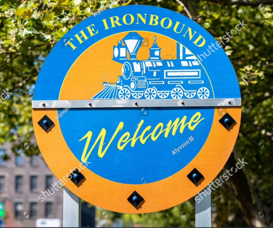
The story behind the iconic name linked to one four square mile section within Newark’s East Ward just east of Penn Station is somewhat argumentative.
While it is somewhat subjective how this Newark neighborhood became The Ironbound, no argument can be made that the origin for this name we are referring to – The Ironbound – came about as a result of what was going on in this Newark neighborhood in the early part of the 19th Century.
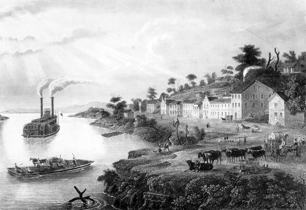
Newark was emerging as one of the preeminent United States manufacturing centers. Trains. Lots of trains. Freight trains. Lots of freight trains. Train tracks. Lots of train tracks. And within that network of Newark train tracks is where we find our origin for “The Ironbound” name.
Newark was transitioning away from being an agricultural economy. To its new identity. As an economy built around heavy industry. Freight trains played a major role in the success of Newark’s economic transition.
By the 1830’s, rail had become the most efficient way to transport the finished manufactured goods which were being made in Newark to outside markets. Where they could then be sold.
During the first half of the 19th century – with this advent of rail – what once had been a section of the city, strewn with swamps and farms, was going through a seismic change. It was becoming a neighborhood dominated by heavy industry. The Ironbound. Surrounded by trains tracks. Train tracks everywhere. Hence, the origin for our name, “The Ironbound.” Train tracks. Lots and lots of train tracks. In this four square mile Newark neighborhood. The Ironbound.
There is an alternative point-of-beginning for the name “The Ironbound.” One attributed not to this network of train tracks in Newark’s East Ward. But rather, to the preeminence of metalworking, forges and foundries found in The Ironbound in the mid-19th Century.
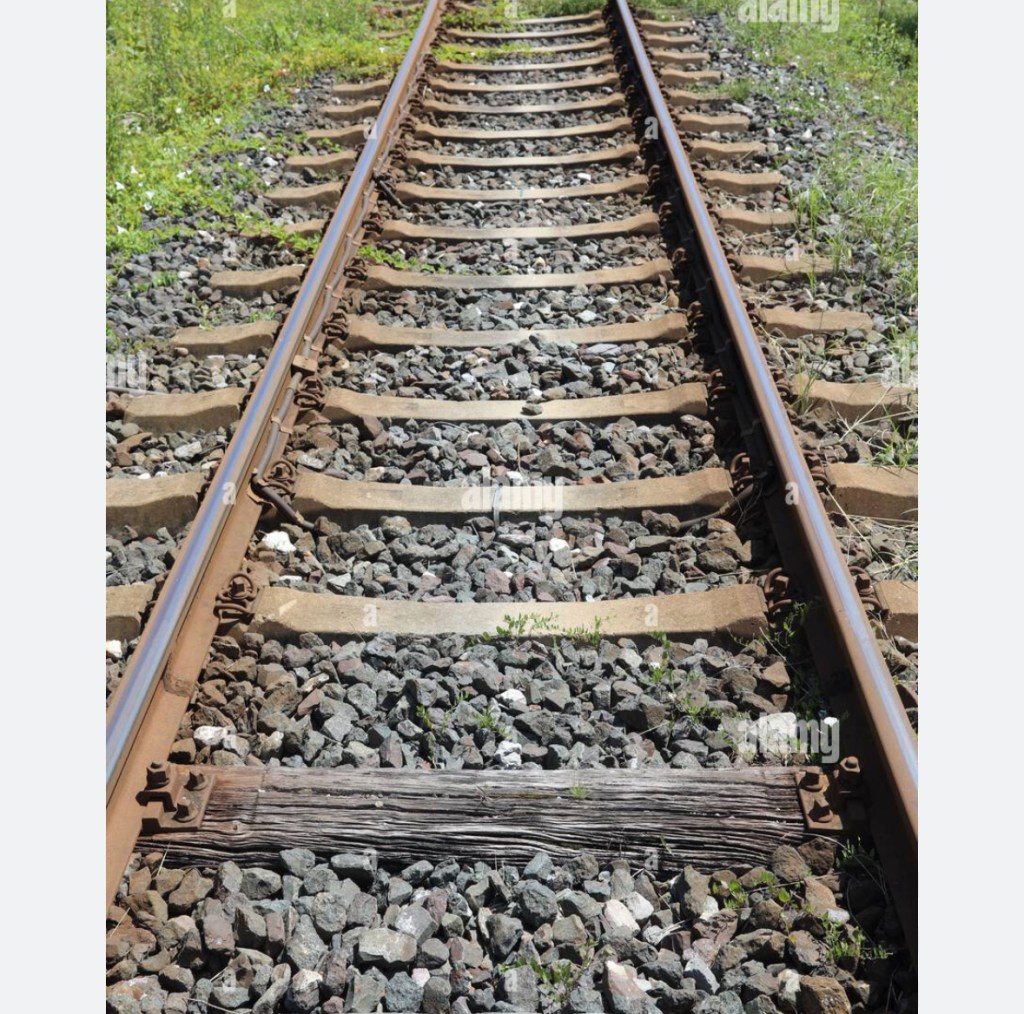
A portion of the reasoning for linking the origin of The Ironbound name to 19th Century metalworking – rather than (primarily) to rail – could be found in knowing that train tracks are made of steel. Not iron. But, a caveat…
It was in the mid-19th Century – after The Ironbound already began to transition from farming to heavy industry – that, for the very first time, steel rails could even be thought of as being used as a possible replacement for the iron rails which were always used (up until that time) to lay tracks. The first steel rails – ever used – were laid in Britain. In 1857. 1857…twenty-one years after Newark Broad Street Station opened. As Newark’s first freight station.
So, when those 19th Century trains roared into – and out of – The Ironbound, those 19th Century tracks the trains rode on were made of iron. Not steel. Hence, The Ironbound.
For those who believe the origin for The Ironbound name is based upon foundries…Seth Boyden.
Seth Boyden opened the first malleable iron foundry in the United States which was capable of producing the buckles and the harnesses which, when used together, then made up the two primary ingredients for the carriage industry. Boyden’s Newark’s foundry was the Malleable Cast Iron Foundry and Condit. The Malleable Foundry and Condit was established in The Ironbound. On Orange Street.
Balbach and Sons Refining and Smelting Company – once the second largest metal processing enterprise in the United States – was located where one now finds Riverbank Park in The Ironbound.
The Oscar Barnet Foundry was located on McWhorter Street in The Ironbound.
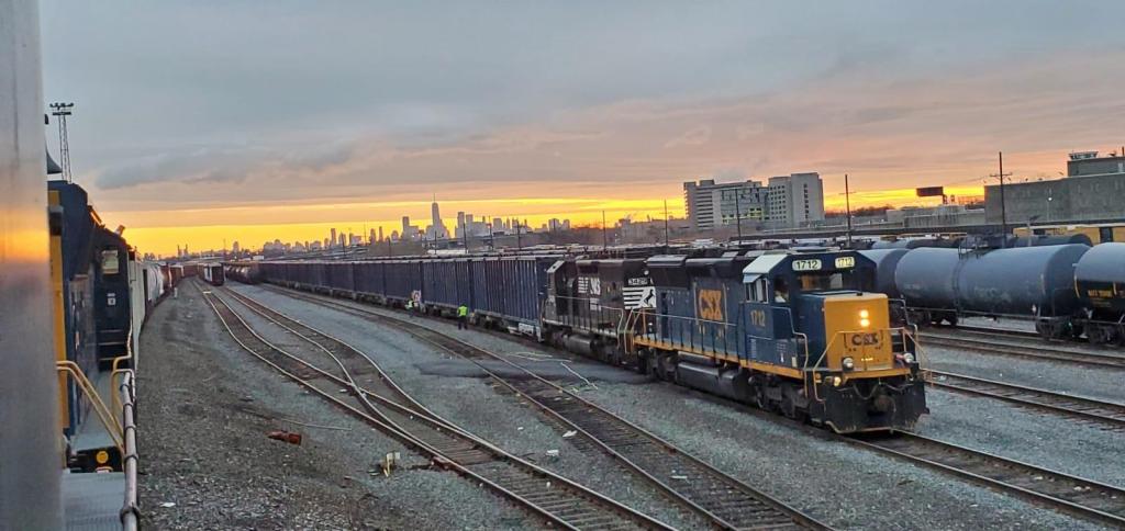
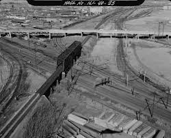
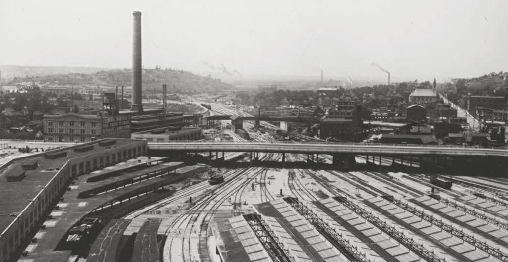
Foundries, metalworking and forges. Yet morseso than the foundries which once flourished in The Ironbound, The Ironbound name is most visibly seen today when you drive by 91 Bay Avenue – Oak Island Yard.
Opened in 1903, just about one thousand train cars travel through Oak Island Yard in The Ironbound…to this day.
The Ironbound name? It was those train tracks in The Ironbound. Those iron train tracks.
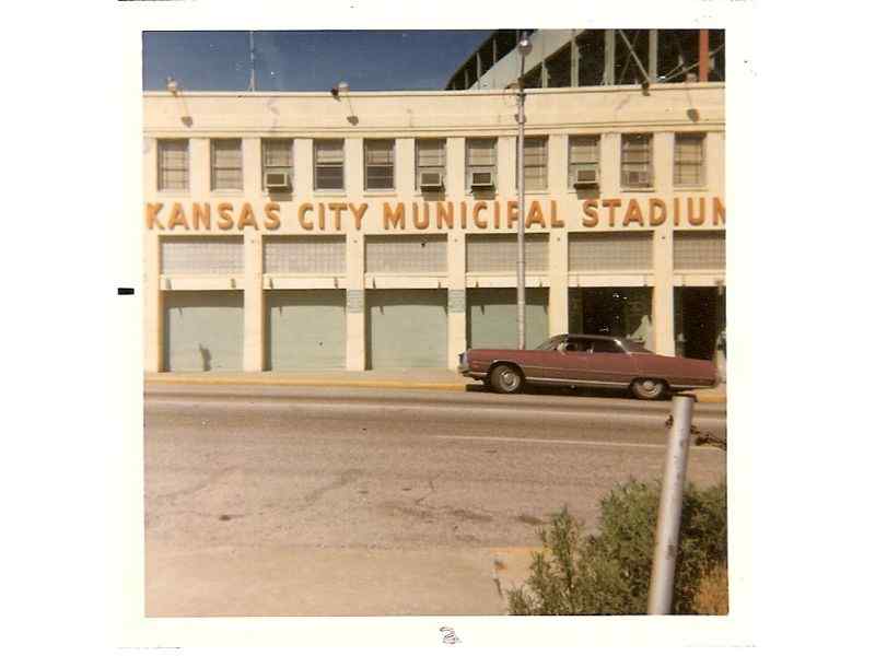
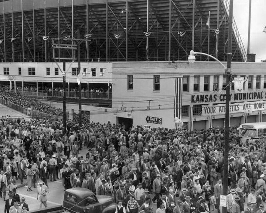
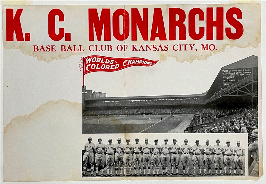
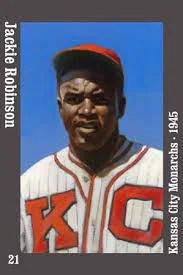
Between 1923 and 1955 the Kansas City Monarchs called Kansas City – and Kansas City Municipal Stadium – “home.”
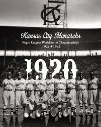
The Kansas City Monarchs won twelve league championships before major league baseball was racially integrated. The Monarchs appeared in four Negro League World Series, winning it all in 1924. And again in 1942.
The Kansas City Monarchs produced more Major League Baseball players than any other Negro League franchise. Some of whom went on to become household names.
Jackie Robinson played for the Kansas City Monarchs in 1945. Jackie Robinson was later signed by the Dodgers…breaking the color barrier in Major League Baseball in 1947.
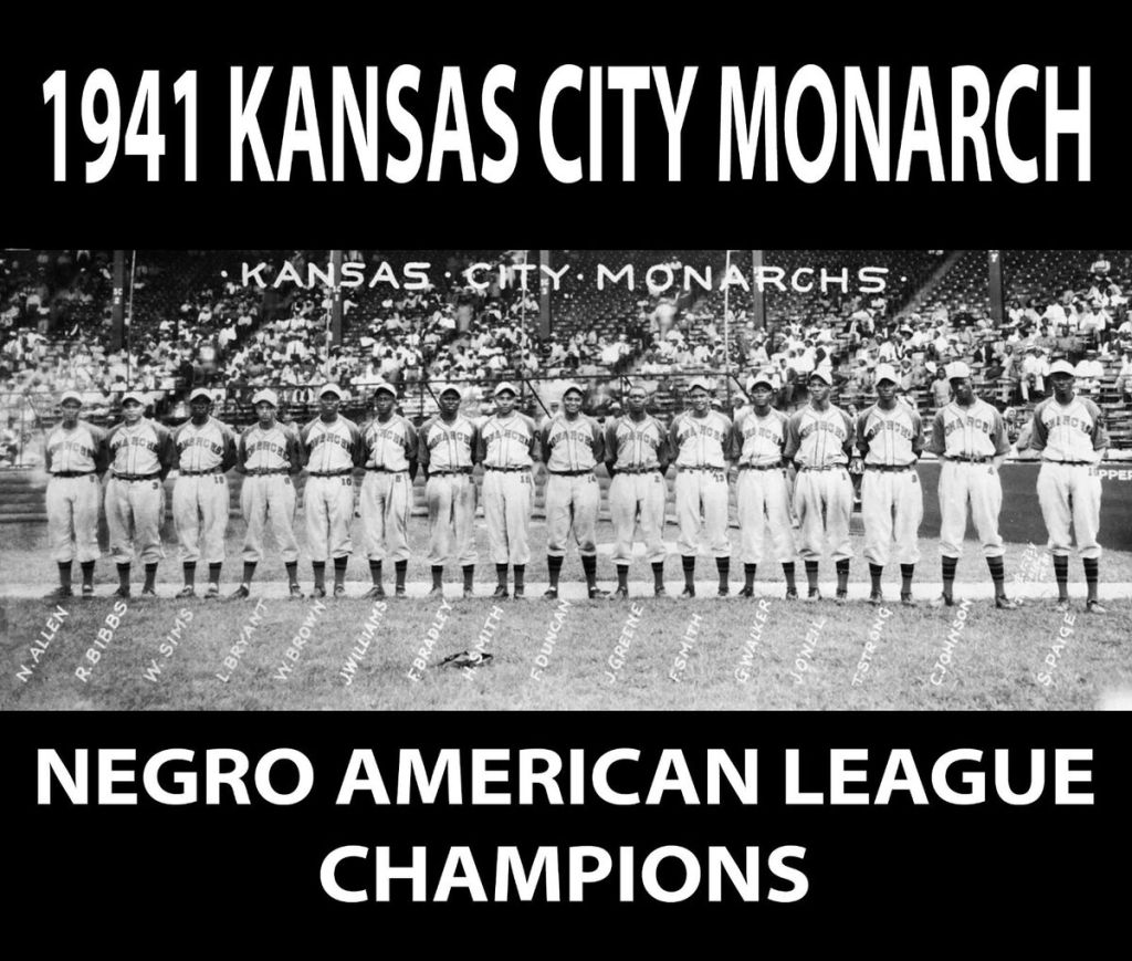
Satchel Paige and Ernie Banks played in Kansas City too. For the Kansas City Monarchs.
There are thirteen one-time Kansas City Monarchs in the Major League Baseball Hall of Fame. There are four Kansas City Monarchs in the Hall of Fame whose Hall of Fame plaques depict the players sporting Kansas City Monarchs uniforms. The four Monarchs in the Hall of Fame, wearing the Monarchs uniform? Willard Brown, Satchel Paige, J.L. Wilkinson and Hilton Smith.
The first Negro League World Series game ever played was played in Kansas City. At Kansas City Municipal Stadium. The year was 1924.
The Negro League Baseball Museum is located a few blocks from where Kansas City Municipal Stadium once stood. In Kansas City’s historic 18th and Vine District.
Jackie Robinson started out in Kansas City. Jackie Robinson’s first contract as a Kansas City Monarch paid him $400/month.
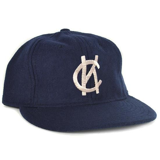
Kansas City’s one-time minor league baseball team – the Kansas City Blues – were the original Municipal Stadium tenants.
The Kansas City Blues have made some notable contributions to Major League Baseball. And to the winningest team in all of sports…the New York Yankees.
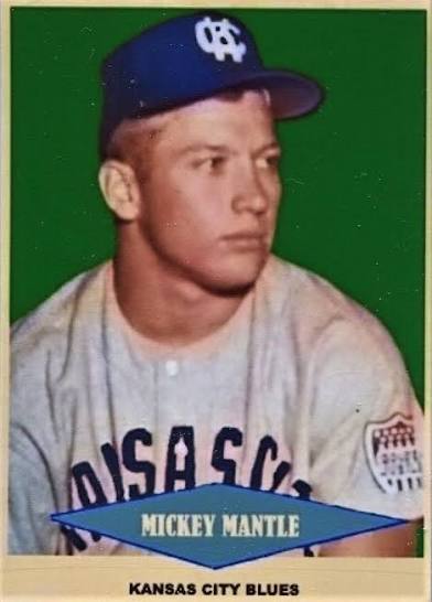
Mickey Mantle once played in Kansas City. For the Kansas City Blues. Whitey Ford, Elston Howard, Yogi Berra and Phil Rizzuto all played for the Kansas City Blues as well.
Between 1955 and 1967, the now-Oakland Athletics were then the Kansas City Athletics. The Kansas City Athletics played their home games at Kansas City Municipal Stadium.
Some famous Oakland A’s – then later, famous New York Yankees – got their starts in Kansas City. As Kansas City Athletics. Those famous Kansas City A’s-turned-Yankees? Reggie Jackson and Catfish Hunter.
Reggie Jackson played his rookie year in Kansas City for the Kansas City Athletics in 1967. Reggie Jackson batted .178 his rookie year in Kansas City. Reggie hit one home run as a Kansas City Athletic that year.
Catfish Hunter played in Kansas City for the Kansas City Athletics from 1965 until 1967.
In 1978, in the playoffs, while playing for the Yankees and against Kansas City, Reggie batted .462, He hit twice as many home runs in the 1978 playoffs against Kansas City as he hit as a rookie in Kansas City. As a Kansas City Athletic. Reggie hit two home runs against Kansas City in the 1978 playoffs.
In 1955, the Kansas City Athletics drew nearly 1.4 million fans to their home games at Municipal Stadium. That year, the Kansas City Athletics had the third best home attendance in baseball.
The New York Yankees had the best attendance in baseball in 1955. On the roster of the 1955 New York Yankees…we find the connection to Kansas City.
Elston Howard. Yogi Berra. Phil Rizzuto. Billy Martin. And Mickey Mantle. All players on the pennant-winning 1955 New York Yankees. Each tracing the beginning of their careers to Kansas City. And to Kansas City Municipal Stadium.
Elston Howard was a Kansas City Monarch in 1948. While in Kansas City, Howard, the first African American to make it onto a Yankees roster, played for Buck O’Neil, the first African American coach in Major League Baseball history.
Yogi Berra played for the Kansas City Blues in 1944 and 1945.
Whitey Ford played for the Kansas City Blues in 1950.
Phil Rizzuto played for the Kansas City Monarchs in 1931, and from 1933 to 1939.
Billy Martin played in Kansas City. Not for the Blues. Not for the Monarchs. Billy Martin played in Kansas City for the Kansas City Athletics. In 1957.
Mickey Mantle played for the Kansas City Blues. In 1952.
The Yankees lost the 1955 World Series to the Brooklyn Dodgers. The Dodgers beat the Yankees in the 1955 World Series in seven games.
On the Series-winning 1955 Dodgers we’d find another all-time great whose career began in Kansas City, playing in Kansas City Municipal Stadium. That Dodger great? Jackie Robinson.
Kansas City, Kansas’s beginning came to be by way of a merger of towns. A merger of towns which then became KCK neighborhoods.
In 1886 Kansas City, Kansas was formed when the independent settlements of Kansas City, Wyandotte City, Armstrong, Riverview and Armordale combined.
Twenty-four years later, Kansas City annexed Argentine. Argentine was built around smelting and mining plants. Argentine’s plants, benefitting from Argentine’s location alongside the Santa Fe Railroad.
Today’s KCK neighborhood of Argentine borders Rosedale.
Prior to its annexation by Kansas City in 1922, Rosedale had been The Town of Rosedale. Settled in 1872.
Annexed by Kansas City in 1923, Quindaro was originally a free state port alongside the Missouri River. Within the abolitionist movement, Quindaro was once an Underground Railroad station.
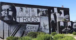
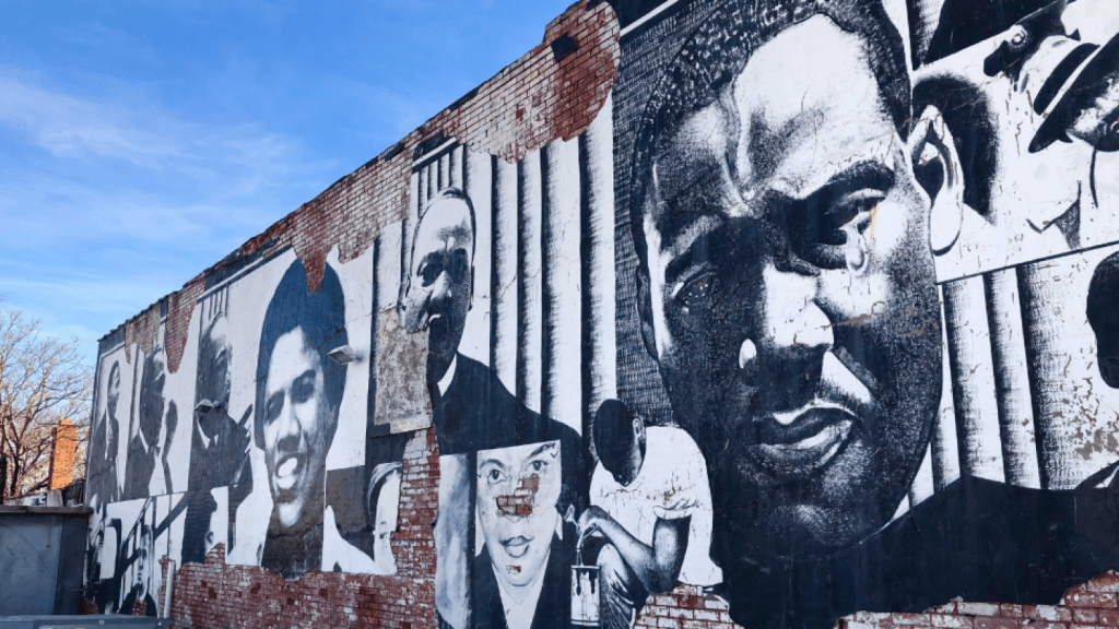
There is an interesting, historically significant 10-mile street in Kansas City, Missouri which runs from 4th Street to Bannister. The Kansas City, Missouri street I am referring to here is Troost Avenue.
Among the Kansas City, Missouri neighborhoods which border Troost Avenue are…Beacon Hill, Longfellow, Squier Park, Rockhill and Hyde Park. All are fabulously sought-after KC neighborhoods.
Troost Avenue was named after a doctor – Benoist Troost. Dr. Troost, as well as being a prominent Kansas City physician, had been a civic leader in KC. Troost Avenue.
Troost Avenue was once home to “Millionaire’s Row.” Early in the 20th Century, “Millionaire’s Row” had been a strip of stunning mansions constructed all along Troost Avenue. Those mansions adorned Troost from 31st Street to 34th Street.
Today, Troost Avenue is experiencing keen interest. And a tasteful renaissance of redevelopment. In times past, Troost Avenue experienced a storied history of disinvestment. And decline. Prior to Troost’s renaissance. So what led to Troost’s decline?
Disinvestment. But real estate disinvestment was not the primary catalyst which led to Troost’s mid-20th Century decline. Real estate disinvestment certainly was one catalyst which led to Troost’s decline. But real estate disinvestment was not the primary catalyst which led to Troost’s decline.
Disinvestment in public schools east of Troost was the primary catalyst which led to Troost’s decline.
Starting off in the late ‘60’s, the School Board in Kansas City, Missouri consistently requested increases in education funding for Kansas City, Missouri schools located east of Troost Avenue. For this topic, there were in the range of twenty such education funding requests made by the Kansas City School Board during this time. These were funding requests made throughout 1960’s. Throughout the 1970’s. For twenty years.
The additional funds – if approved – would have gone to Kansas City, Missouri public schools east of Troost Avenue. Funding requests were voted down. The result? White flight.
Families – those having the means, that is…meaning, predominantly white families at that time – moved. Families moved outside of the underfunded Kansas City, Missouri School District. Schools east of Troost were underfunded.
White flight. Neighborhood home values decreased. One prominent Kansas City mayor once referred to Troost Avenue as, “…the demarcation line in a war zone.”
The problem – east of Troost – wasn’t the legal segregation of schools. Nor was the problem – east of Troost – the illegal segregation of schools. The problem – east of Troost – was school funding. Or a lack thereof.
Long before round after round after round after round of failed requests were submitted to secure funding for Kansas City, Missouri public schools east of Troost, those same public schools were in fact desegregated. Yet school desegregation didn’t really solve this problem in Kansas City east of Troost. Because while school desegregation based upon race was the national mandate after Brown v. the Board of Education, decisions made which affected education funding were – and are – made at the local level. And therein was the problem for public schools east of Troost. At that time.
In 1954, the United States Supreme Court unanimously ruled in Brown v. the Board of Education of Topeka, Kansas that state-sanctioned segregation of public schools was unconstitutional. Prior to this 1954 Supreme Court ruling, in Kansas City, Missouri – east of Troost Avenue – Lincoln High School had once been the only high school providing post-elementary education to Black students. One high school.
In 1955, one year after Brown v. the Board of Education, the Kansas City School Board kind of enacted a “segregation” of public schools, in a different way. This was like a “de-facto segregation.” Not based upon race. But rather, this was a different form of segregation which was based upon attendance zones. Not race.
Yet, do we recall the aforementioned white flight east of Troost? The white flight which took place as round after round of funding requests for schools was voted down? Which led to panic selling? Which led to block busting? As white families relocated out of the Kansas City, Missouri school district?
Kansas City, Missouri public schools east of Troost were not segregated based upon race after the 1954 Supreme Court decision. But yet, in a practical sense, they kinda still were.
The city’s expansion…
Beginning in the 1950’s, and extending onwards through the 1960’s, Kansas City, Missouri – as a city – grew. During this time, Kansas City, Missouri added over 200 square miles to the city’s footprint. Yet, during this same time, what about Kansas City, Missouri public school sizes? What about Kansas City, Missouri public school teacher count? What about Kansas City, Missouri public school classroom sizes? What about Kansas City, Missouri public school classroom capacity?
None of those public school categories grew in a commensurate way – east of Troost, that is – to Kansas City’s population growth. Nor to Kansas City’s expanding public school education requirements. During the city’s expansion in the ‘50’s and ‘60’s – east of Troost – Kansas City, Missouri public schools remained overcrowded. And underfunded. The city’s expansion just made it worse.
In real estate, developers often utilize – and benefit from – tax abatements. On Troost Avenue – and east of Troost – there is a genuine renaissance which has taken hold. It’s long overdue. And it’s welcomed.
Let’s go back for a moment to the topic of Kansas City, Missouri public schools, east of Troost. To the underfunding of public schools, east of Troost. To classroom sizes…
The definition of a tax abatement is, the reduction of, or the exemption from, taxes granted by a government for a specific period, usually to encourage certain activities.
Over one six-year period – between 2017 and 2023 – Kansas City, Missouri public schools lost in excess of $200 million in potential education funding which could have gone (but didn’t go) to Kansas City, Missouri public schools. Funds redirected away from Kansas City, Missouri public schools due to development incentives given out. Development incentives coming from tax abatements.
Public schools in Kansas City, Missouri have accrued nearly $400 million in deferred maintenance. Underfunded.
Those of us who love Kansas City applaud the spectacular redevelopment which is taking place on Troost Avenue. Still, it’s not really a stretch for us to take a moment and think about what led to Troost’s decline. It was the schools.
If the #1 goal is redevelopment and private schools…all good.
While panic selling and block busting were two factors which contributed to neighborhood disruption east of Troost long, long ago, neighborhoods east of Troost will experience no such disruptions this time. As the “Troost pendulum”swings all the way…in the other direction.
What we’ll see is, not decreasing property values east of Troost. We’ll see increasing property values east of Troost.
We won’t see panic selling east of Troost. We’ll see home sellers fetching ever-increasing prices for their homes, east of Troost.
We won’t see blockbusting, east of Troost. We’ll see continued investor interest in homes, east of Troost.
What we’ll also see – east of Troost – is community members being priced out of their neighborhoods. We’ll see gentrification. We’ll see investment. Not disinvestment. We’ll see tax abatements.
We’ll also see hundreds of millions of dollars in deferred maintenance which has already been incurred by Kansas City, Missouri public schools.
We’ll see challenges in education. Different education challenges. Not segregation. Not the same challenges as before. But challenges in education east of Troost, nonetheless.
If redevelopment on Troost Avenue is the goal, all good.
If there are other topics to consider, maybe we revisit Kansas City history? Focusing on this topic: public schools east of Troost.
During the latter part of the 19th Century, goods making their way to the Western-most points of an ever-expanding United States would have likely ended up trekking through Paris of the Plains. Through Kansas City. Through Crossroads.
Kansas City was (and is) truly an American Crossroads.
In a fast-industrializing early-20th Century United States, Kansas City – I.e.: Crossroads – connected an industrial Northeast to agricultural centers in the American west. And in the American southwest.
The Santa Fe Trail. Kansas City’s unique location at the confluence of two major rivers – the Kansas River and the Missouri River. And later, as a major railroad hub. A railroad hub which, during its heyday, was second only to Chicago’s railyards in terms of rail traffic, and rail capacity. Each converged in Kansas City. Kansas City became a Crossroads. Due to its geographical location. Due to America’s expansion west. Due to rail. Due to trade patterns. Crossroads…
Lewis and Clark arrived in Crossroads at the onset of the 19th Century. Lewis and Clark arrived in Crossroads at a time when the United States government was keen on opening up the west to American interests. The most effective pathway west at that time? That would have been the Missouri River. Kansas City was built alongside “Big Muddy.” Built alongside the Missouri River.
Switching eras. Fast forwarding in time. Switching methods of transportation. Yet staying on the subject of Crossroads..
In order to facilitate Kansas City’s unique position as an American Crossroads, nearly 100 years after Lewis and Clark arrived with their team of 50 – and 3 boats – by the late-19th Century, the first train depot opened in Kansas City. The year was 1878. And that Crossroads train depot would have been Kansas City’s Union Depot.
Kansas City’s Union Depot became the second union depot which opened in the United States. Indianapolis’s union depot was the first.
By 1945, nearly 700,000 rail passengers stepped foot in Kansas City’s train station. At its height, close to 200 trains pulled into Kansas City every single day. Crossroads.
A Crossroads. A gateway. To an exciting new 19th Century American frontier. A Crossroads for 20th Century American train travelers. A Crossroads for American soldiers during wartime. A Crossroads for American industry. A Crossroads for freight trains. Crossroads.
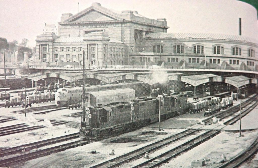
In the mid-20th Century, rail was the preeminent method of transportation for freight. In the mid-20th Century, rail was the preferred method of transportation for civilian passengers. As an American Crossroads, Kansas City quickly outgrew its original Union Depot.
Desiring – and requiring – additional capacity for their freight trains, the railroads which were collectively utilizing Kansas City’s Union Depot in KC’s industrial West Bottoms made a decision. Their decision? They were going to replace the outdated, ill-sized Union Depot with a new, larger more accommodative train station. Built in a new location. Union Depot was out. A depot in the West Bottoms – as the West Bottoms was prone to floods – was out. The new Kansas City train station would be near Kansas City’s central business district. Not in a floodplain. Built up on the hill.
Kansas City’s Union Station opened to the public in 1914 – a 850,000 square feet major railway hub. Union Station prospered. Rail, at that time, was an integral part of Kansas City’s position as an American Crossroads. Yet, as Union Station – and as rail – cemented Kansas City’s Crossroads status, macro circumstances in the United States changed. Macro circumstances changed the future of Kansas City’s Union Station. Macro circumstances changed the utilization of Kansas City’s Union Station. Macro circumstances changed the fate of Kansas City’s Union Station.
As the 20th Century progressed, the preferred method of transportation in the United States changed. For civilian passengers. For industry.
An emerging airline industry – coupled to travelers’ newfound preference for convenient flights, rather than long train rides – changed how Kansas City functioned as a rail-centric Crossroads. And trucks. Highways.
As flights replaced rail for passengers, trucks and highways replaced rail as the preferred method of transportation for freight. As such, the “DNA” for Crossroads changed.
By the 1970’s, rail traffic through Kansas City’s Union Station dropped. Significantly. From what had been a near-700,000 train passengers walking through Kansas City’s Union Station each year…that number precipitously dropped. Year by year. To, in the early part of the 1970’s, just about 30,000 yearly passengers.
At one time, close to 200 trains pulled into Kansas City’s Union Station everyday. Today? A total of 4 Amtrak trains pull into Union Station, daily.
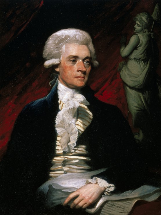
Through it all, the origin for Kansas City’s status as a Crossroads? I would say, that was never Union Station. It was not the nearly-200 trains which pulled into Kansas City each day. It was not the American GI’s who arrived in Kansas City during the War. The origin for Kansas City’s status as Crossroads? That would be one United States President. The origin for Kansas City’s status as Crossroads would be, in my humble opinion, Thomas Jefferson.
In 1803, the size of the United States doubled. The doubling in size of the United States in 1803 was the result of one $15,000,000 real estate deal. That real estate deal being the Louisiana Purchase.
The Louisiana Purchase added 828,000 square miles to the footprint of the United States. And, once the Louisiana Purchase was enacted, Kansas City’s location went from perfect, to PERFECT.
One year after the Louisiana Purchase, President Thomas Jefferson tapped an old wartime buddy of his. That buddy? Meriweather Lewis. Jefferson’s idea? For Meriweather Lewis to lead an expedition west. For Lewis to explore this vast new territory acquired by the United States through the Louisiana Purchase.
Meriweather Lewis added William Clark to this planned expedition. Six weeks after the Jefferson-directed expedition began, Lewis and Clark arrived at a confluence of two important rivers. The Missouri River. The Kansas River.
Or, as we now know this area to be, six weeks after Lewis and Clark ventured out with 3 boats – and a team of 50 – Lewis and Clark arrived at Crossroads. Lewis and Clark arrived in, what would go on to become…Kansas City.
Kansas City… Kansas City, Missouri. Kansas City, Kansas.
There had been a few different beginnings for what we now know to be Kansas City. The very first one?
In the 1830s, we had the first one – Westport Landing.
Westport Landing was established on a section of 257 acres which would evolve into what would become Kansas City, Missouri.
The 257 acres had been sold by the federal government to a man of French ancestry…Gabriel Prudhomme. This land sale took place in 1831.
Whereas the land Gabriel Prudhomme purchased from the federal government would go on to become Kansas City, Missouri, Westport Landing was the early, pre-Kansas City, Kansas City development.
Westport Landing – strategically set up alongside the heavily-trafficked Santa Fe Trail – was an unincorporated collection of merchants. These were merchants who established their businesses in Westport Landing to provide Santa Fe Trail travelers with supplies.
The merchants were inland. And the Westport Landing merchants figured out they could reduce their costs by receiving supplies by way of the Missouri River. Rather than by land. And they did.
The waterway entry point at which Westport Landing merchants were able to receive supplies shipped to them on the Missouri River was located where what is now Grand Boulevard in Kansas City, Missouri intersects with the Missouri River. And it is at this intersection – where Grand Boulevard meets the “Big Muddy” – where we found Westport Landing.
Twenty years later – in 1850 – Westport Landing was incorporated as the Town of Kansas.
Three years after that – in 1853 – the Town of Kansas was reincorporated and renamed. The new name for the Town of Kansas? The City of Kansas. And this renaming – as the City of Kansas – took place eight years before the State of Kansas became the 34th state of the United States. In 1861.
In 1889, the name for the city – the City of Kansas – was changed. Changed to Kansas City. The very, very first Kansas City – that first Kansas City being, Westport – was annexed by Kansas City, Missouri eight years later. In 1897.
All the while, on the other side of the Missouri River – in the new Kansas Territory – small Kansas settlements were forming. And growing. Growing into small Kansas towns.
In 1872, a consortium of small Kansas towns – on the other side of the river – merged. And incorporated. Therein – in 1872 – we have the origin for Kansas City, Kansas.
Wherein the larger Kansas City – and the older Kansas City, too – is the one which is located in Missouri, and not in Kansas, the “Kansas” in Kansas City is not derived from the State of Kansas.
The name of the city – Kansas City, Missouri – was named after a river. Not a state. Not Kansas. That river being…the Kanza River.
The Kanza River would go on to become the Kansas River. The Kansas River provided the name – “Kansas” – for the city – Kansas City, Missouri.
So the city – Kansas City – which originally formed as Westport Landing, which would later go on to become the Town of Kansas, which would later go on to become the City of Kansas, which would later go on to become Kansas City…does not derive its name from its neighbor to the west – the State of Kansas.
Kansas City… Kansas City, Missouri. Kansas City, Kansas.
There had been a few different beginnings for what we now know to be Kansas City. The very first one?
In the 1830s, we had the first one – Westport Landing.
Westport Landing was established on a section of 257 acres which would evolve into what would become Kansas City, Missouri.
The 257 acres had been sold by the federal government to a man of French ancestry…Gabriel Prudhomme. This land sale took place in 1831.
Whereas the land Gabriel Prudhomme purchased from the federal government would go on to become Kansas City, Missouri, Westport Landing was the early, pre-Kansas City, Kansas City development.
Westport Landing – strategically set up alongside the heavily-trafficked Santa Fe Trail – was an unincorporated collection of merchants. These were merchants who established their businesses in Westport Landing to provide Santa Fe Trail travelers with supplies.
The merchants were inland. And the Westport Landing merchants figured out they could reduce their costs by receiving supplies by way of the Missouri River. Rather than by land. And they did.
The waterway entry point at which Westport Landing merchants were able to receive supplies shipped to them on the Missouri River was located where what is now Grand Boulevard in Kansas City, Missouri intersects with the Missouri River. And it is at this intersection – where Grand Boulevard meets the “Big Muddy” – where we found Westport Landing.
Twenty years later – in 1850 – Westport Landing was incorporated as the Town of Kansas.
Three years after that – in 1853 – the Town of Kansas was reincorporated and renamed. The new name for the Town of Kansas? The City of Kansas. And this renaming – as the City of Kansas – took place eight years before the State of Kansas became the 34th state of the United States. In 1861.
In 1889, the name for the city – the City of Kansas – was changed. Changed to Kansas City. The very, very first Kansas City – that first Kansas City being, Westport – was annexed by Kansas City, Missouri eight years later. In 1897.
All the while, on the other side of the Missouri River – in the new Kansas Territory – small Kansas settlements were forming. And growing. Growing into small Kansas towns.
In 1872, a consortium of small Kansas towns – on the other side of the river – merged. And incorporated. Therein – in 1872 – we have the origin for Kansas City, Kansas.
Wherein the larger Kansas City – and the older Kansas City, too – is the one which is located in Missouri, and not in Kansas, the “Kansas” in Kansas City is not derived from the State of Kansas.
The name of the city – Kansas City, Missouri – was named after a river. Not a state. Not Kansas. That river being…the Kanza River.
The Kanza River would go on to become the Kansas River. The Kansas River provided the name – “Kansas” – for the city – Kansas City, Missouri.
And Kansas
So the city – Kansas City – which originally formed as Westport Landing, which would later go on to become the Town of Kansas, which would later go on to become the City of Kansas, which would later go on to become Kansas City…does not derive its name from its neighbor to the west – the State of Kansas.
Brookside is a proud collection of charming, quaint, leafy neighborhoods. Located in a southern section within Paris of the Plains – Kansas City, Missouri. Brookside also happens to be the largest contiguous master-planned community in the United States. Master-planned communities…that topic shall be left for another writing.
Part of the Country Club District, original plans for Brookside neighborhoods included building new homes for middle-income families, upper middle-income families, as well as high-income families. The more expensive homes in Brookside neighborhoods tended to have been built towards the west. Oftentimes, higher home values in Brookside neighborhoods have been assumed to be able to be determined based upon how far east – or how far west – of Main Street the home was originally built.
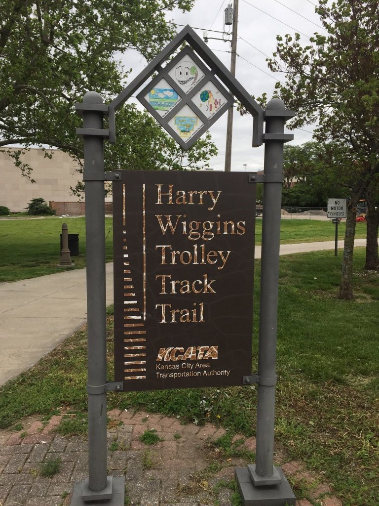
Brookside’s Trolley Track Trail…
The Harry Wiggins Trolley Track Trail. This iconically-Brookside-only feature, named after the KC-born Missouri state senator Harry Wiggins – is a six-mile long pathway which runs right through the middle of those charming Brookside neighborhoods.
There is no trolley that one would ever find today on this Brookside trolley trail. No trolley, and no trolley tracks either. But at one time, there had been a trolley. Trolley tracks too. That old Brookside trolley run in Kansas City had been born in the late 19th Century.
By the late 1800’s, similar to cable cars which were already running out west in San Francisco, early-day KC trolleys, traveling along the Harry Wiggins Trolley Track Trail – through Brookside – were propelled by underground cables. The earliest Brookside trolleys ran by gripping underground cables. The underground cables were built along – I.e.: built underneath – the Brookside trolley track.
As the late 19th Century transitioned into the early part of the 20th Century, the means by which KC streetcars and trolleys were propelled – the underground cable system – was replaced with a streetcar and a trolley propulsion system, powered by electricity.
Those old Brookside trolley tracks we are talking about here have long since been torn up. The Harry Wiggins Trolley Track Trail is a now KC favorite among walkers, runners and cyclists. Not trolleys. Those old, adorable KC trolleys in Brookside – as well as the trolley tracks on which Brookside trolleys once traveled – long since having been replaced by a walking path. And by Kansas Citians walking, jogging or cycling over to Roasterie to enjoy a nice latte. In Brookside.
At its inception, the Harry Wiggins Trolley Track Trail fostered a trackbed, wooden cross ties, and the ballast. Facilitating a trolley’s passageway, through Brookside neighborhoods. This trolley line? This was the Country Club Line.
The Country Club Line took trolley patrons south in KC…over to Brookside Shops at 63rd Street and Brookside Boulevard. To a fun-filled day of Brookside shopping.
Founded in 1920, the Brookside Shopping District was Kansas City’s first suburban shopping center. Thirty-seven years after the Brookside Shopping District first opened, the last KC trolley chugged along that old Country Cub Line, and into Brookside. That was in 1957…1957 being the year the last trolley traveled into Brookside.
At one time, Kansas City had one of the most extensive streetcar systems – and trolley systems – in the country. In 2024, Kansas City – happily, once again – has its own fabulous KC streetcar system. One which is quite unique to Kansas City.
During the latter part of the 19th Century – and on in to the early part of the 20th Century – Kansas City’s streetcar system functioned as the primary mode of public transportation for Kansas Citians.
Times changed. Kansas City, like most cities by the mid-20th Century, replaced their streetcar system – as well as their trolley, and their trolley tracks – with buses. And bus routes.
Long, long ago those old trolley tracks in Brookside were torn up. Streetcar lines were torn up throughout Kansas City. The end of KC’s streetcar. The end of KC’s Brookside trolley.
In Brookside, this end-of-an-era transportation transformation led to the adoption of the Harry Wiggins Trolley Track Trail as a Brookside neighborhood favorite. For walkers, joggers and cyclists.
The origin of Monmouth County’s Colts Neck Township goes all the way back to the late 17th Century. So let’s take a look at our 17th Century beginning for what we know today to be, Colts Neck Township.
The origin of Colts Neck Township…
In 1676, two Native Americans brokered a real estate sale. This was a land sale. The land sale totaled just under 1,200 acres. To be precise, it a 1,170-acre brokered land sale.
This acreage was sold to four Monmouth County locals. These four Monmouth County locals? Nathaniel Leonard, Thomas Leonard, Henry Leonard and Samuel Leonard.
Here is the breakdown for the Leonards’ 1.170-acre 17th Century Monmouth County land purchase – Henry Leonard acquired 450 of the 1,170 total acres. Samuel Leonard acquired 240 acres. Nathaniel Leonard acquired 120 acres. John Leonard acquired 120 acres. And Samuel Leonard acquired 120 acres. Here we have the original real estate sale for what would go on to become, Colts Neck Township.
Recorded in the minutes of the Board of Proprietors of the Eastern Division of New Jersey is one specific bill of sale which would be of interest to those who love Colts Neck. As well as to Monmouth County historians. This, the bill of sale for our aforementioned 17th Century “Colts Neck” land sale – the Leonards’ acquisition of these 1,170 acres in Monmouth County. Nearly 1,200 acres which would, in time, evolve into today’s Colts Neck Township.
The four Leonards acquired their land from two native Americans. The two Native American land sellers? The sellers of the 1,170 Monmouth County acres which would go on to become Colts Neck Township? Almeseke and Lamasand.
While the history of, How Colts Neck Township came to be…, goes all the way back to this brokered 17th Century real estate sale between the Leonards and Almeseke and Lamasand, it would be another two hundred years after this brokered land sale until Colts Neck Township officially became a New Jersey township. And from this point, it would be another one hundred years until the township name – Colts Neck Township – would become the official name for today’s Colts NeckTownship.
As a township name, Colts Neck Township was officially adopted in 1962. Through a local referendum.
Prior to the aforementioned 1962 referendum – which gave Colts Neck Township its name – what is now Colts Neck was, at that time, Atlantic Township.
Atlantic Township?
In 1847, through an act which was carried out by the New Jersey legislature, Atlantic Township was established.
Atlantic Township, circa 1847 (formed by way of an act of the New Jersey legislature) would be renamed Colts Neck Township, circa 1962 (by way of a local referendum).
Through an act of the New Jersey legislature, Colts Neck Township – I.e.: Atlantic Township, at that time – was initially spun off from portions of three neighboring townships – Shrewsbury, Middletown and Freehold. There is a bit of irony to this 1847 legislative land spin off. This irony involves Shrewsbury.
At one time, Shrewsbury had been one of the largest sections of the land area which we would have, informally at that time – prior to any local referendums, prior to any acts carried out by the New Jersey legislature, and prior to any Township Act – called “Colts Neck.”
Through the New Jersey Township Act, Shrewsbury – as one contributor to the formal origin of what is today, Colts Neck Township– became a New Jersey township 49 years prior to Colts Neck’s appointment as a New Jersey township.
For comments about this article, or for ideas or suggestions for additional pieces written about Colts Neck Township, kindly email or call the author, Ted Ihde.
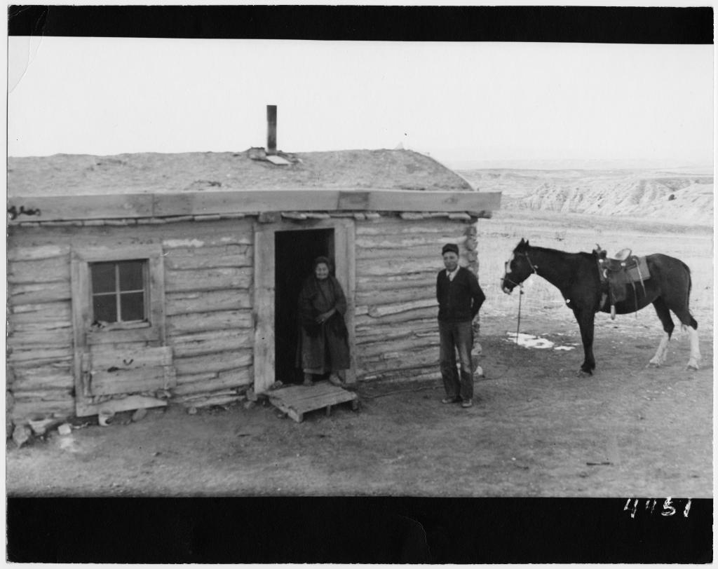
Early on in American history, as settlers pushed westward across the country, land had been able to be conveyed to those early American settlers through the Homestead Act.
Provisions within the Homestead Act called for conveyed land to be transferred with one condition of land transfers being, for that land to be settled, resided upon and cultivated – I:e.: improved – by he who acquired the land.
Early American “developers” – I:e.: westward-pushing settlers – were instrumental in effectuating intent found within the Homestead Act.
Homesteading had been a federal policy in the United States through the mid-1970’s.
In 1976, when President Gerald Ford signed the Federal Land Policy and Management Act, homesteading – as a federal policy – ceased to exist. The Federal Land Policy and Management Act was (and is) applicable to public land in the United States which is managed by the Bureau of Land Management.