Rumson, New Jersey…in the very beginning.


The Borough of Rumson is a charming seven square mile bedroom community of New York City. With two of those seven square miles, consisting of water.

Rumson is home to a tad more than 7,000. Long, long before Rumson became Rumson, Rumson was Navarumsunk. Or, Narumsum. 

Today’s Rumson was once Navarumsunk. This, when territory including the 7 square miles which would one day become Rumson was purchased by English settlers. English settlers who migrated to the area from New England. And from Long Island. English sellers purchased Navarumsunk from the Lenape Indians.

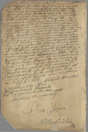
Negotiations for the sale of Navarumsunk to English settlers began in 1663. Two years later, Governor Richard Nicholls confirmed the land purchase. By way of the Monmouth Patent. The year was 1665.

Through attrition, over time, due to, in a nutshell, shall we say, convenience, the longer Indian denomination of Navarumsunk was shortened. Shortened, to Rumson

The origin for the borough’s name – Rumson – is seen in naming assigned by Native Americans. Navarumsunk. Navarumsum. Rumson.

Today’s Rumson resulted from this 17th Century land purchase. A sprawling acquisition of land, this sale by the Lenape, certainly was. Land sold consisted of one tract of land nestled in between the Navesink River and the Shrewsbury River.

Extending from today’s Sea Bright, to the east. Flowing west, to tributaries emptying into the Shrewsbury River. Today’s Rumson. 

Held by the English, Navarumsunk became Ramson’s Neck.

Ramson’s Neck was never a township. Ramson’s Neck was never a settlement. Ramson’s Neck included what would go on to become Rumson. 

The catalyst for our 1665 land purchase which became Ramson’s Neck, a section of which, later becoming Rumson, was found across “the Pond” – English colonial expansion.

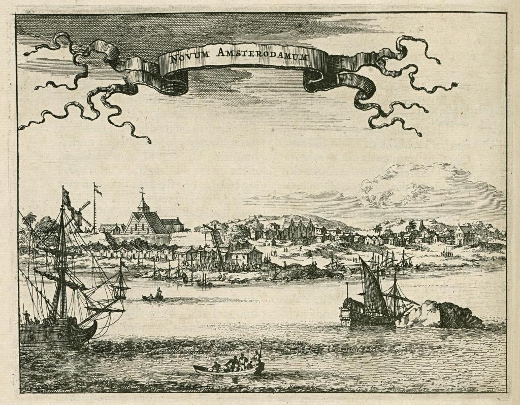
A land conveyance by royalty in Great Britain can be pointed to as the reason there was a Ramson’s Neck. This same royal land conveyance also led to the establishment of Monmouth County. This was a conveyance of land in what was then Dutch territory – New Netherlands.

England’s king at the time was King Charles II. Charles II granted land in New Netherlands to his brother, James. The Duke of York.

The king granted to the duke a tract of unsettled land inclusive of today’s Monmouth County.

At the time of conveyance – from king, to Duke – New Netherlands was controlled by the Dutch. The English had their sight on taking this Dutch region for themselves. This, a land mass extending from what today would be Connecticut, going due south, to today what would be Delaware.

Charles II granted this entire Mid-Atlantic region – from Connecticut to Delaware – to his brother. James. The Duke of York. 

Upon receiving this land from his brother, the King of England, Duke of York authorized Governor Richard Nicholls to commence settlements. Settlements in what was still the Dutch’s New Netherlands.

Underpinnings for English settlements in Dutch territory emanated from the Monmouth Patent. 


The Monmouth Patent, understood best, within our context, was the assumption by Governor Richard Nicholls of a responsibility. A responsibility bestowed upon Governor Nicholls by the Duke of York.

The responsibility? To attract one hundred families to settle in this Mid-Atlantic Dutch territory. By 1668. Three years to accomplish the settlement threshold. Which led to, the Nicholls grant. With Governor Nicholls providing land grants for settlement.


The Nicholls grant was for land in Monmouth County, Ocean County and Middlesex County. Monmouth County, in which our Borough of Rumson resides.

Establishment of one hundred new English settlements within three years, aligned with the Monmouth Patent, included a prerequisite. A condition.

A condition was attached by Great Britain to Governor Nicholls’ land grants.

In order for what today is Monmouth County, Ocean County and Middlesex County to not revert back to the Duke of York from Governor Nicholls one hundred settlements were to take hold within the three year allotment.

The very first English settlers to arrive by way of Nicholls grants went in Shrewsbury village.

The Nicholls grant bestowed upon settlers a broad discretion. This, to govern themselves.

The “carrot” of self governance. An enticement to settle. These settlers were called, Patentees. Aptly named, because at the very core, these settlements came through the Monmouth Patent.

The Monmouth Patent, the Nicholls grant and Patentees. Emanating from Great Britain. The colonial goal? To establish one hundred new English settlements over three years. In Dutch territory. The expansionist colonial mindset of the British Empire.

The Monmouth Patent hit a bump in the road. British expansion, struck, and removed from uninterrupted accord. 

In 1674, the Dutch recaptured their New Netherlands territory. Taken back. From the English. 

While Dutch governance of New Netherlands (once again) proved to be a short lived reign, previous English grants – the Nicholls grant, the Monmouth Patent – were nullified. Through the change in imperial governance. From Great Britain. To Holland. 

Nullified, technically. Yet English settlements were not as alterable as would be flying a Vlag van Nederland (flag of the Netherlands) rather than the Union Jack over settlements.

By 1675, the English wrestled control of the Mid-Atlantic from the Dutch. 

Seven years later, the duke’s goal for Governor Nicholls to establish one hundred settlements was far surpassed. By 1682, four settlements were established in Ramson’s Neck and in surrounding land. Encompassing thousands of acres of plantations. Precursors to numerous cuter boroughs and townships. One of which being, Rumson.

Through the Revolutionary War times, Ramson’s Neck – today’s Rumson, Fair Haven, Red Bank, Little Silver and Shrewsbury – were sections within Shrewsbury Township.

Rumson was part of Shrewsbury for the next hundred years. Rumson became an independent borough in 1907. Rumson’s birthday is March 15, 1907. 

Holmdel Township in the very beginning…


What one could say was the dawn for New Jersey’s Holmdel Township finds its beginning verse in the Monmouth Patent.

The onset for Holmdel Township started off with the annexation by Great Britain of territory formerly possessed by the Dutch.


This territory – that which had once been the Netherlands’ New Amsterdam – was put under the control of Great Britain’s Royal Crown. As such, the Monmouth Patent enabled conveyances of land to settlers by Great Britain in this new British territory.

In April of 1665, Great Britain’s deputy-governor for New Amsterdam granted “patents” for a triangular parcel of land located in today’s Monmouth County. This was the Monmouth Patent. This, the tract of land in Great Britain’s New Amsterdam territory which would later become New Jersey’s Monmouth County.


The earliest families to acquire land through the Monmouth Patent in what today we recognize as Holmdel Township had been the Bowne family, the Holmes family, the Cotterell family and the Stout family.

The Holmes family’s tract of land stretched north of Ramanessin Brook to Hop Brook Farm – the Holmes Tract.

John Bowne’s tract of land touched the northernmost boundary of the Monmouth Patent “triangle.”

Eliezer Cotterell received two land conveyances. Cotterell’s first conveyance totaled 100 acres. Cotterell’s second conveyance totaled 130 acres.

Richard Stout acquired a tract of land within the “triangle” which was situated to the east of Ramanessin Brook – the Richard Stout, Senior Tract.

One other such early land conveyance through the Monmouth Patent was the Bray Tract. This, the conveyance of land to a Baptist minister. John Bray.

Fifty acres was the Bray Tract…running from the easternmost portion of the Monmouth Patent “triangle” – at Bray’s Brook – to the east side of Hop Book Farms. 

And it was this 1687 purchase of territory by John Bray which led to the establishment of the first Baptist church in the State of New Jersey. Which was rather symbolically supportive of the Monmouth Patent “exercise” in the first place. As the Monmouth Patent codified religious freedom in this new British territory of New Amsterdam.

New Jersey’s first Baptist church evolved from this Bray Tract. In time, becoming Middletown Baptist Church. A church located in today what we know to be, Holmdel Township. As Baptists throughout New Jersey can point to their New Jersey origin as being, the Bay Tract.

On land John Bray acquired through the Monmouth Patent, John Bray proceeded to set up Bray’s Meeting House. 

Bray’s Meeting House became a congregation for Baptists. Local Baptists whose house of worship became…Bray’s Meeting House. At the corner what today would be Main Street and Holmdel Road. In Holmdel Township.


As the number of Baptists who resided within and near this new British territory of New Amsterdam in today what we call “Holmdel” grew, in 1709 John Bray donated a portion of his land to the Baptist Church. This land donation by John Bray led to New Jersey’s first Baptist church. This first Baptist church in New Jersey was, at first, known as The Upper Meeting House


With The Upper Meeting House established, during the first half of the 18th Century, this farming community of what one day would one become Holmdel Township experienced an increase in the migration of Baptists to the area.

First, at John Bray’s Meeting House, then later, at what would become The Upper Meeting House, Baptists weren’t yet meeting in Holmdel Township. Where Holmdel Road meets Main Street, as Baptists joined together, this was not yet Holmdel Township. At that time, Baptists were meeting in Middletown. There was not yet a “Holmdel.”

What had been Middletown then consisted of all of the territory in Monmouth County north of the Navesink River. And east of today’s Freehold Township. So for nearly 150 years, The Upper Meeting House – at the corner of Main Street and Holmdel Road – was located in Middletown.

In 1848, the expansiveness of what was then Middletown was altered. Middletown was broken up. And parceled out. 


In 1848, Raritan Township was spun off from Middletown. This new Raritan Township consisted of what later would become Hazlet, Aberdeen, Union Beach, Keansburg, Keyport, and Matawan. As well as…Holmdel.

Nine years after Middletown was restructured, in 1857, Holmdel Township officially formed. Formed, through an act of the New Jersey Legislature. 

John Bray originally settled in today’s Holmdel Township in 1684. Three years later, John Bray received his 50 acres. Granted to Bray by New Amsterdam’s acting governor.

The earliest land conveyances made possible through the Monmouth Patent were not enacted through the acts of a full-fledged territory governor. 

In 1664, the British territory made up of what would one day become New Jersey – then, being, New Amsterdam – was governed by a British deputy governor. This British deputy governor in 1664 was Richard Nicolls.


A few years after settling in Monmouth County, John Bray increased his land holdings. Bray purchased two additional tracts of land. These purchases took place in 1688.

The first of John Bray’s subsequent land purchases totaled 130 acres. Bray’s second land purchase in 1688 totaled 30 acres.

Johm Bray’s land holdings – the land grant he received from Deputy Governor Richard Nicolls, coupled to his subsequent land purchases – foretold of the pathway to Bray’s later establishment of his Meeting House. While also foretelling of Bray’s later land donation. To the Baptist church. Leading to, New Jersey’s first Baptist church.

On the corner of Main Street and Holmdel Road.

Colts Neck Township

The origin of Monmouth County’s Colts Neck Township goes all the way back to the late 17th Century. So let’s take a look at our 17th Century beginning for what we know today to be, Colts Neck Township.


The origin of Colts Neck Township

In 1676, two Native Americans brokered a real estate sale. This was a land sale. The land sale totaled just under 1,200 acres. To be precise, it a 1,170-acre brokered land sale.

This acreage was sold to four Monmouth County locals. These four Monmouth County locals? Nathaniel Leonard, Thomas Leonard, Henry Leonard and Samuel Leonard. 

Here is the breakdown for the Leonards’ 1.170-acre 17th Century Monmouth County land purchase – Henry Leonard acquired 450 of the 1,170 total acres. Samuel Leonard acquired 240 acres. Nathaniel Leonard acquired 120 acres. John Leonard acquired 120 acres. And Samuel Leonard acquired 120 acres. Here we have the original real estate sale for what would go on to become, Colts Neck Township.


Recorded in the minutes of the Board of Proprietors of the Eastern Division of New Jersey is one specific bill of sale which would be of interest to those who love Colts Neck. As well as to Monmouth County historians. This, the bill of sale for our aforementioned 17th Century “Colts Neck” land sale – the Leonards’ acquisition of these 1,170 acres in Monmouth County. Nearly 1,200 acres which would, in time, evolve into today’s Colts Neck Township.

The four Leonards acquired their land from two native Americans. The two Native American land sellers? The sellers of the 1,170 Monmouth County acres which would go on to become Colts Neck Township? Almeseke and Lamasand.


While the history of, How Colts Neck Township came to be…, goes all the way back to this brokered 17th Century real estate sale between the Leonards and Almeseke and Lamasand, it would be another two hundred years after this brokered land sale until Colts Neck Township officially became a New Jersey township. And from this point, it would be another one hundred years until the township name – Colts Neck Township – would become the official name for today’s Colts Neck Township.


As a township name, Colts Neck Township was officially adopted in 1962. Through a local referendum. 


Prior to the aforementioned 1962 referendum – which gave Colts Neck Township its name – what is now Colts Neck was, at that time, Atlantic Township. 

Atlantic Township?

In 1847, through an act which was carried out by the New Jersey legislature, Atlantic Township was established.

Atlantic Township, circa 1847 (formed by way of an act of the New Jersey legislature) would be renamed Colts Neck Township, circa 1962 (by way of a local referendum).  

Through an act of the New Jersey legislature, Colts Neck TownshipI.e.: Atlantic Township, at that time – was initially spun off from portions of three neighboring townships – Shrewsbury, Middletown and Freehold. There is a bit of irony to this 1847 legislative land spin off. This irony involves Shrewsbury. 

At one time, Shrewsbury had been one of the largest sections of the land area which we would have, informally at that time – prior to any local referendums, prior to any acts carried out by the New Jersey legislature, and prior to any Township Act – called “Colts Neck.

Through the New Jersey Township Act, Shrewsbury – as one contributor to the formal origin of what is today, Colts Neck Township– became a New Jersey township 49 years prior to Colts Neck’s appointment as a New Jersey township.


For comments about this article, or for ideas or suggestions for additional pieces written about Colts Neck Township, kindly email or call the author, Ted Ihde.

email: authortedihde@gmail.com

mobile: (816) 699-6804