IMPACT FEES


Come January 31st, each of New Jersey’s 564 municipalities is required to file their own resolution with the State, adopting affordable housing obligations for their municipality.

Come June 30th, each of New Jersey’s 564 municipalities is required to submit their affordable housing plan to the State, for their municipality.

Last October, the New Jersey Department of Community Affairs released New Jersey affordable housing requirements. These will need to be completed by 2035. And here they are…

A) Create 84,698 new affordable housing units.

B) Preserve an additional 65,410 existing housing units.

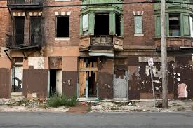
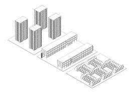
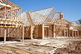
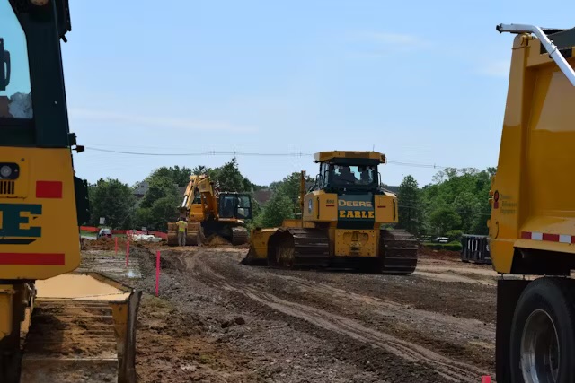
140,00 homes built or renovated over the next ten years. That’s a lot of homes. That’s a lot of infrastructure needed.

Impact fees…and Trenton.

The Municipal Development Impact Fee Authorization Act – presently in committee in Trenton – would, if passed, broaden New Jersey municipalities’ ability to pass through development-related costs to real estate developers. By broadening the scope for how impact fees can be collected by municipalities.


New Jersey is one of 22 states which presently authorizes the collection of impact fees by a municipality. Different states may refer to “impact fees” though their own state vernacular. For example, in Kansas – Kansas does authorize impact fees – impact fees are also referred to as adequate facility taxes. Or excise taxes.

At the present time, in New Jersey, the impact fees which can be passed along by municipalities to developers are pretty much limited to off-site improvements which arise as a direct consequence of the development. Direct consequence?

My humble opinion…

The way impact fees are levied upon developers in New Jersey today seems a bit…unjust. Tilted too far in favor of developers. At the expense of municipalities. See, direct consequence.

For example, an increased allocation of funds – and personnel – will likely be required in order to accommodate the higher number of classroom students which will be arrived at through the construction of new homes within any municipality. New homes are built. New families move in. Families have kids. Kids go to school.

Yet, in New Jersey, this increase in education funding which will be required by a municipality – as a result of new development – is not able to be passed through to real estate developers by way of impact fees. Though they should be able to be so.

Because any increase in education funding needed in order to accommodate larger classroom sizes – or additional teachers – which comes about as a direct result of development is as much of a direct development-related cost as one can think of. It’s attributed to…the building of new homes. Isn’t it?

Education funds for a New Jersey municipality – collected through impact fees charged to real estate developers – should be permissible.

Larger classrooms. Additional teachers. Potentially, the construction of a brand new school. These are a few of the costs – real costs – that a municipality will incur as a result of an increase in the student population. Because new homes were built in the municipality.

One proposed solution? A boardening of the scope for the collection of impact fees by New Jersey municipalities.

Whereas critics of increasing impact fees may view additional impact fees charged to developers as impediments to growth, that argument is easily overcome.

Impact fees can be collected in lieu of local property tax hikes. Furthermore, impact fees are specific to the development at hand. To the area being developed. As such, the implantation of impact fees enables the broader property tax-paying populace to not be unduly burdened through an increased annual property tax bill. To fund development in town…which really does not directly affect them.

ABANDONED HOMES

Processes to consider when thinking through how to transition abandoned homes from absentee owners to developers could include: a) land banking, b) spot blight eminent domain, and c) receivership. Tools. Why focus on this problem? Why cultivate ideas? Why develop solutions? 

Abandoned homes become financial drains on a city’s resources. For example, the cost to demolish an abandoned home?Demolition costs could reach up to $20,000. Per home.

And there are social costs as well…

Neighborhoods with abandoned homes become breeding grounds for crime. For drug use. For violence. Social costs.

But social costs are not always correlated to dollars and cents. Furthermore, social costs are often viewed as someone else’s problem.

But are social costs easy to understand? Are social costs someone else’s problem?

Social costs attributed to abandoned homes correlate to financial costs. Financial costs incurred by the city. Financial costs incurred by the city’s stakeholders. Financial costs incurred by the city’s taxpayers.

Social costs attributed to abandoned homes affect city residents who may – at first – believe abandoned homes would not be a problem affecting them.

For example…

A New Yorker living in Tribeca or on the Upper East Side is part of New York City. As such, they pay New York City taxes. So, while there may be few abandoned homes in their neighborhood, Tribeca and the Upper East Side are still coupled to the poorest neighborhoods in New York City. To the Morrisania and the Crotona neighborhoods in the Bronx.

In Morrisania and Crotona, nearly 4-out-of-10 live below the poverty line.

Let’s say socioeconomic challenges in Morrisania or Crotona lead to a foreclosure in either neighborhood. That foreclosure, then becoming an abandoned home.

Increased police patrolling is one byproduct of abandoned homes. Enacted to prevent neighborhoods from spiraling into crime magnets.

Increased New York City police patrolling in the Bronx is a financial cost. Which addresses the social cost. And that is a New York City cost. A cost which is bourne by…Morrisania residents. A cost which is bourne by…residents on the Upper East Side. A cost which is bourne by…residents in Tribeca. A cost which is bourne by…Crotona residents.

Redevelopment

Within a Redevelopment Area, a municipality’s goal could be to transition residential, commercial and industrial properties within the Redevelopment Area into vibrant community assets. The pursuit of which could take on a community-centric theme. Renovations, repurposing properties, new home construction… Goals pursuant to the redevelopment of properties within a Redevelopment Area.


Redevelopment of properties within a Redevelopment Area could start out with a city council resolution. To redevelop properties. With the resolution, a planning board might then choose to construct a Redevelopment map. With a Redevelopment map – and upon notification to the public of an upcoming hearing – a planning board could then look to adopt a Redevelopment resolution. The resolution could recommend the establishment of a Redevelopment Area within the municipality.

Potential steps a municipality could consider beginning with in order to establish a Redevelopment Area within the municipality…


You can direct any comments or questions to Ted Ihde.

email: authortedihde@gmail.com

direct: 816-699-6804

Tax Incremental Financing


When you are considering whether to pursue a real estate development project, reaching out to local government officials regarding the availability of tax incremental financing is one step you can take.

Tax incremental financing – TIF –is a development subsidy whereby the municipality diverts future property tax revenue towards economic development. The origin of tax incremental financing traces back to the State of California. And to 1952.

In order to establish a TIF subsidy, an urban renewal district – a TIF district – is first drawn up by the municipality.

With tax incremental financing, the municipality will be diverting increases in property taxes within the urban renewal district from the municipality, to development. It’s a subsidy. With a lifespan of twenty or twenty-five years.

The foundation for TIF? Development leads to increases in property values within the TIF district. As well as in surrounding neighborhoods. The theory? Increasing property values, which lead to an increase in property tax receipts collected by the municipality, offset TIF subsidies.

Kansas City’s Old Film Row


A film row is a collection of film studio offices which are located next to each other. Film rows functioned as motion picture industry sales hubs and fulfillment centers. Film rows also played host to meetings and events.

From the 1920’s and on through the 1970’s, Hollywood used film rows to produce and distribute content.

Kansas City’s Old Film Row was located in what is today Crossroads Arts District – 17 buildings within a four block radius. Most of those buildings are still there.

Columbia Pictures and Paramount had offices between Central and Wyandotte on 18th Street.

Where 17th Street intersects with Wyandotte, Warner Brothers and Universal Studios were across the street from one another. 1700 Wyandotte had been Universal Studios’ Midwest storage and distribution center.

United Artists had an office on the corner of Central and 18th Street.

Walt Disney Company was located on 18th Street…just off Wyandotte.

Disney evolved out of Laugh-O-Gram Studio. Laugh-O-Gram started out in the McConahay Building – 1127 East 31st Street.

The MGM building – built in 1930 – was at 220 West 18th Street.

National Screen Service – 18th Street and Baltimore – was one of the largest distributors of movie posters, accessories and print ads.

Screenland Café – Wyandotte and 18th Street – had two screening rooms as well as two theatre circuits. Those two theatre circuits would evolve into AMC Theaters.

AMC was founded in 1920 in KC by Maurice, Edward and Barney Dubinsky. The Durbinsky’s would go on to change their name. From Dubinsky to Durwood.

Prior to AMC, the Durwood’s had Durwood Theatres. Durwood Theatres started out on Baltimore Street. In Old Film Row.

Density Bonus Programs


Density bonus programs are developer incentives. They function as “build catalysts.” Catalysts which make it worthwhile – and economically feasible – for developers to undertake the construction of inclusionary housing projects. In summary, a density bonus program permits an increase in allowed dwelling units per acre – DU/A.

Here is how a density bonus program works…

Density bonuses enable developers to build in excess of a site’s base zoning. In exchange for the municipality permitting a developer to build unit totals which exceed standard allowances, the developer is required to designate a set number of units built as income-restricted affordable housing.

Density bonus programs are enacted through local ordinances. Ordinances amend zoning codes. The process of having zoning codes amended, through ordinances, accompanies the implementation of density bonus programs. This is so because standard zoning codes – prior to the codes being amended – would not authorize the developer’s proposed build, if not amended. The intended outcome? Construction of more affordable housing units.

Density bonus programs establish developer thresholds. Once the threshold is met by the developer, the developer qualifies for the density bonus.

Typically, density bonus programs allow for increases of between 10% and 20% over baseline permitted density. This, in exchange for the developer’s commitment to the provision of a pre-set number of affordable housing units.

The council-manager form of local government


Since the 1920’s, Kansas City, Missouri has utilized the council-manager form of government. Phoenix is the largest American city which utilizes the council-manager form of government.

In a council-manager form of government, city council charts how the city functions. An analogy…

In a council-manager form of government, city council could be looked at as being comparable to a corporate board of directors. The council-manager form of government, through its construct, looks somewhat like corporate governance. Using the corporate analogy, a city manager would be the city’s “executive officer.” The city’s “CEO.” The city manager, which is an unelected position, is hired by the city.

The city manager works, in theory (ideally) outside of the scope of the political arena. The city manager executes policy. The city manager implements ordinances…ordinances passed by, using our corporate analogy once again, the city’s “board of directors.” The “board of directors” being…city council.

The city’s “CEO?” City manager. The city’s “board of directors?” City council.

Under the council-manager form of government, the mayor is an elected public official. Elected by voters.

The city manager operates behind the-scenes. Running the city’s day-to-day operations. The mayoral position is a more visible position. Interviews? Newspaper articles? Mayor. 

As executive officer, the city manager is responsible for oversight of city departments. The city manager collaborates with the mayor – and with city council – to enact policy. City policy? That policy emanates from city council.

City planning? City programs? The city budget? These are responsibilities of the city manager.

The position of mayor is a political position. The city manager position is apolitical.

City managers are not out campaigning alongside candidates who are running for public office. The city manager does not publicly promote the interests of Democrats, nor of Republicans.

Campaigning? Part of what it takes to become mayor. Politics? Goes hand-in hand with winning an election and becoming mayor.

Photo ops? Fundraising? TV appearances? Mayor. The city manager may very well attend these events as well. Yet it will be the mayor – moreso than the city manager – who is more likely to show up and make an appearance.

Land Banks in New York…it’s working.

Map of New York in blue colour

There are just about than 4 million total residential homes in state of New York. If one is looking for a real estate development specialty to consider going into 2025, today, 13 years after the New York Land Bank Law went into effect, there are still in excess of somewhere in the neighborhood of 40,000 vacant residential homes located in municipalities throughout the state of New York.

Two general truths…

Truth “A”: a land bank has procedures available to the land bank which enables the land bank to acquire vacant and abandoned properties.

Truth “B”: Developers look for opportunities to acquire – and redevelop – non-performing properties.

Once transitioned from a non-performing property to a “performing” property, that property can then be sold. Thus, returning what was once a now-performing property to a neighborhood as a “performing” properties. As a community asset. As a property which is now on the municipality’s property tax roll. As such, performing properties create newly-found tax revenue for municipalities. This eases budget constraints.

Through New York’s Land Bank Law, in New York State, the New York municipality possesses an ability to create their own land bank. By establishing a land bank, resources, direction, vision, personnel – coupled to funding – enable New York redevelopment. Once created, New York land banks improve adverse conditions stemming from non-performing properties located within New York State tax districts.


The New York Land Bank law was signed by Governor Cuomo on July 29,2011. New York’s first land bank was established the next year.. in 2012. Today, there are over 30 land banks in operation in New York State..

Here are some land bank statistics from the part of New York Stare where Josh Allen plays quarterback:

A. 230 properties acquired

B. 44 renovations completed

C. $2.4 million in assessed Values returned to communities

D. $14 million in leveraged investment

Redevelopment Area: New Jersey

In a designated Redevelopment Area, a municipality’s goals could be focused upon transitioning now non-performing residential, commercial and industrial properties to vibrant community assets. The pursuit of which could take on a community-centric theme. Renovations. Repurposing properties. And reconstruction too. Each of these being potential goals pursuant to redeveloping non-performing properties in designated Redevelopment Areas.


Steps taken by a municipality in their progression towards neighborhood revitalization in Redevelopment Areas – progression, coupled to a redevelopment plan emanating from city hall – often starts off with a city council passing a resolution. Following the resolution, the planning board then might construct a Redevelopment map. With a Redevelopment map formulated – and upon notification to the public of a scheduled hearing – a planning board could then potentially adopt a Redevelopment resolution. 

A Redevelopment resolution could recommend the establishment of a Redevelopment Area within a municipality. There is quite a bit more technical minutiae to this process, needless to say. Yet, in summarily-simplified terms, this is one we can thus arrive at the designation of a Redevelopment Area within a municipality.

Marlboro Township

The name – Marlboro Township – can be traced back to what had been a local discovery…a discovery which occurred, nearly three hundred years ago.

This local Marlboro discovery, then too, the utilization of what had been discovered nearly three-hundred years ago alongside what is now Marlboro Township, was a mineral. That mineral – emerging to go on to become quite important to the local agricultural industry – being this region’s marl. 


Marl is a mineral which, by the late 18th century in New Jersey, was relied upon first, by local farmers who owned farms in what would go on to become Marlboro Township. Then, later, by farmers farming farmland situated throughout New Jersey. Then, later, by farmers farming farmland well beyond – and outside of – New Jersey.

In Monmouth County New Jersey, marl was discovered in 1768. East of where the township lines for what we now call Marlboro Township can be found. A true farmer’s ally, the functionality of marl as a mineral can be seen in how marl – composed of the remains of prehistoric fish – was able to be spread over topsoil of area farmland during the winter months. Then tilled into the farmland soil in the spring. Farmers, in what we now know to be Marlboro Township, came to rely upon marl as the means through which they could improve their soil’s fertility.

Marl is not exclusive to New Jersey, by any means. The recognized use of marl goes way, way, way back. To the 1st century. 

Marl is a de-facto natural fertilizer. A natural fertilizer which had been found to exist in the grounds underneath Marlboro Township in the 18th Century. Long, long, long before the comeuppance of any commercial fertilizer industry in New Jersey would have been able to supply local New Jersey farmers with a finished fertilizer product which could be used for their farms.

Harvested in what would later go on to become Marlboro Township, the region’s marl – once the marl had been harvested – would go on to evolve as an industry. Later, to be transported by rail. On to nearby agricultural markets. New Jersey’s local discovery of marl established an industry early on for Marlboro Township.  

By the mid-19th Century, the transportation of New Jersey marl was key to facilitating commerce. For the local harvesters of marl. For the local “exporters” of this marl. And for the farmers and the farms which came to rely upon – and use – marl as fertilizer. 

To that effect – relating to marl, as a local industry…and to the transportation of marl as well – in 1853, the Freehold and Jamesburg Agricultural Railroad was founded in Jamesburg, New Jersey. Founded, primarily to facilitate the transportation – by rail – of this newly-identified regional mineral.

The Freehold and Jamesburg Agricultural Railroad operated along a 27-mile rail line.  Connecting the locally-harvested marl – in what is now Marlboro Township – to nearby agricultural markets. Among them, Freehold, Jamesburg, Monroe, Manalapan and Englishtown.  


For comments about this article, or to offer suggestions and ideas for further pieces written about Marlboro Township, kindly reach out to the author, Ted Ihde.

phone: (816) 699-6804

email: authortedihde@gmail.com